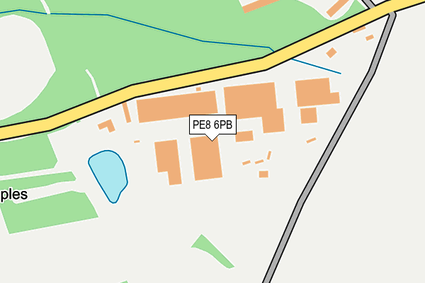
PE8 6PB is located in the Oundle electoral ward, within the unitary authority of North Northamptonshire and the English Parliamentary constituency of Corby. The Sub Integrated Care Board (ICB) Location is NHS Northamptonshire ICB - 78H and the police force is Northamptonshire. This postcode has been in use since December 1998.


GetTheData
Source: OS OpenMap – Local (Ordnance Survey)
Source: OS VectorMap District (Ordnance Survey)
Licence: Open Government Licence (requires attribution)
| Easting | 504309 |
| Northing | 298574 |
| Latitude | 52.574991 |
| Longitude | -0.462211 |
GetTheData
Source: Open Postcode Geo
Licence: Open Government Licence
| Country | England |
| Postcode District | PE8 |
➜ See where PE8 is on a map | |
GetTheData
Source: Land Registry Price Paid Data
Licence: Open Government Licence
Elevation or altitude of PE8 6PB as distance above sea level:
| Metres | Feet | |
|---|---|---|
| Elevation | 60m | 197ft |
Elevation is measured from the approximate centre of the postcode, to the nearest point on an OS contour line from OS Terrain 50, which has contour spacing of ten vertical metres.
➜ How high above sea level am I? Find the elevation of your current position using your device's GPS.
GetTheData
Source: Open Postcode Elevation
Licence: Open Government Licence
| Ward | Oundle |
| Constituency | Corby |
GetTheData
Source: ONS Postcode Database
Licence: Open Government Licence
GetTheData
Source: ONS Postcode Database
Licence: Open Government Licence


➜ Get more ratings from the Food Standards Agency
GetTheData
Source: Food Standards Agency
Licence: FSA terms & conditions
| Last Collection | |||
|---|---|---|---|
| Location | Mon-Fri | Sat | Distance |
| London Road | 16:45 | 10:30 | 3,149m |
| Wansford Post Office | 17:00 | 11:40 | 3,348m |
| Elton Road | 17:00 | 07:00 | 4,103m |
GetTheData
Source: Dracos
Licence: Creative Commons Attribution-ShareAlike
The below table lists the International Territorial Level (ITL) codes (formerly Nomenclature of Territorial Units for Statistics (NUTS) codes) and Local Administrative Units (LAU) codes for PE8 6PB:
| ITL 1 Code | Name |
|---|---|
| TLF | East Midlands (England) |
| ITL 2 Code | Name |
| TLF2 | Leicestershire, Rutland and Northamptonshire |
| ITL 3 Code | Name |
| TLF25 | North Northamptonshire |
| LAU 1 Code | Name |
| E07000152 | East Northamptonshire |
GetTheData
Source: ONS Postcode Directory
Licence: Open Government Licence
The below table lists the Census Output Area (OA), Lower Layer Super Output Area (LSOA), and Middle Layer Super Output Area (MSOA) for PE8 6PB:
| Code | Name | |
|---|---|---|
| OA | E00137594 | |
| LSOA | E01027050 | East Northamptonshire 001C |
| MSOA | E02005629 | East Northamptonshire 001 |
GetTheData
Source: ONS Postcode Directory
Licence: Open Government Licence
| PE8 6NU | Kings Cliffe Road | 759m |
| PE8 6PA | Sulehay Road | 1121m |
| PE8 6NX | Kings Cliffe Road | 1204m |
| PE8 6NL | Leicester Road | 1959m |
| PE8 6QT | Apethorpe Road | 2035m |
| PE8 6NH | Leicester Road | 2403m |
| PE8 6PW | Old Sulehay Road | 2480m |
| PE8 6PN | Wansford Road | 2541m |
| PE8 6PP | Nassington Road | 2543m |
| PE8 6PJ | Prebendal Green | 2593m |
GetTheData
Source: Open Postcode Geo; Land Registry Price Paid Data
Licence: Open Government Licence