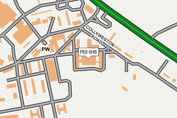
PE8 6HB is located in the Wittering electoral ward, within the unitary authority of Peterborough and the English Parliamentary constituency of North West Cambridgeshire. The Sub Integrated Care Board (ICB) Location is NHS Cambridgeshire and Peterborough ICB - 06H and the police force is Cambridgeshire. This postcode has been in use since January 1980.


GetTheData
Source: OS OpenMap – Local (Ordnance Survey)
Source: OS VectorMap District (Ordnance Survey)
Licence: Open Government Licence (requires attribution)
| Easting | 505235 |
| Northing | 302945 |
| Latitude | 52.614093 |
| Longitude | -0.447164 |
GetTheData
Source: Open Postcode Geo
Licence: Open Government Licence
| Country | England |
| Postcode District | PE8 |
➜ See where PE8 is on a map | |
GetTheData
Source: Land Registry Price Paid Data
Licence: Open Government Licence
Elevation or altitude of PE8 6HB as distance above sea level:
| Metres | Feet | |
|---|---|---|
| Elevation | 70m | 230ft |
Elevation is measured from the approximate centre of the postcode, to the nearest point on an OS contour line from OS Terrain 50, which has contour spacing of ten vertical metres.
➜ How high above sea level am I? Find the elevation of your current position using your device's GPS.
GetTheData
Source: Open Postcode Elevation
Licence: Open Government Licence
| Ward | Wittering |
| Constituency | North West Cambridgeshire |
GetTheData
Source: ONS Postcode Database
Licence: Open Government Licence
| Post Office (Townsend Road) | Wittering | 492m |
| Exeter Road (Burghley Avenue) | Wittering | 615m |
| Church Road | Wittering | 858m |
| Spar Shop (St Georges Road) | Wittering | 893m |
| Parker Road | Wittering | 1,038m |
| Stamford Station | 4.4km |
GetTheData
Source: NaPTAN
Licence: Open Government Licence
GetTheData
Source: ONS Postcode Database
Licence: Open Government Licence


➜ Get more ratings from the Food Standards Agency
GetTheData
Source: Food Standards Agency
Licence: FSA terms & conditions
| Last Collection | |||
|---|---|---|---|
| Location | Mon-Fri | Sat | Distance |
| Barnack Road | 16:45 | 10:00 | 2,948m |
| Pilsgate | 17:00 | 10:00 | 2,962m |
| Southorpe | 16:45 | 09:30 | 3,023m |
GetTheData
Source: Dracos
Licence: Creative Commons Attribution-ShareAlike
The below table lists the International Territorial Level (ITL) codes (formerly Nomenclature of Territorial Units for Statistics (NUTS) codes) and Local Administrative Units (LAU) codes for PE8 6HB:
| ITL 1 Code | Name |
|---|---|
| TLH | East |
| ITL 2 Code | Name |
| TLH1 | East Anglia |
| ITL 3 Code | Name |
| TLH11 | Peterborough |
| LAU 1 Code | Name |
| E06000031 | Peterborough |
GetTheData
Source: ONS Postcode Directory
Licence: Open Government Licence
The below table lists the Census Output Area (OA), Lower Layer Super Output Area (LSOA), and Middle Layer Super Output Area (MSOA) for PE8 6HB:
| Code | Name | |
|---|---|---|
| OA | E00171325 | |
| LSOA | E01015628 | Peterborough 004D |
| MSOA | E02003240 | Peterborough 004 |
GetTheData
Source: ONS Postcode Directory
Licence: Open Government Licence
| PE8 6DX | Hillside Gardens | 405m |
| PE8 6BY | Silver Birch Court | 465m |
| PE8 6AD | Townsend Close | 486m |
| PE8 6BH | Harvey Close | 487m |
| PE8 6AB | Towns End Road | 493m |
| PE8 6DU | Park Farm | 527m |
| PE8 6BD | Towns End Road | 528m |
| PE8 6BQ | The Limes | 537m |
| PE8 6DF | Beech Tree Close | 538m |
| PE8 6AA | Main Street | 558m |
GetTheData
Source: Open Postcode Geo; Land Registry Price Paid Data
Licence: Open Government Licence