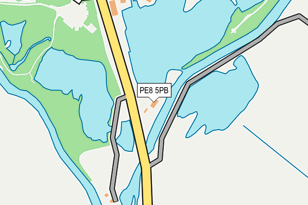
PE8 5PB lies on Barnwell Road in Oundle, Peterborough. PE8 5PB is located in the Thrapston electoral ward, within the unitary authority of North Northamptonshire and the English Parliamentary constituency of Corby. The Sub Integrated Care Board (ICB) Location is NHS Northamptonshire ICB - 78H and the police force is Northamptonshire. This postcode has been in use since January 1980.


GetTheData
Source: OS OpenMap – Local (Ordnance Survey)
Source: OS VectorMap District (Ordnance Survey)
Licence: Open Government Licence (requires attribution)
| Easting | 503836 |
| Northing | 287109 |
| Latitude | 52.472066 |
| Longitude | -0.472750 |
GetTheData
Source: Open Postcode Geo
Licence: Open Government Licence
| Street | Barnwell Road |
| Locality | Oundle |
| Town/City | Peterborough |
| Country | England |
| Postcode District | PE8 |
➜ See where PE8 is on a map | |
GetTheData
Source: Land Registry Price Paid Data
Licence: Open Government Licence
Elevation or altitude of PE8 5PB as distance above sea level:
| Metres | Feet | |
|---|---|---|
| Elevation | 30m | 98ft |
Elevation is measured from the approximate centre of the postcode, to the nearest point on an OS contour line from OS Terrain 50, which has contour spacing of ten vertical metres.
➜ How high above sea level am I? Find the elevation of your current position using your device's GPS.
GetTheData
Source: Open Postcode Elevation
Licence: Open Government Licence
| Ward | Thrapston |
| Constituency | Corby |
GetTheData
Source: ONS Postcode Database
Licence: Open Government Licence
| The Mill (Barnwell Road) | Barnwell | 175m |
| The Mill (Barnwell Road) | Barnwell | 179m |
| Prince William School (Herne Road) | Oundle | 871m |
| Victoria Yard (West Street) | Oundle | 1,007m |
| Co-op Store (St Osyths Lane) | Oundle | 1,010m |
GetTheData
Source: NaPTAN
Licence: Open Government Licence
| Percentage of properties with Next Generation Access | 100.0% |
| Percentage of properties with Superfast Broadband | 100.0% |
| Percentage of properties with Ultrafast Broadband | 100.0% |
| Percentage of properties with Full Fibre Broadband | 100.0% |
Superfast Broadband is between 30Mbps and 300Mbps
Ultrafast Broadband is > 300Mbps
| Median download speed | 22.5Mbps |
| Average download speed | 22.4Mbps |
| Maximum download speed | 41.75Mbps |
| Median upload speed | 1.2Mbps |
| Average upload speed | 3.7Mbps |
| Maximum upload speed | 10.00Mbps |
| Percentage of properties unable to receive 2Mbps | 0.0% |
| Percentage of properties unable to receive 5Mbps | 0.0% |
| Percentage of properties unable to receive 10Mbps | 0.0% |
| Percentage of properties unable to receive 30Mbps | 0.0% |
GetTheData
Source: Ofcom
Licence: Ofcom Terms of Use (requires attribution)
GetTheData
Source: ONS Postcode Database
Licence: Open Government Licence


➜ Get more ratings from the Food Standards Agency
GetTheData
Source: Food Standards Agency
Licence: FSA terms & conditions
| Last Collection | |||
|---|---|---|---|
| Location | Mon-Fri | Sat | Distance |
| Stoke Doyle | 16:30 | 10:30 | 1,606m |
| Barnwell Post Office | 16:30 | 11:00 | 2,392m |
| Tansor | 16:00 | 09:45 | 4,070m |
GetTheData
Source: Dracos
Licence: Creative Commons Attribution-ShareAlike
| Risk of PE8 5PB flooding from rivers and sea | High |
| ➜ PE8 5PB flood map | |
GetTheData
Source: Open Flood Risk by Postcode
Licence: Open Government Licence
The below table lists the International Territorial Level (ITL) codes (formerly Nomenclature of Territorial Units for Statistics (NUTS) codes) and Local Administrative Units (LAU) codes for PE8 5PB:
| ITL 1 Code | Name |
|---|---|
| TLF | East Midlands (England) |
| ITL 2 Code | Name |
| TLF2 | Leicestershire, Rutland and Northamptonshire |
| ITL 3 Code | Name |
| TLF25 | North Northamptonshire |
| LAU 1 Code | Name |
| E07000152 | East Northamptonshire |
GetTheData
Source: ONS Postcode Directory
Licence: Open Government Licence
The below table lists the Census Output Area (OA), Lower Layer Super Output Area (LSOA), and Middle Layer Super Output Area (MSOA) for PE8 5PB:
| Code | Name | |
|---|---|---|
| OA | E00137486 | |
| LSOA | E01027031 | East Northamptonshire 002A |
| MSOA | E02005630 | East Northamptonshire 002 |
GetTheData
Source: ONS Postcode Directory
Licence: Open Government Licence
| PE8 4DN | Riverside Close | 729m |
| PE8 4DW | Bassett Ford Road | 752m |
| PE8 4BS | Herne Road | 824m |
| PE8 4BP | South Road | 837m |
| PE8 4DZ | Brewery Court | 847m |
| PE8 4DJ | Danfords Close | 878m |
| PE8 4DU | Auction Mews | 880m |
| PE8 4BU | South Road | 882m |
| PE8 4BT | Bassett Place | 895m |
| PE8 4DH | Southbridge Close | 901m |
GetTheData
Source: Open Postcode Geo; Land Registry Price Paid Data
Licence: Open Government Licence