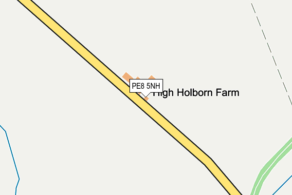
PE8 5NH is located in the Thrapston electoral ward, within the unitary authority of North Northamptonshire and the English Parliamentary constituency of Corby. The Sub Integrated Care Board (ICB) Location is NHS Northamptonshire ICB - 78H and the police force is Northamptonshire. This postcode has been in use since January 1980.


GetTheData
Source: OS OpenMap – Local (Ordnance Survey)
Source: OS VectorMap District (Ordnance Survey)
Licence: Open Government Licence (requires attribution)
| Easting | 512025 |
| Northing | 286408 |
| Latitude | 52.464133 |
| Longitude | -0.352496 |
GetTheData
Source: Open Postcode Geo
Licence: Open Government Licence
| Country | England |
| Postcode District | PE8 |
➜ See where PE8 is on a map | |
GetTheData
Source: Land Registry Price Paid Data
Licence: Open Government Licence
Elevation or altitude of PE8 5NH as distance above sea level:
| Metres | Feet | |
|---|---|---|
| Elevation | 60m | 197ft |
Elevation is measured from the approximate centre of the postcode, to the nearest point on an OS contour line from OS Terrain 50, which has contour spacing of ten vertical metres.
➜ How high above sea level am I? Find the elevation of your current position using your device's GPS.
GetTheData
Source: Open Postcode Elevation
Licence: Open Government Licence
| Ward | Thrapston |
| Constituency | Corby |
GetTheData
Source: ONS Postcode Database
Licence: Open Government Licence
| St Peter's Church (Washingley Road) | Lutton | 1,594m |
| Demand Responsive Area | Lutton | 1,596m |
| St Peter's Church (Washingley Road) | Lutton | 1,599m |
| Milton House (Main Street) | Lutton | 1,705m |
| Ducks Nest (Main Street) | Lutton | 1,786m |
GetTheData
Source: NaPTAN
Licence: Open Government Licence
GetTheData
Source: ONS Postcode Database
Licence: Open Government Licence

➜ Get more ratings from the Food Standards Agency
GetTheData
Source: Food Standards Agency
Licence: FSA terms & conditions
| Last Collection | |||
|---|---|---|---|
| Location | Mon-Fri | Sat | Distance |
| Main Street Great Gidding | 16:15 | 10:00 | 2,962m |
| Caldcote | 16:00 | 07:30 | 3,130m |
| Hemington | 16:15 | 09:30 | 3,211m |
GetTheData
Source: Dracos
Licence: Creative Commons Attribution-ShareAlike
The below table lists the International Territorial Level (ITL) codes (formerly Nomenclature of Territorial Units for Statistics (NUTS) codes) and Local Administrative Units (LAU) codes for PE8 5NH:
| ITL 1 Code | Name |
|---|---|
| TLF | East Midlands (England) |
| ITL 2 Code | Name |
| TLF2 | Leicestershire, Rutland and Northamptonshire |
| ITL 3 Code | Name |
| TLF25 | North Northamptonshire |
| LAU 1 Code | Name |
| E07000152 | East Northamptonshire |
GetTheData
Source: ONS Postcode Directory
Licence: Open Government Licence
The below table lists the Census Output Area (OA), Lower Layer Super Output Area (LSOA), and Middle Layer Super Output Area (MSOA) for PE8 5NH:
| Code | Name | |
|---|---|---|
| OA | E00137563 | |
| LSOA | E01027044 | East Northamptonshire 002B |
| MSOA | E02005630 | East Northamptonshire 002 |
GetTheData
Source: ONS Postcode Directory
Licence: Open Government Licence
| PE8 5QL | 1424m | |
| PE8 5NE | 1625m | |
| PE8 5QS | 1654m | |
| PE8 5QN | Lutton Road | 1676m |
| PE8 5ND | 1791m | |
| PE28 5RX | High Haden Road | 1911m |
| PE7 3SH | Bullock Road | 1986m |
| PE7 3SL | 2878m | |
| PE28 5NT | Mill Road | 2922m |
| PE28 5NU | Main Street | 2973m |
GetTheData
Source: Open Postcode Geo; Land Registry Price Paid Data
Licence: Open Government Licence