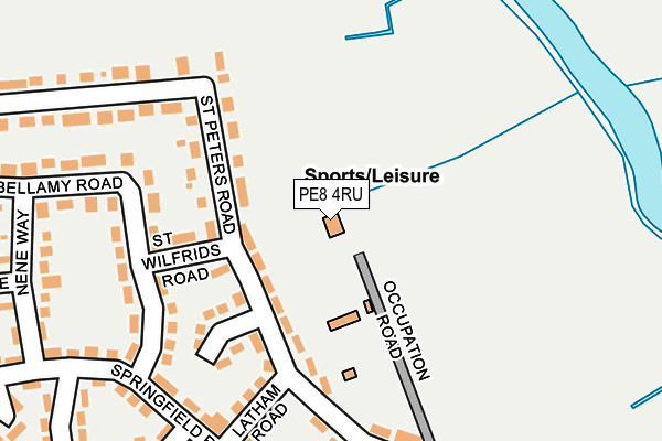
PE8 4RU is located in the Oundle electoral ward, within the unitary authority of North Northamptonshire and the English Parliamentary constituency of Corby. The Sub Integrated Care Board (ICB) Location is NHS Northamptonshire ICB - 78H and the police force is Northamptonshire. This postcode has been in use since December 1997.


GetTheData
Source: OS OpenMap – Local (Ordnance Survey)
Source: OS VectorMap District (Ordnance Survey)
Licence: Open Government Licence (requires attribution)
| Easting | 504040 |
| Northing | 289172 |
| Latitude | 52.490550 |
| Longitude | -0.469120 |
GetTheData
Source: Open Postcode Geo
Licence: Open Government Licence
| Country | England |
| Postcode District | PE8 |
➜ See where PE8 is on a map ➜ Where is Oundle? | |
GetTheData
Source: Land Registry Price Paid Data
Licence: Open Government Licence
Elevation or altitude of PE8 4RU as distance above sea level:
| Metres | Feet | |
|---|---|---|
| Elevation | 20m | 66ft |
Elevation is measured from the approximate centre of the postcode, to the nearest point on an OS contour line from OS Terrain 50, which has contour spacing of ten vertical metres.
➜ How high above sea level am I? Find the elevation of your current position using your device's GPS.
GetTheData
Source: Open Postcode Elevation
Licence: Open Government Licence
| Ward | Oundle |
| Constituency | Corby |
GetTheData
Source: ONS Postcode Database
Licence: Open Government Licence
| St Wilfrids Road (St Peters Road) | Oundle | 96m |
| St Wilfrids Road (St Peters Road) | Oundle | 96m |
| Nene View (Springfield Road) | Oundle | 262m |
| Nene View (Springfield Road) | Oundle | 264m |
| Nene Way (Bellamy Road) | Oundle | 269m |
GetTheData
Source: NaPTAN
Licence: Open Government Licence
GetTheData
Source: ONS Postcode Database
Licence: Open Government Licence


➜ Get more ratings from the Food Standards Agency
GetTheData
Source: Food Standards Agency
Licence: FSA terms & conditions
| Last Collection | |||
|---|---|---|---|
| Location | Mon-Fri | Sat | Distance |
| Tansor | 16:00 | 09:45 | 2,180m |
| Stoke Doyle | 16:30 | 10:30 | 3,283m |
| Barnwell Post Office | 16:30 | 11:00 | 4,312m |
GetTheData
Source: Dracos
Licence: Creative Commons Attribution-ShareAlike
The below table lists the International Territorial Level (ITL) codes (formerly Nomenclature of Territorial Units for Statistics (NUTS) codes) and Local Administrative Units (LAU) codes for PE8 4RU:
| ITL 1 Code | Name |
|---|---|
| TLF | East Midlands (England) |
| ITL 2 Code | Name |
| TLF2 | Leicestershire, Rutland and Northamptonshire |
| ITL 3 Code | Name |
| TLF25 | North Northamptonshire |
| LAU 1 Code | Name |
| E07000152 | East Northamptonshire |
GetTheData
Source: ONS Postcode Directory
Licence: Open Government Licence
The below table lists the Census Output Area (OA), Lower Layer Super Output Area (LSOA), and Middle Layer Super Output Area (MSOA) for PE8 4RU:
| Code | Name | |
|---|---|---|
| OA | E00137584 | |
| LSOA | E01027047 | East Northamptonshire 002D |
| MSOA | E02005630 | East Northamptonshire 002 |
GetTheData
Source: ONS Postcode Directory
Licence: Open Government Licence
| PE8 4NU | St Peters Road | 82m |
| PE8 4NT | St Peters Road | 126m |
| PE8 4NX | St Wilfrids Road | 143m |
| PE8 4NA | Bellamy Road | 176m |
| PE8 4NR | St Peters Road | 180m |
| PE8 4NG | Latham Road | 187m |
| PE8 4NQ | St Peters Road | 193m |
| PE8 4ND | Bellamy Road | 195m |
| PE8 4NS | St Peters Road | 208m |
| PE8 4NB | Bellamy Road | 214m |
GetTheData
Source: Open Postcode Geo; Land Registry Price Paid Data
Licence: Open Government Licence