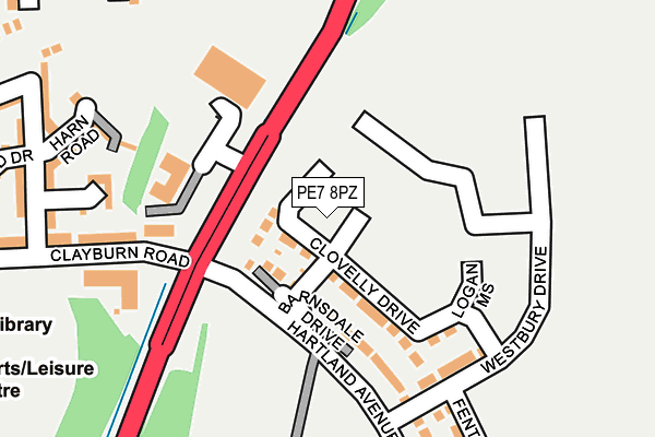
PE7 8PZ is located in the Hargate and Hempsted electoral ward, within the unitary authority of Peterborough and the English Parliamentary constituency of North West Cambridgeshire. The Sub Integrated Care Board (ICB) Location is NHS Cambridgeshire and Peterborough ICB - 06H and the police force is Cambridgeshire. This postcode has been in use since June 2017.


GetTheData
Source: OS OpenMap – Local (Ordnance Survey)
Source: OS VectorMap District (Ordnance Survey)
Licence: Open Government Licence (requires attribution)
| Easting | 518381 |
| Northing | 294486 |
| Latitude | 52.535398 |
| Longitude | -0.256099 |
GetTheData
Source: Open Postcode Geo
Licence: Open Government Licence
| Country | England |
| Postcode District | PE7 |
➜ See where PE7 is on a map ➜ Where is Peterborough? | |
GetTheData
Source: Land Registry Price Paid Data
Licence: Open Government Licence
| Ward | Hargate And Hempsted |
| Constituency | North West Cambridgeshire |
GetTheData
Source: ONS Postcode Database
Licence: Open Government Licence
2024 28 MAR £301,000 |
2023 14 APR £282,000 |
2022 25 NOV £355,000 |
2021 25 FEB £280,000 |
2020 31 JUL £258,000 |
2020 29 JUN £238,000 |
2020 13 MAR £245,000 |
2, CLOVELLY DRIVE, HAMPTON GARDENS, PETERBOROUGH, PE7 8PZ 2018 31 JUL £317,995 |
20, CLOVELLY DRIVE, HAMPTON GARDENS, PETERBOROUGH, PE7 8PZ 2018 4 JUN £362,995 |
54, CLOVELLY DRIVE, HAMPTON GARDENS, PETERBOROUGH, PE7 8PZ 2018 25 MAY £252,995 |
GetTheData
Source: HM Land Registry Price Paid Data
Licence: Contains HM Land Registry data © Crown copyright and database right 2024. This data is licensed under the Open Government Licence v3.0.
| Hampton College (Clayburn Road) | Hampton | 683m |
| Hampton College (Clayburn Road) | Hampton | 684m |
| Tabor Court (Silver Hill) | Hampton | 800m |
| Tabor Court (Silver Hill) | Hampton | 803m |
| Hempsted Road (Eagle Way) | Hampton Vale | 822m |
| Peterborough Station | 4.4km |
GetTheData
Source: NaPTAN
Licence: Open Government Licence
| Percentage of properties with Next Generation Access | 100.0% |
| Percentage of properties with Superfast Broadband | 100.0% |
| Percentage of properties with Ultrafast Broadband | 100.0% |
| Percentage of properties with Full Fibre Broadband | 100.0% |
Superfast Broadband is between 30Mbps and 300Mbps
Ultrafast Broadband is > 300Mbps
| Median download speed | 360.0Mbps |
| Average download speed | 355.7Mbps |
| Maximum download speed | 360.00Mbps |
| Median upload speed | 360.0Mbps |
| Average upload speed | 354.9Mbps |
| Maximum upload speed | 360.00Mbps |
| Percentage of properties unable to receive 2Mbps | 0.0% |
| Percentage of properties unable to receive 5Mbps | 0.0% |
| Percentage of properties unable to receive 10Mbps | 0.0% |
| Percentage of properties unable to receive 30Mbps | 0.0% |
GetTheData
Source: Ofcom
Licence: Ofcom Terms of Use (requires attribution)
GetTheData
Source: ONS Postcode Database
Licence: Open Government Licence

➜ Get more ratings from the Food Standards Agency
GetTheData
Source: Food Standards Agency
Licence: FSA terms & conditions
| Last Collection | |||
|---|---|---|---|
| Location | Mon-Fri | Sat | Distance |
| Silver Hill | 18:00 | 12:30 | 978m |
| New Shopping Centre | 18:00 | 12:30 | 1,162m |
| Westlake Avenue | 18:00 | 12:30 | 1,346m |
GetTheData
Source: Dracos
Licence: Creative Commons Attribution-ShareAlike
The below table lists the International Territorial Level (ITL) codes (formerly Nomenclature of Territorial Units for Statistics (NUTS) codes) and Local Administrative Units (LAU) codes for PE7 8PZ:
| ITL 1 Code | Name |
|---|---|
| TLH | East |
| ITL 2 Code | Name |
| TLH1 | East Anglia |
| ITL 3 Code | Name |
| TLH11 | Peterborough |
| LAU 1 Code | Name |
| E06000031 | Peterborough |
GetTheData
Source: ONS Postcode Directory
Licence: Open Government Licence
The below table lists the Census Output Area (OA), Lower Layer Super Output Area (LSOA), and Middle Layer Super Output Area (MSOA) for PE7 8PZ:
| Code | Name | |
|---|---|---|
| OA | E00171322 | |
| LSOA | E01033176 | Peterborough 023C |
| MSOA | E02006878 | Peterborough 023 |
GetTheData
Source: ONS Postcode Directory
Licence: Open Government Licence
| PE7 8GH | Harn Road | 313m |
| PE7 8GG | Torold Drive | 370m |
| PE7 8GL | Clayburn Road | 386m |
| PE7 8GJ | Delves Way | 393m |
| PE7 8GP | Bank Avenue | 430m |
| PE7 8GN | Brickstead Road | 505m |
| PE7 8LL | The Ridge | 553m |
| PE7 8BT | Ashbourne Road | 559m |
| PE7 8GS | Eagle Way | 650m |
| PE7 8NU | Teasel Way | 669m |
GetTheData
Source: Open Postcode Geo; Land Registry Price Paid Data
Licence: Open Government Licence