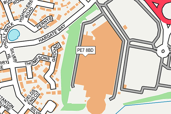
PE7 8BD is located in the Hargate and Hempsted electoral ward, within the unitary authority of Peterborough and the English Parliamentary constituency of North West Cambridgeshire. The Sub Integrated Care Board (ICB) Location is NHS Cambridgeshire and Peterborough ICB - 06H and the police force is Cambridgeshire. This postcode has been in use since June 1999.


GetTheData
Source: OS OpenMap – Local (Ordnance Survey)
Source: OS VectorMap District (Ordnance Survey)
Licence: Open Government Licence (requires attribution)
| Easting | 517847 |
| Northing | 295063 |
| Latitude | 52.540681 |
| Longitude | -0.263780 |
GetTheData
Source: Open Postcode Geo
Licence: Open Government Licence
| Country | England |
| Postcode District | PE7 |
➜ See where PE7 is on a map ➜ Where is Peterborough? | |
GetTheData
Source: Land Registry Price Paid Data
Licence: Open Government Licence
Elevation or altitude of PE7 8BD as distance above sea level:
| Metres | Feet | |
|---|---|---|
| Elevation | 20m | 66ft |
Elevation is measured from the approximate centre of the postcode, to the nearest point on an OS contour line from OS Terrain 50, which has contour spacing of ten vertical metres.
➜ How high above sea level am I? Find the elevation of your current position using your device's GPS.
GetTheData
Source: Open Postcode Elevation
Licence: Open Government Licence
| Ward | Hargate And Hempsted |
| Constituency | North West Cambridgeshire |
GetTheData
Source: ONS Postcode Database
Licence: Open Government Licence
| Hargate Way | Hampton | 145m |
| Hargate Way | Hampton | 151m |
| Tabor Court (Silver Hill) | Hampton | 249m |
| Tabor Court (Silver Hill) | Hampton | 268m |
| Archers Wood (Hargate Way) | Hampton Hargate | 413m |
| Peterborough Station | 3.9km |
GetTheData
Source: NaPTAN
Licence: Open Government Licence
GetTheData
Source: ONS Postcode Database
Licence: Open Government Licence


➜ Get more ratings from the Food Standards Agency
GetTheData
Source: Food Standards Agency
Licence: FSA terms & conditions
| Last Collection | |||
|---|---|---|---|
| Location | Mon-Fri | Sat | Distance |
| Silver Hill | 18:00 | 12:30 | 270m |
| New Shopping Centre | 18:00 | 12:30 | 659m |
| Eldern Centre | 18:30 | 11:45 | 952m |
GetTheData
Source: Dracos
Licence: Creative Commons Attribution-ShareAlike
The below table lists the International Territorial Level (ITL) codes (formerly Nomenclature of Territorial Units for Statistics (NUTS) codes) and Local Administrative Units (LAU) codes for PE7 8BD:
| ITL 1 Code | Name |
|---|---|
| TLH | East |
| ITL 2 Code | Name |
| TLH1 | East Anglia |
| ITL 3 Code | Name |
| TLH11 | Peterborough |
| LAU 1 Code | Name |
| E06000031 | Peterborough |
GetTheData
Source: ONS Postcode Directory
Licence: Open Government Licence
The below table lists the Census Output Area (OA), Lower Layer Super Output Area (LSOA), and Middle Layer Super Output Area (MSOA) for PE7 8BD:
| Code | Name | |
|---|---|---|
| OA | E00171313 | |
| LSOA | E01033181 | Peterborough 022E |
| MSOA | E02006877 | Peterborough 022 |
GetTheData
Source: ONS Postcode Directory
Licence: Open Government Licence
| PE7 8BE | Serpentine Green Shopping Centre | 105m |
| PE7 8AY | Lornas Field | 108m |
| PE7 8AL | Pernys Close | 174m |
| PE7 8AU | Thompsons Ground | 193m |
| PE7 8AJ | Holly Walk | 208m |
| PE7 8GF | Tabor Court | 211m |
| PE7 8AX | Middlefield | 212m |
| PE7 8AS | Fields End Close | 213m |
| PE7 8EH | Ribes Close | 220m |
| PE7 8AT | Silver Hill | 243m |
GetTheData
Source: Open Postcode Geo; Land Registry Price Paid Data
Licence: Open Government Licence