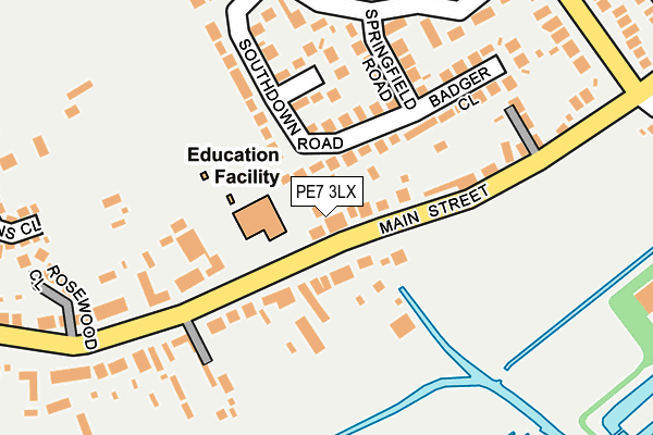
PE7 3LX is located in the Yaxley electoral ward, within the local authority district of Huntingdonshire and the English Parliamentary constituency of North West Cambridgeshire. The Sub Integrated Care Board (ICB) Location is NHS Cambridgeshire and Peterborough ICB - 06H and the police force is Cambridgeshire. This postcode has been in use since July 2017.


GetTheData
Source: OS OpenMap – Local (Ordnance Survey)
Source: OS VectorMap District (Ordnance Survey)
Licence: Open Government Licence (requires attribution)
| Easting | 518350 |
| Northing | 292669 |
| Latitude | 52.519078 |
| Longitude | -0.257201 |
GetTheData
Source: Open Postcode Geo
Licence: Open Government Licence
| Country | England |
| Postcode District | PE7 |
➜ See where PE7 is on a map ➜ Where is Yaxley? | |
GetTheData
Source: Land Registry Price Paid Data
Licence: Open Government Licence
| Ward | Yaxley |
| Constituency | North West Cambridgeshire |
GetTheData
Source: ONS Postcode Database
Licence: Open Government Licence
| Morgan Close (Bentley Avenue) | Yaxley | 152m |
| Middletons Road (Broadway) | Yaxley | 162m |
| Morgan Close (Bentley Avenue) | Yaxley | 165m |
| Middletons Road (Broadway) | Yaxley | 232m |
| Queen Street (Broadway) | Yaxley | 240m |
GetTheData
Source: NaPTAN
Licence: Open Government Licence
GetTheData
Source: ONS Postcode Database
Licence: Open Government Licence


➜ Get more ratings from the Food Standards Agency
GetTheData
Source: Food Standards Agency
Licence: FSA terms & conditions
| Last Collection | |||
|---|---|---|---|
| Location | Mon-Fri | Sat | Distance |
| Yaxley Post Office | 17:15 | 12:45 | 306m |
| Broadway/Green Lane | 16:45 | 12:30 | 464m |
| Village Green | 16:45 | 12:30 | 544m |
GetTheData
Source: Dracos
Licence: Creative Commons Attribution-ShareAlike
The below table lists the International Territorial Level (ITL) codes (formerly Nomenclature of Territorial Units for Statistics (NUTS) codes) and Local Administrative Units (LAU) codes for PE7 3LX:
| ITL 1 Code | Name |
|---|---|
| TLH | East |
| ITL 2 Code | Name |
| TLH1 | East Anglia |
| ITL 3 Code | Name |
| TLH12 | Cambridgeshire CC |
| LAU 1 Code | Name |
| E07000011 | Huntingdonshire |
GetTheData
Source: ONS Postcode Directory
Licence: Open Government Licence
The below table lists the Census Output Area (OA), Lower Layer Super Output Area (LSOA), and Middle Layer Super Output Area (MSOA) for PE7 3LX:
| Code | Name | |
|---|---|---|
| OA | E00173803 | |
| LSOA | E01018214 | Huntingdonshire 001C |
| MSOA | E02003753 | Huntingdonshire 001 |
GetTheData
Source: ONS Postcode Directory
Licence: Open Government Licence
| PE7 3JD | Broadway | 76m |
| PE7 3GE | Morgan Close | 87m |
| PE7 3NU | Middletons Road | 184m |
| PE7 3ZT | Bentley Avenue | 195m |
| PE7 3QY | Royce Close | 240m |
| PE7 3NX | Middletons Road | 243m |
| PE7 3ZS | Bentley Avenue | 246m |
| PE7 3BF | Aston Close | 268m |
| PE7 3ZU | Wolseley Close | 282m |
| PE7 3JH | Crane Avenue | 302m |
GetTheData
Source: Open Postcode Geo; Land Registry Price Paid Data
Licence: Open Government Licence