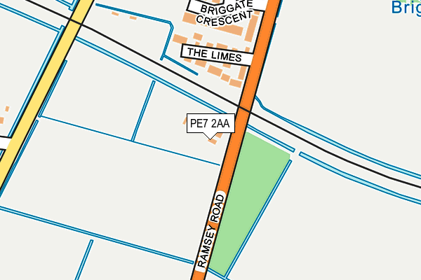
PE7 2AA is located in the Whittlesey South electoral ward, within the local authority district of Fenland and the English Parliamentary constituency of North East Cambridgeshire. The Sub Integrated Care Board (ICB) Location is NHS Cambridgeshire and Peterborough ICB - 06H and the police force is Cambridgeshire. This postcode has been in use since December 2012.


GetTheData
Source: OS OpenMap – Local (Ordnance Survey)
Source: OS VectorMap District (Ordnance Survey)
Licence: Open Government Licence (requires attribution)
| Easting | 526573 |
| Northing | 296368 |
| Latitude | 52.550450 |
| Longitude | -0.134689 |
GetTheData
Source: Open Postcode Geo
Licence: Open Government Licence
| Country | England |
| Postcode District | PE7 |
➜ See where PE7 is on a map | |
GetTheData
Source: Land Registry Price Paid Data
Licence: Open Government Licence
Elevation or altitude of PE7 2AA as distance above sea level:
| Metres | Feet | |
|---|---|---|
| Elevation | 0m | 0ft |
Elevation is measured from the approximate centre of the postcode, to the nearest point on an OS contour line from OS Terrain 50, which has contour spacing of ten vertical metres.
➜ How high above sea level am I? Find the elevation of your current position using your device's GPS.
GetTheData
Source: Open Postcode Elevation
Licence: Open Government Licence
| Ward | Whittlesey South |
| Constituency | North East Cambridgeshire |
GetTheData
Source: ONS Postcode Database
Licence: Open Government Licence
| Briggate Crescent (Ramsey Road) | Whittlesey | 260m |
| Briggate Crescent (Ramsey Road) | Whittlesey | 305m |
| Queen Street (Whittlesey Market Place) | Whittlesey | 808m |
| Whitmore Street (Broad Street) | Whittlesey | 824m |
| Queen Street | Whittlesey | 829m |
| Whittlesea Station | 1.1km |
GetTheData
Source: NaPTAN
Licence: Open Government Licence
GetTheData
Source: ONS Postcode Database
Licence: Open Government Licence


➜ Get more ratings from the Food Standards Agency
GetTheData
Source: Food Standards Agency
Licence: FSA terms & conditions
| Last Collection | |||
|---|---|---|---|
| Location | Mon-Fri | Sat | Distance |
| Station Road | 17:30 | 11:30 | 693m |
| The Maltings | 18:00 | 12:30 | 784m |
| Hallcroft Road | 17:45 | 12:00 | 878m |
GetTheData
Source: Dracos
Licence: Creative Commons Attribution-ShareAlike
| Risk of PE7 2AA flooding from rivers and sea | Medium |
| ➜ PE7 2AA flood map | |
GetTheData
Source: Open Flood Risk by Postcode
Licence: Open Government Licence
The below table lists the International Territorial Level (ITL) codes (formerly Nomenclature of Territorial Units for Statistics (NUTS) codes) and Local Administrative Units (LAU) codes for PE7 2AA:
| ITL 1 Code | Name |
|---|---|
| TLH | East |
| ITL 2 Code | Name |
| TLH1 | East Anglia |
| ITL 3 Code | Name |
| TLH12 | Cambridgeshire CC |
| LAU 1 Code | Name |
| E07000010 | Fenland |
GetTheData
Source: ONS Postcode Directory
Licence: Open Government Licence
The below table lists the Census Output Area (OA), Lower Layer Super Output Area (LSOA), and Middle Layer Super Output Area (MSOA) for PE7 2AA:
| Code | Name | |
|---|---|---|
| OA | E00091109 | |
| LSOA | E01018059 | Fenland 008B |
| MSOA | E02003749 | Fenland 008 |
GetTheData
Source: ONS Postcode Directory
Licence: Open Government Licence
| PE7 1DS | The Limes | 137m |
| PE7 1DN | Briggate Crescent | 164m |
| PE7 1DW | Ashline Grove | 254m |
| PE7 1DR | Ramsey Road | 291m |
| PE7 1DL | Riverside Close | 328m |
| PE7 1DT | Braemar Gardens | 368m |
| PE7 1DJ | Briggate West | 386m |
| PE7 1EG | Briggate East | 446m |
| PE7 1JE | Love Lane | 504m |
| PE7 1DE | Church Street | 513m |
GetTheData
Source: Open Postcode Geo; Land Registry Price Paid Data
Licence: Open Government Licence