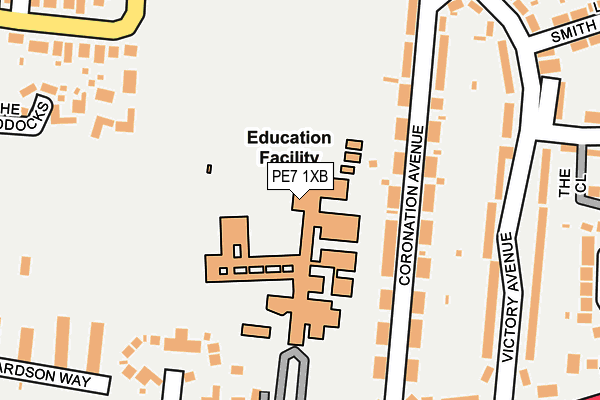
PE7 1XB is located in the Whittlesey East & Villages electoral ward, within the local authority district of Fenland and the English Parliamentary constituency of North East Cambridgeshire. The Sub Integrated Care Board (ICB) Location is NHS Cambridgeshire and Peterborough ICB - 06H and the police force is Cambridgeshire. This postcode has been in use since January 1980.


GetTheData
Source: OS OpenMap – Local (Ordnance Survey)
Source: OS VectorMap District (Ordnance Survey)
Licence: Open Government Licence (requires attribution)
| Easting | 527678 |
| Northing | 297341 |
| Latitude | 52.558935 |
| Longitude | -0.118028 |
GetTheData
Source: Open Postcode Geo
Licence: Open Government Licence
| Country | England |
| Postcode District | PE7 |
➜ See where PE7 is on a map ➜ Where is Whittlesey? | |
GetTheData
Source: Land Registry Price Paid Data
Licence: Open Government Licence
Elevation or altitude of PE7 1XB as distance above sea level:
| Metres | Feet | |
|---|---|---|
| Elevation | 0m | 0ft |
Elevation is measured from the approximate centre of the postcode, to the nearest point on an OS contour line from OS Terrain 50, which has contour spacing of ten vertical metres.
➜ How high above sea level am I? Find the elevation of your current position using your device's GPS.
GetTheData
Source: Open Postcode Elevation
Licence: Open Government Licence
| Ward | Whittlesey East & Villages |
| Constituency | North East Cambridgeshire |
GetTheData
Source: ONS Postcode Database
Licence: Open Government Licence
| H&r Coronation Avenue (Coronation Avenue) | Whittlesey | 128m |
| H&r Coronation Avenue (Coronation Avenue) | Whittlesey | 137m |
| Coronation Avenue | Whittlesey | 183m |
| Sir Harry Smith College Forecourt (Eastrea Road) | Whittlesey | 194m |
| Victory Avenue | Whittlesey | 213m |
| Whittlesea Station | 1km |
GetTheData
Source: NaPTAN
Licence: Open Government Licence
GetTheData
Source: ONS Postcode Database
Licence: Open Government Licence


➜ Get more ratings from the Food Standards Agency
GetTheData
Source: Food Standards Agency
Licence: FSA terms & conditions
| Last Collection | |||
|---|---|---|---|
| Location | Mon-Fri | Sat | Distance |
| Coronation Avenue | 17:30 | 11:30 | 258m |
| Feldale Place | 17:30 | 11:45 | 316m |
| Drybread Road (School) | 17:30 | 11:45 | 343m |
GetTheData
Source: Dracos
Licence: Creative Commons Attribution-ShareAlike
The below table lists the International Territorial Level (ITL) codes (formerly Nomenclature of Territorial Units for Statistics (NUTS) codes) and Local Administrative Units (LAU) codes for PE7 1XB:
| ITL 1 Code | Name |
|---|---|
| TLH | East |
| ITL 2 Code | Name |
| TLH1 | East Anglia |
| ITL 3 Code | Name |
| TLH12 | Cambridgeshire CC |
| LAU 1 Code | Name |
| E07000010 | Fenland |
GetTheData
Source: ONS Postcode Directory
Licence: Open Government Licence
The below table lists the Census Output Area (OA), Lower Layer Super Output Area (LSOA), and Middle Layer Super Output Area (MSOA) for PE7 1XB:
| Code | Name | |
|---|---|---|
| OA | E00091173 | |
| LSOA | E01018072 | Fenland 006B |
| MSOA | E02003747 | Fenland 006 |
GetTheData
Source: ONS Postcode Directory
Licence: Open Government Licence
| PE7 1XD | Coronation Avenue | 120m |
| PE7 1XE | Coronation Avenue | 149m |
| PE7 1SQ | Lattersey Close | 197m |
| PE7 1PL | The Paddocks | 242m |
| PE7 1XT | Victory Avenue | 246m |
| PE7 1XU | Victory Avenue | 247m |
| PE7 1XA | Eastrea Road | 264m |
| PE7 1RR | Bassenhally Road | 275m |
| PE7 1RS | Richardson Way | 281m |
| PE7 1SG | Eastrea Road | 303m |
GetTheData
Source: Open Postcode Geo; Land Registry Price Paid Data
Licence: Open Government Licence