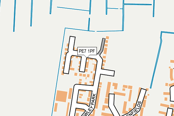
PE7 1PF is located in the Whittlesey North West electoral ward, within the local authority district of Fenland and the English Parliamentary constituency of North East Cambridgeshire. The Sub Integrated Care Board (ICB) Location is NHS Cambridgeshire and Peterborough ICB - 06H and the police force is Cambridgeshire. This postcode has been in use since March 2017.


GetTheData
Source: OS OpenMap – Local (Ordnance Survey)
Source: OS VectorMap District (Ordnance Survey)
Licence: Open Government Licence (requires attribution)
| Easting | 525971 |
| Northing | 297996 |
| Latitude | 52.565236 |
| Longitude | -0.142928 |
GetTheData
Source: Open Postcode Geo
Licence: Open Government Licence
| Country | England |
| Postcode District | PE7 |
➜ See where PE7 is on a map ➜ Where is Whittlesey? | |
GetTheData
Source: Land Registry Price Paid Data
Licence: Open Government Licence
| Ward | Whittlesey North West |
| Constituency | North East Cambridgeshire |
GetTheData
Source: ONS Postcode Database
Licence: Open Government Licence
2024 20 AUG £392,500 |
2024 7 JUN £310,000 |
2023 26 MAY £475,000 |
2022 8 JUN £313,000 |
2021 12 FEB £333,000 |
108, SNOWLEY PARK, WHITTLESEY, PETERBOROUGH, PE7 1PF 2018 18 MAY £439,995 |
109, SNOWLEY PARK, WHITTLESEY, PETERBOROUGH, PE7 1PF 2018 23 MAR £397,995 |
99, SNOWLEY PARK, WHITTLESEY, PETERBOROUGH, PE7 1PF 2018 9 MAR £397,995 |
100, SNOWLEY PARK, WHITTLESEY, PETERBOROUGH, PE7 1PF 2018 9 MAR £279,995 |
98, SNOWLEY PARK, WHITTLESEY, PETERBOROUGH, PE7 1PF 2018 8 MAR £279,995 |
GetTheData
Source: HM Land Registry Price Paid Data
Licence: Contains HM Land Registry data © Crown copyright and database right 2025. This data is licensed under the Open Government Licence v3.0.
| Crossway Hand (Peterborough Road) | Whittlesey | 484m |
| Crossway Hand (Peterborough Road) | Whittlesey | 503m |
| West End | Whittlesey | 536m |
| West End | Whittlesey | 547m |
| Low Cross (West End) | Whittlesey | 887m |
| Whittlesea Station | 2.4km |
GetTheData
Source: NaPTAN
Licence: Open Government Licence
| Percentage of properties with Next Generation Access | 100.0% |
| Percentage of properties with Superfast Broadband | 100.0% |
| Percentage of properties with Ultrafast Broadband | 98.2% |
| Percentage of properties with Full Fibre Broadband | 98.2% |
Superfast Broadband is between 30Mbps and 300Mbps
Ultrafast Broadband is > 300Mbps
| Median download speed | 100.0Mbps |
| Average download speed | 165.6Mbps |
| Maximum download speed | 350.00Mbps |
Ofcom does not currently provide upload speed data for PE7 1PF. This is because there are less than four broadband connections in this postcode.
| Percentage of properties unable to receive 2Mbps | 0.0% |
| Percentage of properties unable to receive 5Mbps | 0.0% |
| Percentage of properties unable to receive 10Mbps | 0.0% |
| Percentage of properties unable to receive 30Mbps | 0.0% |
GetTheData
Source: Ofcom
Licence: Ofcom Terms of Use (requires attribution)
GetTheData
Source: ONS Postcode Database
Licence: Open Government Licence


➜ Get more ratings from the Food Standards Agency
GetTheData
Source: Food Standards Agency
Licence: FSA terms & conditions
| Last Collection | |||
|---|---|---|---|
| Location | Mon-Fri | Sat | Distance |
| Glenfields-stonald Road | 17:45 | 12:00 | 296m |
| Stonald Road | 17:45 | 12:00 | 680m |
| Headlands Way | 17:30 | 11:45 | 840m |
GetTheData
Source: Dracos
Licence: Creative Commons Attribution-ShareAlike
The below table lists the International Territorial Level (ITL) codes (formerly Nomenclature of Territorial Units for Statistics (NUTS) codes) and Local Administrative Units (LAU) codes for PE7 1PF:
| ITL 1 Code | Name |
|---|---|
| TLH | East |
| ITL 2 Code | Name |
| TLH1 | East Anglia |
| ITL 3 Code | Name |
| TLH12 | Cambridgeshire CC |
| LAU 1 Code | Name |
| E07000010 | Fenland |
GetTheData
Source: ONS Postcode Directory
Licence: Open Government Licence
The below table lists the Census Output Area (OA), Lower Layer Super Output Area (LSOA), and Middle Layer Super Output Area (MSOA) for PE7 1PF:
| Code | Name | |
|---|---|---|
| OA | E00091134 | |
| LSOA | E01018064 | Fenland 006A |
| MSOA | E02003747 | Fenland 006 |
GetTheData
Source: ONS Postcode Directory
Licence: Open Government Licence
| PE7 1JH | Snowley Park | 142m |
| PE7 1JQ | Snowley Park | 154m |
| PE7 1HX | Glenfields | 236m |
| PE7 1QR | Stonald Road | 286m |
| PE7 1HY | Glenfields | 288m |
| PE7 1QG | Stonald Road | 313m |
| PE7 1QF | Tower Close | 340m |
| PE7 1FY | Harvester Road | 345m |
| PE7 1FX | Morris Close | 361m |
| PE7 1PB | Crossway Hand | 386m |
GetTheData
Source: Open Postcode Geo; Land Registry Price Paid Data
Licence: Open Government Licence