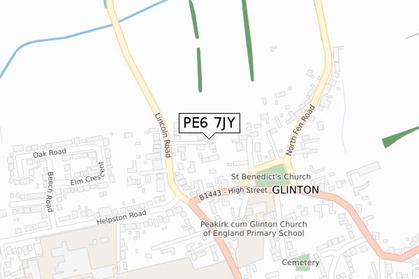
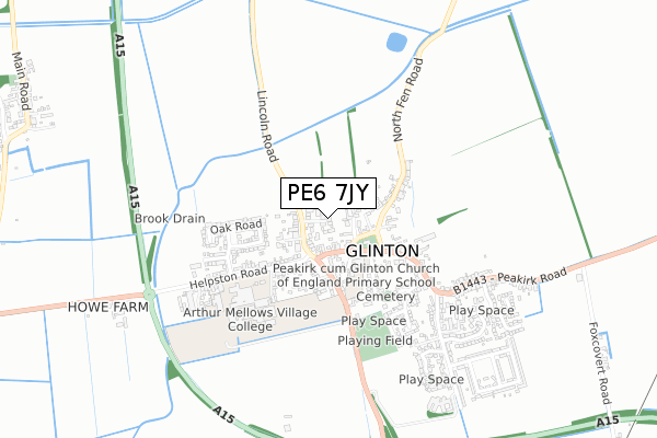
PE6 7JY is located in the Glinton and Castor electoral ward, within the unitary authority of Peterborough and the English Parliamentary constituency of North West Cambridgeshire. The Sub Integrated Care Board (ICB) Location is NHS Cambridgeshire and Peterborough ICB - 06H and the police force is Cambridgeshire. This postcode has been in use since January 2019.


GetTheData
Source: OS Open Zoomstack (Ordnance Survey)
Licence: Open Government Licence (requires attribution)
Attribution: Contains OS data © Crown copyright and database right 2025
Source: Open Postcode Geo
Licence: Open Government Licence (requires attribution)
Attribution: Contains OS data © Crown copyright and database right 2025; Contains Royal Mail data © Royal Mail copyright and database right 2025; Source: Office for National Statistics licensed under the Open Government Licence v.3.0
| Easting | 515268 |
| Northing | 306063 |
| Latitude | 52.640095 |
| Longitude | -0.297949 |
GetTheData
Source: Open Postcode Geo
Licence: Open Government Licence
| Country | England |
| Postcode District | PE6 |
➜ See where PE6 is on a map ➜ Where is Glinton? | |
GetTheData
Source: Land Registry Price Paid Data
Licence: Open Government Licence
| Ward | Glinton And Castor |
| Constituency | North West Cambridgeshire |
GetTheData
Source: ONS Postcode Database
Licence: Open Government Licence
8, POPPYFIELDS, GLINTON, PETERBOROUGH, PE6 7JY 2021 29 MAR £465,000 |
1, POPPYFIELDS, GLINTON, PETERBOROUGH, PE6 7JY 2020 30 OCT £617,500 |
2, POPPYFIELDS, GLINTON, PETERBOROUGH, PE6 7JY 2020 6 MAY £635,000 |
3, POPPYFIELDS, GLINTON, PETERBOROUGH, PE6 7JY 2020 21 FEB £635,000 |
4, POPPYFIELDS, GLINTON, PETERBOROUGH, PE6 7JY 2019 12 NOV £595,000 |
5, POPPYFIELDS, GLINTON, PETERBOROUGH, PE6 7JY 2019 5 JUL £630,000 |
6, POPPYFIELDS, GLINTON, PETERBOROUGH, PE6 7JY 2019 18 MAR £665,000 |
7, POPPYFIELDS, GLINTON, PETERBOROUGH, PE6 7JY 2019 25 JAN £680,000 |
GetTheData
Source: HM Land Registry Price Paid Data
Licence: Contains HM Land Registry data © Crown copyright and database right 2025. This data is licensed under the Open Government Licence v3.0.
| The Green (High Street) | Glinton | 120m |
| The Green (High Street) | Glinton | 171m |
| Crossroads (Lincoln Road) | Glinton | 197m |
| Crossroads (Lincoln Road) | Glinton | 204m |
| Websters Close (High Street) | Glinton | 425m |
GetTheData
Source: NaPTAN
Licence: Open Government Licence
| Percentage of properties with Next Generation Access | 100.0% |
| Percentage of properties with Superfast Broadband | 100.0% |
| Percentage of properties with Ultrafast Broadband | 0.0% |
| Percentage of properties with Full Fibre Broadband | 0.0% |
Superfast Broadband is between 30Mbps and 300Mbps
Ultrafast Broadband is > 300Mbps
| Percentage of properties unable to receive 2Mbps | 0.0% |
| Percentage of properties unable to receive 5Mbps | 0.0% |
| Percentage of properties unable to receive 10Mbps | 0.0% |
| Percentage of properties unable to receive 30Mbps | 0.0% |
GetTheData
Source: Ofcom
Licence: Ofcom Terms of Use (requires attribution)
GetTheData
Source: ONS Postcode Database
Licence: Open Government Licence


➜ Get more ratings from the Food Standards Agency
GetTheData
Source: Food Standards Agency
Licence: FSA terms & conditions
| Last Collection | |||
|---|---|---|---|
| Location | Mon-Fri | Sat | Distance |
| Glinton Post Office | 16:30 | 12:30 | 298m |
| Welmore Road | 16:30 | 07:00 | 663m |
| Main Road | 16:15 | 07:00 | 1,253m |
GetTheData
Source: Dracos
Licence: Creative Commons Attribution-ShareAlike
The below table lists the International Territorial Level (ITL) codes (formerly Nomenclature of Territorial Units for Statistics (NUTS) codes) and Local Administrative Units (LAU) codes for PE6 7JY:
| ITL 1 Code | Name |
|---|---|
| TLH | East |
| ITL 2 Code | Name |
| TLH1 | East Anglia |
| ITL 3 Code | Name |
| TLH11 | Peterborough |
| LAU 1 Code | Name |
| E06000031 | Peterborough |
GetTheData
Source: ONS Postcode Directory
Licence: Open Government Licence
The below table lists the Census Output Area (OA), Lower Layer Super Output Area (LSOA), and Middle Layer Super Output Area (MSOA) for PE6 7JY:
| Code | Name | |
|---|---|---|
| OA | E00079029 | |
| LSOA | E01015629 | Peterborough 001A |
| MSOA | E02003237 | Peterborough 001 |
GetTheData
Source: ONS Postcode Directory
Licence: Open Government Licence
| PE6 7JP | High Street | 115m |
| PE6 7JN | The Green | 118m |
| PE6 7JS | Lincoln Road | 133m |
| PE6 7JW | School Lane | 199m |
| PE6 7JR | Lincoln Road | 262m |
| PE6 7JL | North Fen Road | 278m |
| PE6 7JH | Rectory Gardens | 283m |
| PE6 7LE | Elm Crescent | 288m |
| PE6 7LR | Rectory Lane | 294m |
| PE6 7JU | Westbourne Drive | 346m |
GetTheData
Source: Open Postcode Geo; Land Registry Price Paid Data
Licence: Open Government Licence