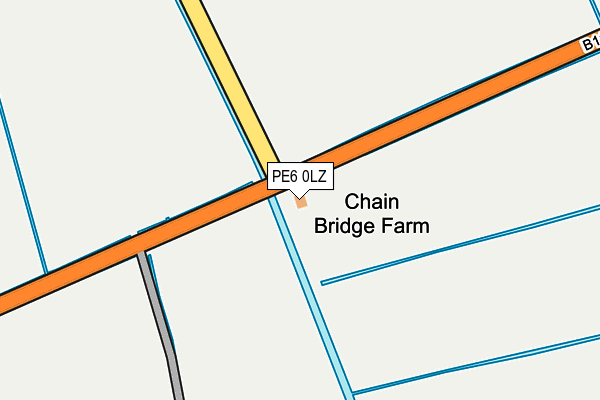
PE6 0LZ lies on Postland in Crowland, Peterborough. PE6 0LZ is located in the Crowland and Deeping St Nicholas electoral ward, within the local authority district of South Holland and the English Parliamentary constituency of South Holland and The Deepings. The Sub Integrated Care Board (ICB) Location is NHS Lincolnshire ICB - 71E and the police force is Lincolnshire. This postcode has been in use since January 1980.


GetTheData
Source: OS OpenMap – Local (Ordnance Survey)
Source: OS VectorMap District (Ordnance Survey)
Licence: Open Government Licence (requires attribution)
| Easting | 527857 |
| Northing | 311831 |
| Latitude | 52.689083 |
| Longitude | -0.109788 |
GetTheData
Source: Open Postcode Geo
Licence: Open Government Licence
| Street | Postland |
| Locality | Crowland |
| Town/City | Peterborough |
| Country | England |
| Postcode District | PE6 |
➜ See where PE6 is on a map | |
GetTheData
Source: Land Registry Price Paid Data
Licence: Open Government Licence
Elevation or altitude of PE6 0LZ as distance above sea level:
| Metres | Feet | |
|---|---|---|
| Elevation | 0m | 0ft |
Elevation is measured from the approximate centre of the postcode, to the nearest point on an OS contour line from OS Terrain 50, which has contour spacing of ten vertical metres.
➜ How high above sea level am I? Find the elevation of your current position using your device's GPS.
GetTheData
Source: Open Postcode Elevation
Licence: Open Government Licence
| Ward | Crowland And Deeping St Nicholas |
| Constituency | South Holland And The Deepings |
GetTheData
Source: ONS Postcode Database
Licence: Open Government Licence
| Coxs Drove (Dowsdale Bank) | Dowsdale | 1,518m |
| Demand Responsive Area | Dowsdale | 1,523m |
| Coxs Drove (Dowsdale Bank) | Dowsdale | 1,528m |
GetTheData
Source: NaPTAN
Licence: Open Government Licence
| Percentage of properties with Next Generation Access | 100.0% |
| Percentage of properties with Superfast Broadband | 0.0% |
| Percentage of properties with Ultrafast Broadband | 0.0% |
| Percentage of properties with Full Fibre Broadband | 0.0% |
Superfast Broadband is between 30Mbps and 300Mbps
Ultrafast Broadband is > 300Mbps
| Percentage of properties unable to receive 2Mbps | 0.0% |
| Percentage of properties unable to receive 5Mbps | 100.0% |
| Percentage of properties unable to receive 10Mbps | 100.0% |
| Percentage of properties unable to receive 30Mbps | 100.0% |
GetTheData
Source: Ofcom
Licence: Ofcom Terms of Use (requires attribution)
GetTheData
Source: ONS Postcode Database
Licence: Open Government Licence
➜ Get more ratings from the Food Standards Agency
GetTheData
Source: Food Standards Agency
Licence: FSA terms & conditions
| Last Collection | |||
|---|---|---|---|
| Location | Mon-Fri | Sat | Distance |
| Shepeau Stow | 16:15 | 10:00 | 2,936m |
| Postland Road | 16:30 | 09:45 | 3,641m |
| Whaplode Drove Village | 16:45 | 09:45 | 3,680m |
GetTheData
Source: Dracos
Licence: Creative Commons Attribution-ShareAlike
| Risk of PE6 0LZ flooding from rivers and sea | Very Low |
| ➜ PE6 0LZ flood map | |
GetTheData
Source: Open Flood Risk by Postcode
Licence: Open Government Licence
The below table lists the International Territorial Level (ITL) codes (formerly Nomenclature of Territorial Units for Statistics (NUTS) codes) and Local Administrative Units (LAU) codes for PE6 0LZ:
| ITL 1 Code | Name |
|---|---|
| TLF | East Midlands (England) |
| ITL 2 Code | Name |
| TLF3 | Lincolnshire |
| ITL 3 Code | Name |
| TLF30 | Lincolnshire CC |
| LAU 1 Code | Name |
| E07000140 | South Holland |
GetTheData
Source: ONS Postcode Directory
Licence: Open Government Licence
The below table lists the Census Output Area (OA), Lower Layer Super Output Area (LSOA), and Middle Layer Super Output Area (MSOA) for PE6 0LZ:
| Code | Name | |
|---|---|---|
| OA | E00133250 | |
| LSOA | E01026239 | South Holland 011A |
| MSOA | E02005475 | South Holland 011 |
GetTheData
Source: ONS Postcode Directory
Licence: Open Government Licence
| PE6 0JX | Postland | 1023m |
| PE6 0ND | Postland | 1298m |
| PE6 0JT | Postland | 1509m |
| PE6 0LR | Dowsdale Bank Road | 1539m |
| PE6 0LT | Postland | 1575m |
| PE6 0NQ | Bank Terrace Dowsdale | 1620m |
| PE6 0NF | Dowsdale | 1702m |
| PE12 0UB | Whale Drove | 1712m |
| PE6 0LX | Spalding Road | 1870m |
| PE6 0JU | Postland | 1991m |
GetTheData
Source: Open Postcode Geo; Land Registry Price Paid Data
Licence: Open Government Licence