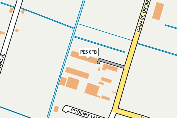
PE6 0FB is located in the Crowland and Deeping St Nicholas electoral ward, within the local authority district of South Holland and the English Parliamentary constituency of South Holland and The Deepings. The Sub Integrated Care Board (ICB) Location is NHS Lincolnshire ICB - 71E and the police force is Lincolnshire. This postcode has been in use since January 2009.


GetTheData
Source: OS OpenMap – Local (Ordnance Survey)
Source: OS VectorMap District (Ordnance Survey)
Licence: Open Government Licence (requires attribution)
| Easting | 523446 |
| Northing | 309516 |
| Latitude | 52.669324 |
| Longitude | -0.175864 |
GetTheData
Source: Open Postcode Geo
Licence: Open Government Licence
| Country | England |
| Postcode District | PE6 |
➜ See where PE6 is on a map ➜ Where is Crowland? | |
GetTheData
Source: Land Registry Price Paid Data
Licence: Open Government Licence
Elevation or altitude of PE6 0FB as distance above sea level:
| Metres | Feet | |
|---|---|---|
| Elevation | 0m | 0ft |
Elevation is measured from the approximate centre of the postcode, to the nearest point on an OS contour line from OS Terrain 50, which has contour spacing of ten vertical metres.
➜ How high above sea level am I? Find the elevation of your current position using your device's GPS.
GetTheData
Source: Open Postcode Elevation
Licence: Open Government Licence
| Ward | Crowland And Deeping St Nicholas |
| Constituency | South Holland And The Deepings |
GetTheData
Source: ONS Postcode Database
Licence: Open Government Licence
| 63 Peterborough Road (Peterborough Road) | Crowland | 555m |
| 48 Peterborough Road (Peterborough Road) | Crowland | 567m |
| Barbers Drove North (Peterborough Road) | Crowland | 621m |
| Barbers Drove North (Peterborough Road) | Crowland | 640m |
| South View Primary School (Broadway) | Crowland | 664m |
GetTheData
Source: NaPTAN
Licence: Open Government Licence
GetTheData
Source: ONS Postcode Database
Licence: Open Government Licence

➜ Get more ratings from the Food Standards Agency
GetTheData
Source: Food Standards Agency
Licence: FSA terms & conditions
| Last Collection | |||
|---|---|---|---|
| Location | Mon-Fri | Sat | Distance |
| Broadway | 16:30 | 09:45 | 546m |
| Peterborough Road | 16:45 | 09:45 | 642m |
| Albion Street | 16:45 | 09:45 | 731m |
GetTheData
Source: Dracos
Licence: Creative Commons Attribution-ShareAlike
| Risk of PE6 0FB flooding from rivers and sea | Medium |
| ➜ PE6 0FB flood map | |
GetTheData
Source: Open Flood Risk by Postcode
Licence: Open Government Licence
The below table lists the International Territorial Level (ITL) codes (formerly Nomenclature of Territorial Units for Statistics (NUTS) codes) and Local Administrative Units (LAU) codes for PE6 0FB:
| ITL 1 Code | Name |
|---|---|
| TLF | East Midlands (England) |
| ITL 2 Code | Name |
| TLF3 | Lincolnshire |
| ITL 3 Code | Name |
| TLF30 | Lincolnshire CC |
| LAU 1 Code | Name |
| E07000140 | South Holland |
GetTheData
Source: ONS Postcode Directory
Licence: Open Government Licence
The below table lists the Census Output Area (OA), Lower Layer Super Output Area (LSOA), and Middle Layer Super Output Area (MSOA) for PE6 0FB:
| Code | Name | |
|---|---|---|
| OA | E00133250 | |
| LSOA | E01026239 | South Holland 011A |
| MSOA | E02005475 | South Holland 011 |
GetTheData
Source: ONS Postcode Directory
Licence: Open Government Licence
| PE6 0BY | Plank Drove | 238m |
| PE6 0LJ | Monks Meadow | 298m |
| PE6 0BN | Crease Drove | 347m |
| PE6 0DT | Beechcroft Gardens | 364m |
| PE6 0BT | Abbots Drive | 426m |
| PE6 0BP | Glebe Gardens | 429m |
| PE6 0AG | Beccelm Drive | 434m |
| PE6 0BX | Low Road | 435m |
| PE6 0BS | Alderlands Close | 439m |
| PE6 0DA | Harvester Way | 449m |
GetTheData
Source: Open Postcode Geo; Land Registry Price Paid Data
Licence: Open Government Licence