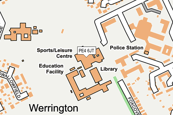
PE4 6JT is located in the Werrington electoral ward, within the unitary authority of Peterborough and the English Parliamentary constituency of Peterborough. The Sub Integrated Care Board (ICB) Location is NHS Cambridgeshire and Peterborough ICB - 06H and the police force is Cambridgeshire. This postcode has been in use since January 1983.


GetTheData
Source: OS OpenMap – Local (Ordnance Survey)
Source: OS VectorMap District (Ordnance Survey)
Licence: Open Government Licence (requires attribution)
| Easting | 516829 |
| Northing | 303933 |
| Latitude | 52.620603 |
| Longitude | -0.275658 |
GetTheData
Source: Open Postcode Geo
Licence: Open Government Licence
| Country | England |
| Postcode District | PE4 |
➜ See where PE4 is on a map ➜ Where is Peterborough? | |
GetTheData
Source: Land Registry Price Paid Data
Licence: Open Government Licence
Elevation or altitude of PE4 6JT as distance above sea level:
| Metres | Feet | |
|---|---|---|
| Elevation | 10m | 33ft |
Elevation is measured from the approximate centre of the postcode, to the nearest point on an OS contour line from OS Terrain 50, which has contour spacing of ten vertical metres.
➜ How high above sea level am I? Find the elevation of your current position using your device's GPS.
GetTheData
Source: Open Postcode Elevation
Licence: Open Government Licence
| Ward | Werrington |
| Constituency | Peterborough |
GetTheData
Source: ONS Postcode Database
Licence: Open Government Licence
| Werrington Centre | Werrington | 299m |
| Wainwright (Twelve Tree Avenue) | Werrington | 320m |
| Wainwright (Twelve Tree Avenue) | Werrington | 328m |
| Twelvetree Avenue | Werrington | 341m |
| Staniland Way (Goodwins Walk) | Werrington | 361m |
GetTheData
Source: NaPTAN
Licence: Open Government Licence
GetTheData
Source: ONS Postcode Database
Licence: Open Government Licence


➜ Get more ratings from the Food Standards Agency
GetTheData
Source: Food Standards Agency
Licence: FSA terms & conditions
| Last Collection | |||
|---|---|---|---|
| Location | Mon-Fri | Sat | Distance |
| Skaters Way-copeswood Corner | 18:30 | 13:00 | 407m |
| Hedgelands | 18:45 | 12:45 | 673m |
| Sapperton | 18:45 | 12:45 | 711m |
GetTheData
Source: Dracos
Licence: Creative Commons Attribution-ShareAlike
The below table lists the International Territorial Level (ITL) codes (formerly Nomenclature of Territorial Units for Statistics (NUTS) codes) and Local Administrative Units (LAU) codes for PE4 6JT:
| ITL 1 Code | Name |
|---|---|
| TLH | East |
| ITL 2 Code | Name |
| TLH1 | East Anglia |
| ITL 3 Code | Name |
| TLH11 | Peterborough |
| LAU 1 Code | Name |
| E06000031 | Peterborough |
GetTheData
Source: ONS Postcode Directory
Licence: Open Government Licence
The below table lists the Census Output Area (OA), Lower Layer Super Output Area (LSOA), and Middle Layer Super Output Area (MSOA) for PE4 6JT:
| Code | Name | |
|---|---|---|
| OA | E00079301 | |
| LSOA | E01015680 | Peterborough 002B |
| MSOA | E02003238 | Peterborough 002 |
GetTheData
Source: ONS Postcode Directory
Licence: Open Government Licence
| PE4 5AX | Long Pasture | 235m |
| PE4 6NB | Skaters Way | 253m |
| PE4 6BZ | Thursfield | 262m |
| PE4 6RF | Foxcovert Road | 267m |
| PE4 5BN | Swallowfield | 280m |
| PE4 5AY | Home Pasture | 302m |
| PE4 5AU | Middle Pasture | 306m |
| PE4 6JR | Gatenby | 317m |
| PE4 6JZ | Crowhurst | 365m |
| PE4 5AW | Home Pasture | 371m |
GetTheData
Source: Open Postcode Geo; Land Registry Price Paid Data
Licence: Open Government Licence