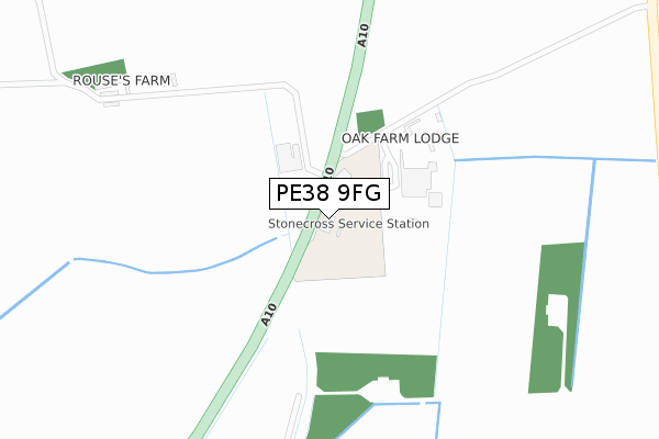
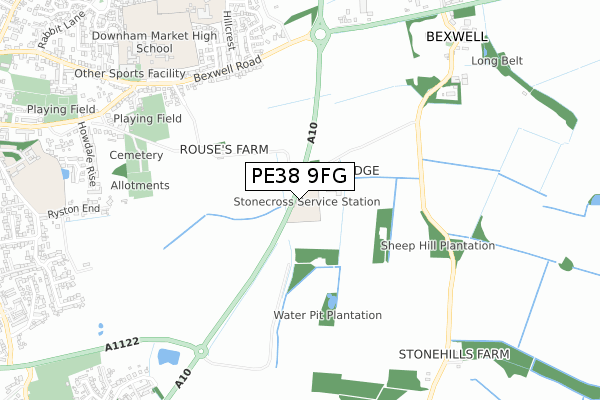
PE38 9FG is located in the Denver electoral ward, within the local authority district of King's Lynn and West Norfolk and the English Parliamentary constituency of South West Norfolk. The Sub Integrated Care Board (ICB) Location is NHS Norfolk and Waveney ICB - 26A and the police force is Norfolk. This postcode has been in use since April 2019.


GetTheData
Source: OS Open Zoomstack (Ordnance Survey)
Licence: Open Government Licence (requires attribution)
Attribution: Contains OS data © Crown copyright and database right 2025
Source: Open Postcode Geo
Licence: Open Government Licence (requires attribution)
Attribution: Contains OS data © Crown copyright and database right 2025; Contains Royal Mail data © Royal Mail copyright and database right 2025; Source: Office for National Statistics licensed under the Open Government Licence v.3.0
| Easting | 562512 |
| Northing | 302744 |
| Latitude | 52.598207 |
| Longitude | 0.398046 |
GetTheData
Source: Open Postcode Geo
Licence: Open Government Licence
| Country | England |
| Postcode District | PE38 |
➜ See where PE38 is on a map | |
GetTheData
Source: Land Registry Price Paid Data
Licence: Open Government Licence
| Ward | Denver |
| Constituency | South West Norfolk |
GetTheData
Source: ONS Postcode Database
Licence: Open Government Licence
| Hillcrest (Bexwell Road) | Downham Market | 612m |
| Hillcrest (Bexwell Road) | Downham Market | 621m |
| Roundabout (Bexwell Road) | Downham Market | 666m |
| High School (Bexwell Road) | Downham Market | 778m |
| High School (Bexwell Road) | Downham Market | 845m |
| Downham Market Station | 2.3km |
GetTheData
Source: NaPTAN
Licence: Open Government Licence
GetTheData
Source: ONS Postcode Database
Licence: Open Government Licence


➜ Get more ratings from the Food Standards Agency
GetTheData
Source: Food Standards Agency
Licence: FSA terms & conditions
| Last Collection | |||
|---|---|---|---|
| Location | Mon-Fri | Sat | Distance |
| Hillcrest | 17:00 | 11:15 | 633m |
| Howdale Road | 17:00 | 11:15 | 969m |
| Bexwell Road | 17:00 | 11:15 | 1,116m |
GetTheData
Source: Dracos
Licence: Creative Commons Attribution-ShareAlike
The below table lists the International Territorial Level (ITL) codes (formerly Nomenclature of Territorial Units for Statistics (NUTS) codes) and Local Administrative Units (LAU) codes for PE38 9FG:
| ITL 1 Code | Name |
|---|---|
| TLH | East |
| ITL 2 Code | Name |
| TLH1 | East Anglia |
| ITL 3 Code | Name |
| TLH16 | North and West Norfolk |
| LAU 1 Code | Name |
| E07000146 | King's Lynn and West Norfolk |
GetTheData
Source: ONS Postcode Directory
Licence: Open Government Licence
The below table lists the Census Output Area (OA), Lower Layer Super Output Area (LSOA), and Middle Layer Super Output Area (MSOA) for PE38 9FG:
| Code | Name | |
|---|---|---|
| OA | E00135598 | |
| LSOA | E01026679 | King's Lynn and West Norfolk 018A |
| MSOA | E02005568 | King's Lynn and West Norfolk 018 |
GetTheData
Source: ONS Postcode Directory
Licence: Open Government Licence
| PE38 0AD | Stonecross Industrial Estate | 101m |
| PE38 9LJ | Bexwell Road | 641m |
| PE38 9LS | Stonecross Road | 675m |
| PE38 9NW | Turner Way | 697m |
| PE38 9NQ | Lowry Way | 725m |
| PE38 9ND | Hillcrest | 726m |
| PE38 9NE | Jubilee Close | 729m |
| PE38 9NF | Sandringham Drive | 756m |
| PE38 9NH | Stubbs Close | 780m |
| PE38 9AN | Rouses Lane | 822m |
GetTheData
Source: Open Postcode Geo; Land Registry Price Paid Data
Licence: Open Government Licence