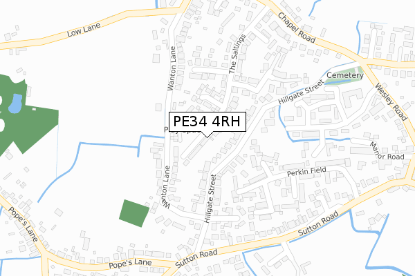
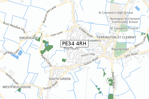
PE34 4RH is located in the Terrington electoral ward, within the local authority district of King's Lynn and West Norfolk and the English Parliamentary constituency of North West Norfolk. The Sub Integrated Care Board (ICB) Location is NHS Norfolk and Waveney ICB - 26A and the police force is Norfolk. This postcode has been in use since October 2017.


GetTheData
Source: OS Open Zoomstack (Ordnance Survey)
Licence: Open Government Licence (requires attribution)
Attribution: Contains OS data © Crown copyright and database right 2024
Source: Open Postcode Geo
Licence: Open Government Licence (requires attribution)
Attribution: Contains OS data © Crown copyright and database right 2024; Contains Royal Mail data © Royal Mail copyright and database right 2024; Source: Office for National Statistics licensed under the Open Government Licence v.3.0
| Easting | 554375 |
| Northing | 320099 |
| Latitude | 52.756470 |
| Longitude | 0.286134 |
GetTheData
Source: Open Postcode Geo
Licence: Open Government Licence
| Country | England |
| Postcode District | PE34 |
➜ See where PE34 is on a map ➜ Where is Terrington St Clement? | |
GetTheData
Source: Land Registry Price Paid Data
Licence: Open Government Licence
| Ward | Terrington |
| Constituency | North West Norfolk |
GetTheData
Source: ONS Postcode Database
Licence: Open Government Licence
| Bus Shelter (Sutton Road) | South Green | 271m |
| Bus Shelter (Sutton Road) | South Green | 286m |
| Wesley Road (Marshland Street) | Terrington St Clement | 506m |
| Wesley Road (Marshland Street) | Terrington St Clement | 509m |
| Station Road | Terrington St Clement | 646m |
GetTheData
Source: NaPTAN
Licence: Open Government Licence
| Percentage of properties with Next Generation Access | 100.0% |
| Percentage of properties with Superfast Broadband | 100.0% |
| Percentage of properties with Ultrafast Broadband | 0.0% |
| Percentage of properties with Full Fibre Broadband | 0.0% |
Superfast Broadband is between 30Mbps and 300Mbps
Ultrafast Broadband is > 300Mbps
| Median download speed | 59.0Mbps |
| Average download speed | 55.8Mbps |
| Maximum download speed | 80.00Mbps |
| Median upload speed | 18.2Mbps |
| Average upload speed | 13.7Mbps |
| Maximum upload speed | 20.00Mbps |
| Percentage of properties unable to receive 2Mbps | 0.0% |
| Percentage of properties unable to receive 5Mbps | 0.0% |
| Percentage of properties unable to receive 10Mbps | 0.0% |
| Percentage of properties unable to receive 30Mbps | 0.0% |
GetTheData
Source: Ofcom
Licence: Ofcom Terms of Use (requires attribution)
GetTheData
Source: ONS Postcode Database
Licence: Open Government Licence


➜ Get more ratings from the Food Standards Agency
GetTheData
Source: Food Standards Agency
Licence: FSA terms & conditions
| Last Collection | |||
|---|---|---|---|
| Location | Mon-Fri | Sat | Distance |
| Marshland Street | 16:15 | 10:15 | 555m |
| Terrington St Clement | 17:15 | 11:10 | 940m |
| Hay Green | 16:00 | 07:15 | 1,722m |
GetTheData
Source: Dracos
Licence: Creative Commons Attribution-ShareAlike
| Risk of PE34 4RH flooding from rivers and sea | Medium |
| ➜ PE34 4RH flood map | |
GetTheData
Source: Open Flood Risk by Postcode
Licence: Open Government Licence
The below table lists the International Territorial Level (ITL) codes (formerly Nomenclature of Territorial Units for Statistics (NUTS) codes) and Local Administrative Units (LAU) codes for PE34 4RH:
| ITL 1 Code | Name |
|---|---|
| TLH | East |
| ITL 2 Code | Name |
| TLH1 | East Anglia |
| ITL 3 Code | Name |
| TLH16 | North and West Norfolk |
| LAU 1 Code | Name |
| E07000146 | King's Lynn and West Norfolk |
GetTheData
Source: ONS Postcode Directory
Licence: Open Government Licence
The below table lists the Census Output Area (OA), Lower Layer Super Output Area (LSOA), and Middle Layer Super Output Area (MSOA) for PE34 4RH:
| Code | Name | |
|---|---|---|
| OA | E00135764 | |
| LSOA | E01026712 | King's Lynn and West Norfolk 008C |
| MSOA | E02005558 | King's Lynn and West Norfolk 008 |
GetTheData
Source: ONS Postcode Directory
Licence: Open Government Licence
| PE34 4NS | Hillgate Street | 89m |
| PE34 4WE | Ffolkes Drive | 145m |
| PE34 4NR | Wanton Lane | 171m |
| PE34 4NP | Wanton Lane | 183m |
| PE34 4PF | Brellows Hill | 183m |
| PE34 4WG | Lovell Way | 202m |
| PE34 4JR | Perkin Field | 219m |
| PE34 4PB | The Saltings | 227m |
| PE34 4JT | Howard Close | 236m |
| PE34 4LS | Cobbs Hill | 241m |
GetTheData
Source: Open Postcode Geo; Land Registry Price Paid Data
Licence: Open Government Licence