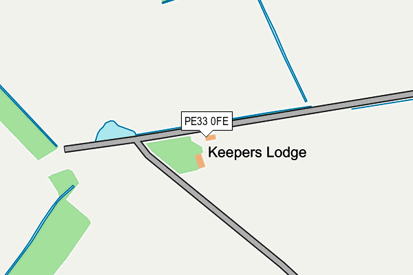
PE33 0FE is located in the Airfield electoral ward, within the local authority district of King's Lynn and West Norfolk and the English Parliamentary constituency of South West Norfolk. The Sub Integrated Care Board (ICB) Location is NHS Norfolk and Waveney ICB - 26A and the police force is Norfolk. This postcode has been in use since June 2017.


GetTheData
Source: OS OpenMap – Local (Ordnance Survey)
Source: OS VectorMap District (Ordnance Survey)
Licence: Open Government Licence (requires attribution)
| Easting | 566052 |
| Northing | 312831 |
| Latitude | 52.687736 |
| Longitude | 0.455331 |
GetTheData
Source: Open Postcode Geo
Licence: Open Government Licence
| Country | England |
| Postcode District | PE33 |
➜ See where PE33 is on a map | |
GetTheData
Source: Land Registry Price Paid Data
Licence: Open Government Licence
| Ward | Airfield |
| Constituency | South West Norfolk |
GetTheData
Source: ONS Postcode Database
Licence: Open Government Licence
| Castle Road | Wormegay | 1,036m |
| Hill Estate (Wormegay Road) | Wormegay | 1,348m |
| Hill Estate (Wormegay Road) | Wormegay | 1,364m |
| Wormegay Road (Stoke Road) | Wormegay | 2,017m |
| Wormegay Road (Stoke Road) | Wormegay | 2,028m |
| Watlington Station | 5.1km |
GetTheData
Source: NaPTAN
Licence: Open Government Licence
| Percentage of properties with Next Generation Access | 100.0% |
| Percentage of properties with Superfast Broadband | 0.0% |
| Percentage of properties with Ultrafast Broadband | 0.0% |
| Percentage of properties with Full Fibre Broadband | 0.0% |
Superfast Broadband is between 30Mbps and 300Mbps
Ultrafast Broadband is > 300Mbps
| Percentage of properties unable to receive 2Mbps | 0.0% |
| Percentage of properties unable to receive 5Mbps | 0.0% |
| Percentage of properties unable to receive 10Mbps | 0.0% |
| Percentage of properties unable to receive 30Mbps | 100.0% |
GetTheData
Source: Ofcom
Licence: Ofcom Terms of Use (requires attribution)
GetTheData
Source: ONS Postcode Database
Licence: Open Government Licence
➜ Get more ratings from the Food Standards Agency
GetTheData
Source: Food Standards Agency
Licence: FSA terms & conditions
| Last Collection | |||
|---|---|---|---|
| Location | Mon-Fri | Sat | Distance |
| Setchey | 17:45 | 10:45 | 2,592m |
| The Row | 18:00 | 10:30 | 2,910m |
| Fodderstone Gap | 17:20 | 10:20 | 3,961m |
GetTheData
Source: Dracos
Licence: Creative Commons Attribution-ShareAlike
The below table lists the International Territorial Level (ITL) codes (formerly Nomenclature of Territorial Units for Statistics (NUTS) codes) and Local Administrative Units (LAU) codes for PE33 0FE:
| ITL 1 Code | Name |
|---|---|
| TLH | East |
| ITL 2 Code | Name |
| TLH1 | East Anglia |
| ITL 3 Code | Name |
| TLH16 | North and West Norfolk |
| LAU 1 Code | Name |
| E07000146 | King's Lynn and West Norfolk |
GetTheData
Source: ONS Postcode Directory
Licence: Open Government Licence
The below table lists the Census Output Area (OA), Lower Layer Super Output Area (LSOA), and Middle Layer Super Output Area (MSOA) for PE33 0FE:
| Code | Name | |
|---|---|---|
| OA | E00135397 | |
| LSOA | E01026643 | King's Lynn and West Norfolk 014B |
| MSOA | E02005564 | King's Lynn and West Norfolk 014 |
GetTheData
Source: ONS Postcode Directory
Licence: Open Government Licence
| PE33 0SE | Castle Road | 1016m |
| PE33 0SF | Bardolph Way | 1024m |
| PE33 0SG | Castle Road | 1059m |
| PE33 0SQ | Castle Road | 1082m |
| PE33 0SD | Hill Estate | 1417m |
| PE33 0SB | 1444m | |
| PE32 1SJ | Mill Row | 1801m |
| PE32 1SQ | Priory Cottage | 1818m |
| PE32 1SG | Wormegay Road | 1828m |
| PE32 1SH | Mill Lane | 1887m |
GetTheData
Source: Open Postcode Geo; Land Registry Price Paid Data
Licence: Open Government Licence