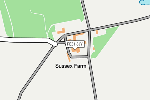
PE31 8JY lies on Sussex Farm in Burnham Market, King's Lynn. PE31 8JY is located in the Burnham Market & Docking electoral ward, within the local authority district of King's Lynn and West Norfolk and the English Parliamentary constituency of North West Norfolk. The Sub Integrated Care Board (ICB) Location is NHS Norfolk and Waveney ICB - 26A and the police force is Norfolk. This postcode has been in use since January 1980.


GetTheData
Source: OS OpenMap – Local (Ordnance Survey)
Source: OS VectorMap District (Ordnance Survey)
Licence: Open Government Licence (requires attribution)
| Easting | 580244 |
| Northing | 341915 |
| Latitude | 52.944373 |
| Longitude | 0.681091 |
GetTheData
Source: Open Postcode Geo
Licence: Open Government Licence
| Street | Sussex Farm |
| Locality | Burnham Market |
| Town/City | King's Lynn |
| Country | England |
| Postcode District | PE31 |
➜ See where PE31 is on a map | |
GetTheData
Source: Land Registry Price Paid Data
Licence: Open Government Licence
Elevation or altitude of PE31 8JY as distance above sea level:
| Metres | Feet | |
|---|---|---|
| Elevation | 40m | 131ft |
Elevation is measured from the approximate centre of the postcode, to the nearest point on an OS contour line from OS Terrain 50, which has contour spacing of ten vertical metres.
➜ How high above sea level am I? Find the elevation of your current position using your device's GPS.
GetTheData
Source: Open Postcode Elevation
Licence: Open Government Licence
| Ward | Burnham Market & Docking |
| Constituency | North West Norfolk |
GetTheData
Source: ONS Postcode Database
Licence: Open Government Licence
| Percentage of properties with Next Generation Access | 100.0% |
| Percentage of properties with Superfast Broadband | 91.7% |
| Percentage of properties with Ultrafast Broadband | 0.0% |
| Percentage of properties with Full Fibre Broadband | 0.0% |
Superfast Broadband is between 30Mbps and 300Mbps
Ultrafast Broadband is > 300Mbps
| Median download speed | 72.6Mbps |
| Average download speed | 60.7Mbps |
| Maximum download speed | 80.00Mbps |
| Median upload speed | 17.0Mbps |
| Average upload speed | 14.1Mbps |
| Maximum upload speed | 20.00Mbps |
| Percentage of properties unable to receive 2Mbps | 0.0% |
| Percentage of properties unable to receive 5Mbps | 0.0% |
| Percentage of properties unable to receive 10Mbps | 0.0% |
| Percentage of properties unable to receive 30Mbps | 8.3% |
GetTheData
Source: Ofcom
Licence: Ofcom Terms of Use (requires attribution)
GetTheData
Source: ONS Postcode Database
Licence: Open Government Licence
| Last Collection | |||
|---|---|---|---|
| Location | Mon-Fri | Sat | Distance |
| Deepdale Post Office | 16:00 | 10:45 | 2,385m |
| Brancaster Staithe | 16:15 | 10:45 | 2,447m |
| Church Walk | 16:00 | 10:00 | 2,462m |
GetTheData
Source: Dracos
Licence: Creative Commons Attribution-ShareAlike
The below table lists the International Territorial Level (ITL) codes (formerly Nomenclature of Territorial Units for Statistics (NUTS) codes) and Local Administrative Units (LAU) codes for PE31 8JY:
| ITL 1 Code | Name |
|---|---|
| TLH | East |
| ITL 2 Code | Name |
| TLH1 | East Anglia |
| ITL 3 Code | Name |
| TLH16 | North and West Norfolk |
| LAU 1 Code | Name |
| E07000146 | King's Lynn and West Norfolk |
GetTheData
Source: ONS Postcode Directory
Licence: Open Government Licence
The below table lists the Census Output Area (OA), Lower Layer Super Output Area (LSOA), and Middle Layer Super Output Area (MSOA) for PE31 8JY:
| Code | Name | |
|---|---|---|
| OA | E00135407 | |
| LSOA | E01026646 | King's Lynn and West Norfolk 002B |
| MSOA | E02005552 | King's Lynn and West Norfolk 002 |
GetTheData
Source: ONS Postcode Directory
Licence: Open Government Licence
| PE31 8DE | 1213m | |
| PE31 8JU | Docking Road | 1649m |
| PE31 8JR | Ringstead Road | 1652m |
| PE31 8EE | 1900m | |
| PE31 8AG | 2174m | |
| PE31 8JX | Docking Road | 2257m |
| PE31 8DN | Docking Road | 2273m |
| PE31 8DF | School Pastures | 2298m |
| PE31 8DA | Dale End | 2321m |
| PE31 8DL | Ringstead Road | 2323m |
GetTheData
Source: Open Postcode Geo; Land Registry Price Paid Data
Licence: Open Government Licence