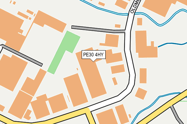
PE30 4HY is located in the South & West Lynn electoral ward, within the local authority district of King's Lynn and West Norfolk and the English Parliamentary constituency of North West Norfolk. The Sub Integrated Care Board (ICB) Location is NHS Norfolk and Waveney ICB - 26A and the police force is Norfolk. This postcode has been in use since April 2006.


GetTheData
Source: OS OpenMap – Local (Ordnance Survey)
Source: OS VectorMap District (Ordnance Survey)
Licence: Open Government Licence (requires attribution)
| Easting | 563262 |
| Northing | 318925 |
| Latitude | 52.743318 |
| Longitude | 0.417116 |
GetTheData
Source: Open Postcode Geo
Licence: Open Government Licence
| Country | England |
| Postcode District | PE30 |
➜ See where PE30 is on a map ➜ Where is King's Lynn? | |
GetTheData
Source: Land Registry Price Paid Data
Licence: Open Government Licence
Elevation or altitude of PE30 4HY as distance above sea level:
| Metres | Feet | |
|---|---|---|
| Elevation | 0m | 0ft |
Elevation is measured from the approximate centre of the postcode, to the nearest point on an OS contour line from OS Terrain 50, which has contour spacing of ten vertical metres.
➜ How high above sea level am I? Find the elevation of your current position using your device's GPS.
GetTheData
Source: Open Postcode Elevation
Licence: Open Government Licence
| Ward | South & West Lynn |
| Constituency | North West Norfolk |
GetTheData
Source: ONS Postcode Database
Licence: Open Government Licence
| Scania Way (Oldmedow Road) | King's Lynn | 140m |
| Scania Way (Oldmedow Road) | King's Lynn | 161m |
| Paxman Road (Hansa Road) | King's Lynn | 456m |
| Paxman Road (Hansa Road) | King's Lynn | 463m |
| Sainsburys (Entrance) | King's Lynn | 502m |
| Kings Lynn Station | 1.5km |
GetTheData
Source: NaPTAN
Licence: Open Government Licence
GetTheData
Source: ONS Postcode Database
Licence: Open Government Licence


➜ Get more ratings from the Food Standards Agency
GetTheData
Source: Food Standards Agency
Licence: FSA terms & conditions
| Last Collection | |||
|---|---|---|---|
| Location | Mon-Fri | Sat | Distance |
| Oldmedow Road | 17:30 | 12:00 | 133m |
| Hansa Road | 18:30 | 505m | |
| Vancouver Avenue | 17:30 | 12:15 | 817m |
GetTheData
Source: Dracos
Licence: Creative Commons Attribution-ShareAlike
| Risk of PE30 4HY flooding from rivers and sea | Low |
| ➜ PE30 4HY flood map | |
GetTheData
Source: Open Flood Risk by Postcode
Licence: Open Government Licence
The below table lists the International Territorial Level (ITL) codes (formerly Nomenclature of Territorial Units for Statistics (NUTS) codes) and Local Administrative Units (LAU) codes for PE30 4HY:
| ITL 1 Code | Name |
|---|---|
| TLH | East |
| ITL 2 Code | Name |
| TLH1 | East Anglia |
| ITL 3 Code | Name |
| TLH16 | North and West Norfolk |
| LAU 1 Code | Name |
| E07000146 | King's Lynn and West Norfolk |
GetTheData
Source: ONS Postcode Directory
Licence: Open Government Licence
The below table lists the Census Output Area (OA), Lower Layer Super Output Area (LSOA), and Middle Layer Super Output Area (MSOA) for PE30 4HY:
| Code | Name | |
|---|---|---|
| OA | E00135735 | |
| LSOA | E01026706 | King's Lynn and West Norfolk 011F |
| MSOA | E02005561 | King's Lynn and West Norfolk 011 |
GetTheData
Source: ONS Postcode Directory
Licence: Open Government Licence
| PE30 4JJ | Oldmedow Road | 153m |
| PE30 4LD | Oldmedow Road | 305m |
| PE30 4JX | Merchants Close | 370m |
| PE30 4JB | Hansa Road | 443m |
| PE30 4NA | Hardwick Road | 477m |
| PE30 4LR | Scania Way | 481m |
| PE30 5NS | Kings Avenue | 500m |
| PE30 4NE | Hardwick Industrial Estate | 501m |
| PE30 4LS | Rollesby Road | 545m |
| PE30 5NY | Holcombe Avenue | 561m |
GetTheData
Source: Open Postcode Geo; Land Registry Price Paid Data
Licence: Open Government Licence