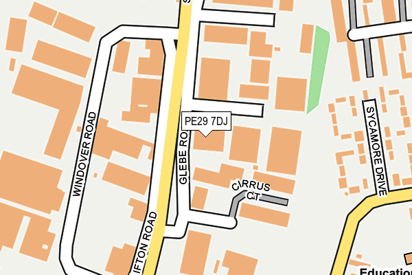
PE29 7DJ is located in the Huntingdon North electoral ward, within the local authority district of Huntingdonshire and the English Parliamentary constituency of Huntingdon. The Sub Integrated Care Board (ICB) Location is NHS Cambridgeshire and Peterborough ICB - 06H and the police force is Cambridgeshire. This postcode has been in use since April 2017.


GetTheData
Source: OS OpenMap – Local (Ordnance Survey)
Source: OS VectorMap District (Ordnance Survey)
Licence: Open Government Licence (requires attribution)
| Easting | 523868 |
| Northing | 273496 |
| Latitude | 52.345571 |
| Longitude | -0.183018 |
GetTheData
Source: Open Postcode Geo
Licence: Open Government Licence
| Country | England |
| Postcode District | PE29 |
➜ See where PE29 is on a map ➜ Where is Huntingdon? | |
GetTheData
Source: Land Registry Price Paid Data
Licence: Open Government Licence
| Ward | Huntingdon North |
| Constituency | Huntingdon |
GetTheData
Source: ONS Postcode Database
Licence: Open Government Licence
| Maple Drive (Sallowbush Road) | Sapley | 290m |
| Maple Drive (Sallowbush Road) | Sapley | 346m |
| Redwongs Way (Sallowbush Road) | Huntingdon | 352m |
| Redwongs Way (Sallowbush Road) | Huntingdon | 416m |
| Cinema (Kings Ripton Road) | Sapley | 540m |
| Huntingdon Station | 2km |
GetTheData
Source: NaPTAN
Licence: Open Government Licence
GetTheData
Source: ONS Postcode Database
Licence: Open Government Licence


➜ Get more ratings from the Food Standards Agency
GetTheData
Source: Food Standards Agency
Licence: FSA terms & conditions
| Last Collection | |||
|---|---|---|---|
| Location | Mon-Fri | Sat | Distance |
| Windover Road | 17:30 | 12:00 | 242m |
| California Road | 17:30 | 12:00 | 634m |
| Ermine Business Park | 18:00 | 11:30 | 1,031m |
GetTheData
Source: Dracos
Licence: Creative Commons Attribution-ShareAlike
The below table lists the International Territorial Level (ITL) codes (formerly Nomenclature of Territorial Units for Statistics (NUTS) codes) and Local Administrative Units (LAU) codes for PE29 7DJ:
| ITL 1 Code | Name |
|---|---|
| TLH | East |
| ITL 2 Code | Name |
| TLH1 | East Anglia |
| ITL 3 Code | Name |
| TLH12 | Cambridgeshire CC |
| LAU 1 Code | Name |
| E07000011 | Huntingdonshire |
GetTheData
Source: ONS Postcode Directory
Licence: Open Government Licence
The below table lists the Census Output Area (OA), Lower Layer Super Output Area (LSOA), and Middle Layer Super Output Area (MSOA) for PE29 7DJ:
| Code | Name | |
|---|---|---|
| OA | E00091546 | |
| LSOA | E01018145 | Huntingdonshire 008C |
| MSOA | E02003760 | Huntingdonshire 008 |
GetTheData
Source: ONS Postcode Directory
Licence: Open Government Licence
| PE29 7DN | Glebe Road | 53m |
| PE29 7JA | Sycamore Drive | 207m |
| PE29 7EB | Windover Road | 268m |
| PE29 7JH | Kent Road | 269m |
| PE29 7JB | Sycamore Drive | 281m |
| PE29 7JQ | Kent Road | 282m |
| PE29 7BE | Sallowbush Road | 299m |
| PE29 7BD | Sallowbush Road | 305m |
| PE29 7JJ | Kent Road | 332m |
| PE29 7JE | Maple Drive | 333m |
GetTheData
Source: Open Postcode Geo; Land Registry Price Paid Data
Licence: Open Government Licence