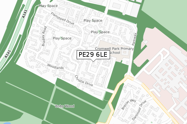
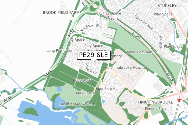
PE29 6LE is located in the Brampton electoral ward, within the local authority district of Huntingdonshire and the English Parliamentary constituency of Huntingdon. The Sub Integrated Care Board (ICB) Location is NHS Cambridgeshire and Peterborough ICB - 06H and the police force is Cambridgeshire. This postcode has been in use since July 2019.


GetTheData
Source: OS Open Zoomstack (Ordnance Survey)
Licence: Open Government Licence (requires attribution)
Attribution: Contains OS data © Crown copyright and database right 2024
Source: Open Postcode Geo
Licence: Open Government Licence (requires attribution)
Attribution: Contains OS data © Crown copyright and database right 2024; Contains Royal Mail data © Royal Mail copyright and database right 2024; Source: Office for National Statistics licensed under the Open Government Licence v.3.0
| Easting | 522141 |
| Northing | 272128 |
| Latitude | 52.333665 |
| Longitude | -0.208854 |
GetTheData
Source: Open Postcode Geo
Licence: Open Government Licence
| Country | England |
| Postcode District | PE29 |
➜ See where PE29 is on a map ➜ Where is Huntingdon? | |
GetTheData
Source: Land Registry Price Paid Data
Licence: Open Government Licence
| Ward | Brampton |
| Constituency | Huntingdon |
GetTheData
Source: ONS Postcode Database
Licence: Open Government Licence
26, BLOOMFIELD DRIVE, HUNTINGDON, PE29 6LE 2020 14 APR £320,000 |
6, BLOOMFIELD DRIVE, HUNTINGDON, PE29 6LE 2020 31 JAN £319,995 |
16, BLOOMFIELD DRIVE, HUNTINGDON, PE29 6LE 2019 20 DEC £320,000 |
22, BLOOMFIELD DRIVE, HUNTINGDON, PE29 6LE 2019 20 DEC £314,000 |
24, BLOOMFIELD DRIVE, HUNTINGDON, PE29 6LE 2019 29 NOV £385,995 |
GetTheData
Source: HM Land Registry Price Paid Data
Licence: Contains HM Land Registry data © Crown copyright and database right 2024. This data is licensed under the Open Government Licence v3.0.
| Hinchingbrooke Hospital (Hinchingbrooke Park Road) | Hinchingbrooke Park | 276m |
| Hinchingbrooke Business Park (Kingfisher Way) | Huntingdon | 495m |
| Hinchingbrooke Business Park (Kingfisher Way) | Huntingdon | 504m |
| Snowdonia Way (Hinchingbrooke Park Road) | Hinchingbrooke Park | 562m |
| Snowdonia Way (Hinchingbrooke Park Rd) | Hinchingbrooke Park | 589m |
| Huntingdon Station | 1.3km |
GetTheData
Source: NaPTAN
Licence: Open Government Licence
| Percentage of properties with Next Generation Access | 100.0% |
| Percentage of properties with Superfast Broadband | 100.0% |
| Percentage of properties with Ultrafast Broadband | 0.0% |
| Percentage of properties with Full Fibre Broadband | 0.0% |
Superfast Broadband is between 30Mbps and 300Mbps
Ultrafast Broadband is > 300Mbps
| Percentage of properties unable to receive 2Mbps | 0.0% |
| Percentage of properties unable to receive 5Mbps | 0.0% |
| Percentage of properties unable to receive 10Mbps | 0.0% |
| Percentage of properties unable to receive 30Mbps | 0.0% |
GetTheData
Source: Ofcom
Licence: Ofcom Terms of Use (requires attribution)
GetTheData
Source: ONS Postcode Database
Licence: Open Government Licence


➜ Get more ratings from the Food Standards Agency
GetTheData
Source: Food Standards Agency
Licence: FSA terms & conditions
| Last Collection | |||
|---|---|---|---|
| Location | Mon-Fri | Sat | Distance |
| Hinchingbrooke Parkway | 17:30 | 12:00 | 270m |
| Seathwaite | 17:30 | 11:30 | 829m |
| Werthen Way | 17:30 | 11:30 | 1,019m |
GetTheData
Source: Dracos
Licence: Creative Commons Attribution-ShareAlike
The below table lists the International Territorial Level (ITL) codes (formerly Nomenclature of Territorial Units for Statistics (NUTS) codes) and Local Administrative Units (LAU) codes for PE29 6LE:
| ITL 1 Code | Name |
|---|---|
| TLH | East |
| ITL 2 Code | Name |
| TLH1 | East Anglia |
| ITL 3 Code | Name |
| TLH12 | Cambridgeshire CC |
| LAU 1 Code | Name |
| E07000011 | Huntingdonshire |
GetTheData
Source: ONS Postcode Directory
Licence: Open Government Licence
The below table lists the Census Output Area (OA), Lower Layer Super Output Area (LSOA), and Middle Layer Super Output Area (MSOA) for PE29 6LE:
| Code | Name | |
|---|---|---|
| OA | E00173790 | |
| LSOA | E01018148 | Huntingdonshire 012B |
| MSOA | E02003764 | Huntingdonshire 012 |
GetTheData
Source: ONS Postcode Directory
Licence: Open Government Licence
| PE29 6JP | Christie Drive | 64m |
| PE29 6JN | Christie Drive | 100m |
| PE29 6LA | Cromwell Drive | 141m |
| PE29 6JQ | Woodlands | 152m |
| PE29 6JD | Christie Drive | 163m |
| PE29 6LB | Cromwell Drive | 180m |
| PE29 6JR | The Glades | 192m |
| PE29 6JA | Parkway | 219m |
| PE29 6JS | The Glades | 225m |
| PE29 6XA | Peaks Court | 256m |
GetTheData
Source: Open Postcode Geo; Land Registry Price Paid Data
Licence: Open Government Licence