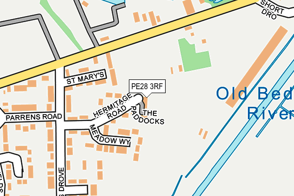
PE28 3RF is located in the Holywell-cum-Needingworth electoral ward, within the local authority district of Huntingdonshire and the English Parliamentary constituency of North West Cambridgeshire. The Sub Integrated Care Board (ICB) Location is NHS Cambridgeshire and Peterborough ICB - 06H and the police force is Cambridgeshire. This postcode has been in use since March 2017.


GetTheData
Source: OS OpenMap – Local (Ordnance Survey)
Source: OS VectorMap District (Ordnance Survey)
Licence: Open Government Licence (requires attribution)
| Easting | 539028 |
| Northing | 275373 |
| Latitude | 52.358806 |
| Longitude | 0.040167 |
GetTheData
Source: Open Postcode Geo
Licence: Open Government Licence
| Country | England |
| Postcode District | PE28 |
➜ See where PE28 is on a map ➜ Where is Earith? | |
GetTheData
Source: Land Registry Price Paid Data
Licence: Open Government Licence
| Ward | Holywell-cum-needingworth |
| Constituency | North West Cambridgeshire |
GetTheData
Source: ONS Postcode Database
Licence: Open Government Licence
| Parrens Road | Earith | 212m |
| Parrens Road | Earith | 214m |
| Adelaide Walk (Cook's Drove) | Earith | 317m |
| Adelaide Walk (Cook's Drove) | Earith | 327m |
| School Road (Greenfields) | Earith | 418m |
GetTheData
Source: NaPTAN
Licence: Open Government Licence
| Percentage of properties with Next Generation Access | 100.0% |
| Percentage of properties with Superfast Broadband | 100.0% |
| Percentage of properties with Ultrafast Broadband | 0.0% |
| Percentage of properties with Full Fibre Broadband | 0.0% |
Superfast Broadband is between 30Mbps and 300Mbps
Ultrafast Broadband is > 300Mbps
| Median download speed | 40.0Mbps |
| Average download speed | 43.0Mbps |
| Maximum download speed | 78.12Mbps |
| Median upload speed | 10.0Mbps |
| Average upload speed | 10.8Mbps |
| Maximum upload speed | 20.00Mbps |
| Percentage of properties unable to receive 2Mbps | 0.0% |
| Percentage of properties unable to receive 5Mbps | 0.0% |
| Percentage of properties unable to receive 10Mbps | 0.0% |
| Percentage of properties unable to receive 30Mbps | 0.0% |
GetTheData
Source: Ofcom
Licence: Ofcom Terms of Use (requires attribution)
GetTheData
Source: ONS Postcode Database
Licence: Open Government Licence


➜ Get more ratings from the Food Standards Agency
GetTheData
Source: Food Standards Agency
Licence: FSA terms & conditions
| Last Collection | |||
|---|---|---|---|
| Location | Mon-Fri | Sat | Distance |
| Cooks Drove Earith | 16:30 | 08:00 | 224m |
| Earith Post Office | 16:30 | 10:00 | 599m |
| Feoffees Road Somersham | 16:00 | 10:00 | 3,697m |
GetTheData
Source: Dracos
Licence: Creative Commons Attribution-ShareAlike
The below table lists the International Territorial Level (ITL) codes (formerly Nomenclature of Territorial Units for Statistics (NUTS) codes) and Local Administrative Units (LAU) codes for PE28 3RF:
| ITL 1 Code | Name |
|---|---|
| TLH | East |
| ITL 2 Code | Name |
| TLH1 | East Anglia |
| ITL 3 Code | Name |
| TLH12 | Cambridgeshire CC |
| LAU 1 Code | Name |
| E07000011 | Huntingdonshire |
GetTheData
Source: ONS Postcode Directory
Licence: Open Government Licence
The below table lists the Census Output Area (OA), Lower Layer Super Output Area (LSOA), and Middle Layer Super Output Area (MSOA) for PE28 3RF:
| Code | Name | |
|---|---|---|
| OA | E00091434 | |
| LSOA | E01018123 | Huntingdonshire 007C |
| MSOA | E02003759 | Huntingdonshire 007 |
GetTheData
Source: ONS Postcode Directory
Licence: Open Government Licence
| PE28 3QD | Hermitage Road | 58m |
| PE28 3QU | St Marys | 102m |
| PE28 3QJ | Meadow Way | 108m |
| PE28 3QG | Cooks Drove | 205m |
| PE28 3QL | Hereward | 206m |
| PE28 3QQ | Parrens Road | 246m |
| PE28 3QS | Adelaide Walk | 279m |
| PE28 3QP | Vermuyden | 319m |
| PE28 3QN | Darford | 330m |
| PE28 3QH | Greenfields | 348m |
GetTheData
Source: Open Postcode Geo; Land Registry Price Paid Data
Licence: Open Government Licence