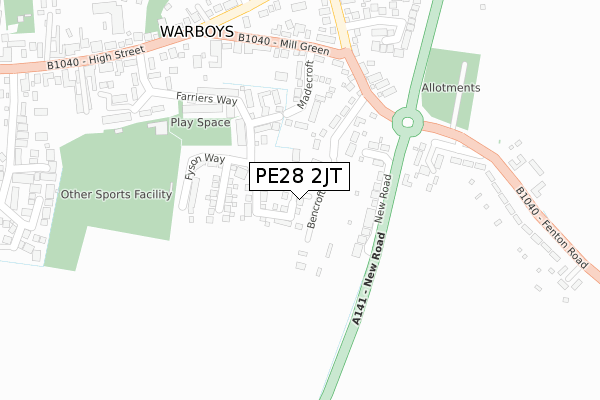
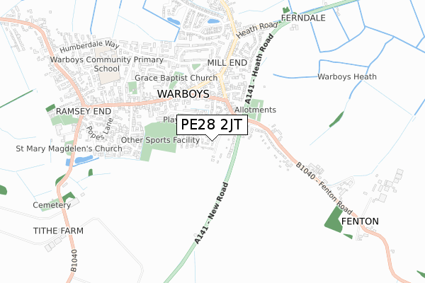
PE28 2JT is located in the Warboys electoral ward, within the local authority district of Huntingdonshire and the English Parliamentary constituency of North West Cambridgeshire. The Sub Integrated Care Board (ICB) Location is NHS Cambridgeshire and Peterborough ICB - 06H and the police force is Cambridgeshire. This postcode has been in use since November 2019.


GetTheData
Source: OS Open Zoomstack (Ordnance Survey)
Licence: Open Government Licence (requires attribution)
Attribution: Contains OS data © Crown copyright and database right 2025
Source: Open Postcode Geo
Licence: Open Government Licence (requires attribution)
Attribution: Contains OS data © Crown copyright and database right 2025; Contains Royal Mail data © Royal Mail copyright and database right 2025; Source: Office for National Statistics licensed under the Open Government Licence v.3.0
| Easting | 531112 |
| Northing | 279885 |
| Latitude | 52.401296 |
| Longitude | -0.074242 |
GetTheData
Source: Open Postcode Geo
Licence: Open Government Licence
| Country | England |
| Postcode District | PE28 |
➜ See where PE28 is on a map ➜ Where is Warboys? | |
GetTheData
Source: Land Registry Price Paid Data
Licence: Open Government Licence
| Ward | Warboys |
| Constituency | North West Cambridgeshire |
GetTheData
Source: ONS Postcode Database
Licence: Open Government Licence
| Madecroft (Mill Green) | Warboys | 257m |
| Madecroft (Mill Green) | Warboys | 282m |
| High Street | Warboys | 449m |
| Goldpits (Statfold Green) | Warboys | 483m |
| Goldpits (Statfold Green) | Warboys | 489m |
GetTheData
Source: NaPTAN
Licence: Open Government Licence
GetTheData
Source: ONS Postcode Database
Licence: Open Government Licence


➜ Get more ratings from the Food Standards Agency
GetTheData
Source: Food Standards Agency
Licence: FSA terms & conditions
| Last Collection | |||
|---|---|---|---|
| Location | Mon-Fri | Sat | Distance |
| Warboys Post Office | 17:10 | 10:20 | 326m |
| Station Road | 17:15 | 08:00 | 492m |
| Ramsey Road | 17:00 | 08:15 | 1,079m |
GetTheData
Source: Dracos
Licence: Creative Commons Attribution-ShareAlike
The below table lists the International Territorial Level (ITL) codes (formerly Nomenclature of Territorial Units for Statistics (NUTS) codes) and Local Administrative Units (LAU) codes for PE28 2JT:
| ITL 1 Code | Name |
|---|---|
| TLH | East |
| ITL 2 Code | Name |
| TLH1 | East Anglia |
| ITL 3 Code | Name |
| TLH12 | Cambridgeshire CC |
| LAU 1 Code | Name |
| E07000011 | Huntingdonshire |
GetTheData
Source: ONS Postcode Directory
Licence: Open Government Licence
The below table lists the Census Output Area (OA), Lower Layer Super Output Area (LSOA), and Middle Layer Super Output Area (MSOA) for PE28 2JT:
| Code | Name | |
|---|---|---|
| OA | E00091864 | |
| LSOA | E01018209 | Huntingdonshire 005B |
| MSOA | E02003757 | Huntingdonshire 005 |
GetTheData
Source: ONS Postcode Directory
Licence: Open Government Licence
| PE28 2SE | Bencroft Lane | 119m |
| PE28 2SS | New Road | 129m |
| PE28 2PS | The Smithy | 161m |
| PE28 2SF | Madecroft | 168m |
| PE28 2LW | Farriers Way | 185m |
| PE28 2SJ | Madecroft Close | 204m |
| PE28 2SD | Fenton Road | 238m |
| PE28 2SA | Mill Green | 244m |
| PE28 2SB | Mill Green | 311m |
| PE28 2TN | Forge Way | 324m |
GetTheData
Source: Open Postcode Geo; Land Registry Price Paid Data
Licence: Open Government Licence