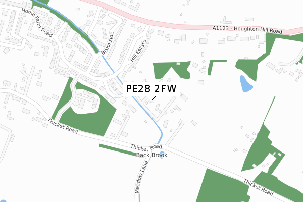
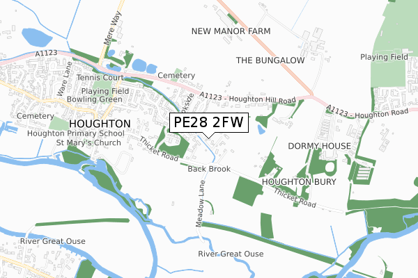
PE28 2FW is located in the Hemingford Grey & Houghton electoral ward, within the local authority district of Huntingdonshire and the English Parliamentary constituency of Huntingdon. The Sub Integrated Care Board (ICB) Location is NHS Cambridgeshire and Peterborough ICB - 06H and the police force is Cambridgeshire. This postcode has been in use since December 2019.


GetTheData
Source: OS Open Zoomstack (Ordnance Survey)
Licence: Open Government Licence (requires attribution)
Attribution: Contains OS data © Crown copyright and database right 2025
Source: Open Postcode Geo
Licence: Open Government Licence (requires attribution)
Attribution: Contains OS data © Crown copyright and database right 2025; Contains Royal Mail data © Royal Mail copyright and database right 2025; Source: Office for National Statistics licensed under the Open Government Licence v.3.0
| Easting | 528841 |
| Northing | 272120 |
| Latitude | 52.332063 |
| Longitude | -0.110582 |
GetTheData
Source: Open Postcode Geo
Licence: Open Government Licence
| Country | England |
| Postcode District | PE28 |
➜ See where PE28 is on a map ➜ Where is Houghton? | |
GetTheData
Source: Land Registry Price Paid Data
Licence: Open Government Licence
| Ward | Hemingford Grey & Houghton |
| Constituency | Huntingdon |
GetTheData
Source: ONS Postcode Database
Licence: Open Government Licence
OLD OAK HOUSE, MEADOW LANE, HOUGHTON, HUNTINGDON, PE28 2FW 2025 18 FEB £1,900,000 |
ASHBOURNE HOUSE, MEADOW LANE, HOUGHTON, HUNTINGDON, PE28 2FW 2021 15 OCT £1,350,000 |
OLD OAK HOUSE, MEADOW LANE, HOUGHTON, HUNTINGDON, PE28 2FW 2021 22 MAR £1,520,000 |
CARDEN HOUSE, MEADOW LANE, HOUGHTON, HUNTINGDON, PE28 2FW 2020 20 NOV £1,250,000 |
GetTheData
Source: HM Land Registry Price Paid Data
Licence: Contains HM Land Registry data © Crown copyright and database right 2025. This data is licensed under the Open Government Licence v3.0.
| Home Farm Road (St Ives Road) | Houghton And Wyton | 636m |
| Home Farm Road (St Ives Road) | Houghton And Wyton | 645m |
| The Clock Tower (The Green) | Houghton And Wyton | 669m |
| The Clock Tower (The Green) | Houghton And Wyton | 687m |
| Sawtry Way (Houghton Road) | Houghton Hill | 765m |
GetTheData
Source: NaPTAN
Licence: Open Government Licence
GetTheData
Source: ONS Postcode Database
Licence: Open Government Licence


➜ Get more ratings from the Food Standards Agency
GetTheData
Source: Food Standards Agency
Licence: FSA terms & conditions
| Last Collection | |||
|---|---|---|---|
| Location | Mon-Fri | Sat | Distance |
| Hemingford Abbots | 17:15 | 09:30 | 1,216m |
| Hill Rise | 17:30 | 11:30 | 1,562m |
| Hemingford Grey The Thorpe | 17:15 | 09:30 | 1,616m |
GetTheData
Source: Dracos
Licence: Creative Commons Attribution-ShareAlike
| Risk of PE28 2FW flooding from rivers and sea | Low |
| ➜ PE28 2FW flood map | |
GetTheData
Source: Open Flood Risk by Postcode
Licence: Open Government Licence
The below table lists the International Territorial Level (ITL) codes (formerly Nomenclature of Territorial Units for Statistics (NUTS) codes) and Local Administrative Units (LAU) codes for PE28 2FW:
| ITL 1 Code | Name |
|---|---|
| TLH | East |
| ITL 2 Code | Name |
| TLH1 | East Anglia |
| ITL 3 Code | Name |
| TLH12 | Cambridgeshire CC |
| LAU 1 Code | Name |
| E07000011 | Huntingdonshire |
GetTheData
Source: ONS Postcode Directory
Licence: Open Government Licence
The below table lists the Census Output Area (OA), Lower Layer Super Output Area (LSOA), and Middle Layer Super Output Area (MSOA) for PE28 2FW:
| Code | Name | |
|---|---|---|
| OA | E00091836 | |
| LSOA | E01018205 | Huntingdonshire 016F |
| MSOA | E02003768 | Huntingdonshire 016 |
GetTheData
Source: ONS Postcode Directory
Licence: Open Government Licence
| PE28 2DQ | Ansley Road | 129m |
| PE28 2BU | Hill Estate | 148m |
| PE28 2DB | Thicket Road | 157m |
| PE28 2FQ | The Elms | 216m |
| PE28 2BF | Hill Estate | 229m |
| PE28 2BS | Houghton Hill | 237m |
| PE28 2BX | Hill Estate | 239m |
| PE28 2BT | Brookside | 258m |
| PE28 2DF | Leslie Green Road | 297m |
| PE28 2BP | Meadow Lane | 309m |
GetTheData
Source: Open Postcode Geo; Land Registry Price Paid Data
Licence: Open Government Licence