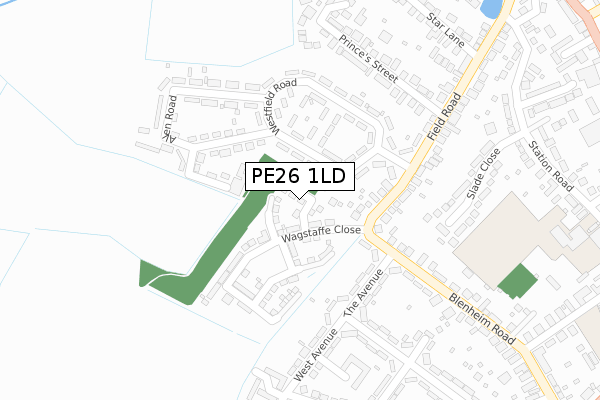
PE26 1LD is located in the Ramsey electoral ward, within the local authority district of Huntingdonshire and the English Parliamentary constituency of North West Cambridgeshire. The Sub Integrated Care Board (ICB) Location is NHS Cambridgeshire and Peterborough ICB - 06H and the police force is Cambridgeshire. This postcode has been in use since October 2019.


GetTheData
Source: OS Open Zoomstack (Ordnance Survey)
Licence: Open Government Licence (requires attribution)
Attribution: Contains OS data © Crown copyright and database right 2025
Source: Open Postcode Geo
Licence: Open Government Licence (requires attribution)
Attribution: Contains OS data © Crown copyright and database right 2025; Contains Royal Mail data © Royal Mail copyright and database right 2025; Source: Office for National Statistics licensed under the Open Government Licence v.3.0
| Easting | 528000 |
| Northing | 285280 |
| Latitude | 52.450508 |
| Longitude | -0.117895 |
GetTheData
Source: Open Postcode Geo
Licence: Open Government Licence
| Country | England |
| Postcode District | PE26 |
➜ See where PE26 is on a map ➜ Where is Ramsey? | |
GetTheData
Source: Land Registry Price Paid Data
Licence: Open Government Licence
| Ward | Ramsey |
| Constituency | North West Cambridgeshire |
GetTheData
Source: ONS Postcode Database
Licence: Open Government Licence
| Westfield Road (Field Road) | Ramsey | 187m |
| Westfield Road (Field Road) | Ramsey | 190m |
| Charles Close (West Avenue) | Ramsey | 274m |
| Charles Close (West Avenue) | Ramsey | 281m |
| Fairfield Drive (Bury Road) | Ramsey | 602m |
GetTheData
Source: NaPTAN
Licence: Open Government Licence
GetTheData
Source: ONS Postcode Database
Licence: Open Government Licence

➜ Get more ratings from the Food Standards Agency
GetTheData
Source: Food Standards Agency
Licence: FSA terms & conditions
| Last Collection | |||
|---|---|---|---|
| Location | Mon-Fri | Sat | Distance |
| Westfield Estate Ramsey | 16:40 | 12:00 | 127m |
| Field Road Ramsey | 16:40 | 12:00 | 138m |
| Park Road Ramsey | 16:35 | 12:00 | 448m |
GetTheData
Source: Dracos
Licence: Creative Commons Attribution-ShareAlike
The below table lists the International Territorial Level (ITL) codes (formerly Nomenclature of Territorial Units for Statistics (NUTS) codes) and Local Administrative Units (LAU) codes for PE26 1LD:
| ITL 1 Code | Name |
|---|---|
| TLH | East |
| ITL 2 Code | Name |
| TLH1 | East Anglia |
| ITL 3 Code | Name |
| TLH12 | Cambridgeshire CC |
| LAU 1 Code | Name |
| E07000011 | Huntingdonshire |
GetTheData
Source: ONS Postcode Directory
Licence: Open Government Licence
The below table lists the Census Output Area (OA), Lower Layer Super Output Area (LSOA), and Middle Layer Super Output Area (MSOA) for PE26 1LD:
| Code | Name | |
|---|---|---|
| OA | E00091611 | |
| LSOA | E01018159 | Huntingdonshire 003D |
| MSOA | E02003755 | Huntingdonshire 003 |
GetTheData
Source: ONS Postcode Directory
Licence: Open Government Licence
| PE26 1JS | South Walk | 121m |
| PE26 1AW | Blenheim Road | 140m |
| PE26 1JT | North Walk | 158m |
| PE26 1JR | Westfield Road | 158m |
| PE26 1JX | Hawthorn Road | 178m |
| PE26 1AP | The Avenue | 181m |
| PE26 1JU | Allen Road | 192m |
| PE26 1JP | Field Road | 209m |
| PE26 1JG | Slade Close | 264m |
| PE26 1AR | The Avenue | 271m |
GetTheData
Source: Open Postcode Geo; Land Registry Price Paid Data
Licence: Open Government Licence