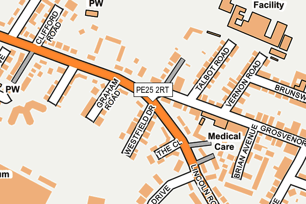
PE25 2RT is located in the St Clement's electoral ward, within the local authority district of East Lindsey and the English Parliamentary constituency of Boston and Skegness. The Sub Integrated Care Board (ICB) Location is NHS Lincolnshire ICB - 71E and the police force is Lincolnshire. This postcode has been in use since March 2017.


GetTheData
Source: OS OpenMap – Local (Ordnance Survey)
Source: OS VectorMap District (Ordnance Survey)
Licence: Open Government Licence (requires attribution)
| Easting | 556057 |
| Northing | 364100 |
| Latitude | 53.151205 |
| Longitude | 0.332195 |
GetTheData
Source: Open Postcode Geo
Licence: Open Government Licence
| Country | England |
| Postcode District | PE25 |
➜ See where PE25 is on a map ➜ Where is Skegness? | |
GetTheData
Source: Land Registry Price Paid Data
Licence: Open Government Licence
| Ward | St Clement's |
| Constituency | Boston And Skegness |
GetTheData
Source: ONS Postcode Database
Licence: Open Government Licence
| St Clements College (Burgh Road) | Skegness | 105m |
| St Clements College Bus Park (Burgh Road) | Skegness | 115m |
| St Clements College (Burgh Road) | Skegness | 127m |
| 146 Church Road North (Church Road North) | Skegness | 254m |
| Greenfield Park (Burgh Road) | Skegness | 259m |
| Skegness Station | 0.9km |
| Havenhouse Station | 5.7km |
GetTheData
Source: NaPTAN
Licence: Open Government Licence
GetTheData
Source: ONS Postcode Database
Licence: Open Government Licence


➜ Get more ratings from the Food Standards Agency
GetTheData
Source: Food Standards Agency
Licence: FSA terms & conditions
| Last Collection | |||
|---|---|---|---|
| Location | Mon-Fri | Sat | Distance |
| Lumley Road-lloyds Bank | 17:30 | 11:45 | 1,033m |
| South Parade | 17:30 | 11:45 | 1,548m |
GetTheData
Source: Dracos
Licence: Creative Commons Attribution-ShareAlike
| Risk of PE25 2RT flooding from rivers and sea | Low |
| ➜ PE25 2RT flood map | |
GetTheData
Source: Open Flood Risk by Postcode
Licence: Open Government Licence
The below table lists the International Territorial Level (ITL) codes (formerly Nomenclature of Territorial Units for Statistics (NUTS) codes) and Local Administrative Units (LAU) codes for PE25 2RT:
| ITL 1 Code | Name |
|---|---|
| TLF | East Midlands (England) |
| ITL 2 Code | Name |
| TLF3 | Lincolnshire |
| ITL 3 Code | Name |
| TLF30 | Lincolnshire CC |
| LAU 1 Code | Name |
| E07000137 | East Lindsey |
GetTheData
Source: ONS Postcode Directory
Licence: Open Government Licence
The below table lists the Census Output Area (OA), Lower Layer Super Output Area (LSOA), and Middle Layer Super Output Area (MSOA) for PE25 2RT:
| Code | Name | |
|---|---|---|
| OA | E00132406 | |
| LSOA | E01026083 | East Lindsey 015A |
| MSOA | E02005438 | East Lindsey 015 |
GetTheData
Source: ONS Postcode Directory
Licence: Open Government Licence
| PE25 2RJ | Burgh Road | 186m |
| PE25 2QG | Morris Gardens | 227m |
| PE25 2QQ | Church Road North | 244m |
| PE25 2DH | Talbot Road | 298m |
| PE25 2QA | Lindum Square | 303m |
| PE25 2DJ | Lansdowne Road | 303m |
| PE25 2QF | Church Road North | 311m |
| PE25 2RP | Lyndhurst Court | 311m |
| PE25 2DP | Clifford Road | 330m |
| PE25 2DL | Grosvenor Road | 343m |
GetTheData
Source: Open Postcode Geo; Land Registry Price Paid Data
Licence: Open Government Licence