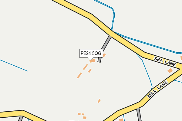
PE24 5QG lies on Sea Road in Hogsthorpe, Skegness. PE24 5QG is located in the Chapel St Leonards electoral ward, within the local authority district of East Lindsey and the English Parliamentary constituency of Louth and Horncastle. The Sub Integrated Care Board (ICB) Location is NHS Lincolnshire ICB - 71E and the police force is Lincolnshire. This postcode has been in use since January 1980.


GetTheData
Source: OS OpenMap – Local (Ordnance Survey)
Source: OS VectorMap District (Ordnance Survey)
Licence: Open Government Licence (requires attribution)
| Easting | 554036 |
| Northing | 372589 |
| Latitude | 53.228037 |
| Longitude | 0.306088 |
GetTheData
Source: Open Postcode Geo
Licence: Open Government Licence
| Street | Sea Road |
| Locality | Hogsthorpe |
| Town/City | Skegness |
| Country | England |
| Postcode District | PE24 |
➜ See where PE24 is on a map ➜ Where is Hogsthorpe? | |
GetTheData
Source: Land Registry Price Paid Data
Licence: Open Government Licence
Elevation or altitude of PE24 5QG as distance above sea level:
| Metres | Feet | |
|---|---|---|
| Elevation | 0m | 0ft |
Elevation is measured from the approximate centre of the postcode, to the nearest point on an OS contour line from OS Terrain 50, which has contour spacing of ten vertical metres.
➜ How high above sea level am I? Find the elevation of your current position using your device's GPS.
GetTheData
Source: Open Postcode Elevation
Licence: Open Government Licence
| Ward | Chapel St Leonards |
| Constituency | Louth And Horncastle |
GetTheData
Source: ONS Postcode Database
Licence: Open Government Licence
LONGACRE COTTAGE, SEA LANE, HOGSTHORPE, SKEGNESS, PE24 5QG 2014 7 FEB £241,500 |
MILL FARM HOUSE, SEA ROAD, HOGSTHORPE, SKEGNESS, PE24 5QG 1998 10 DEC £55,000 |
GetTheData
Source: HM Land Registry Price Paid Data
Licence: Contains HM Land Registry data © Crown copyright and database right 2024. This data is licensed under the Open Government Licence v3.0.
| Community Centre (Thames Street) | Hogsthorpe | 486m |
| Community Centre (Thames Street) | Hogsthorpe | 506m |
| Tavern Lane (Mill Lane) | Hogsthorpe | 565m |
| Tavern Lane (Mill Lane) | Hogsthorpe | 572m |
| Demand Responsive Area | Hogsthorpe | 635m |
GetTheData
Source: NaPTAN
Licence: Open Government Licence
| Percentage of properties with Next Generation Access | 100.0% |
| Percentage of properties with Superfast Broadband | 0.0% |
| Percentage of properties with Ultrafast Broadband | 0.0% |
| Percentage of properties with Full Fibre Broadband | 0.0% |
Superfast Broadband is between 30Mbps and 300Mbps
Ultrafast Broadband is > 300Mbps
| Percentage of properties unable to receive 2Mbps | 0.0% |
| Percentage of properties unable to receive 5Mbps | 0.0% |
| Percentage of properties unable to receive 10Mbps | 50.0% |
| Percentage of properties unable to receive 30Mbps | 100.0% |
GetTheData
Source: Ofcom
Licence: Ofcom Terms of Use (requires attribution)
GetTheData
Source: ONS Postcode Database
Licence: Open Government Licence


➜ Get more ratings from the Food Standards Agency
GetTheData
Source: Food Standards Agency
Licence: FSA terms & conditions
| Risk of PE24 5QG flooding from rivers and sea | Low |
| ➜ PE24 5QG flood map | |
GetTheData
Source: Open Flood Risk by Postcode
Licence: Open Government Licence
The below table lists the International Territorial Level (ITL) codes (formerly Nomenclature of Territorial Units for Statistics (NUTS) codes) and Local Administrative Units (LAU) codes for PE24 5QG:
| ITL 1 Code | Name |
|---|---|
| TLF | East Midlands (England) |
| ITL 2 Code | Name |
| TLF3 | Lincolnshire |
| ITL 3 Code | Name |
| TLF30 | Lincolnshire CC |
| LAU 1 Code | Name |
| E07000137 | East Lindsey |
GetTheData
Source: ONS Postcode Directory
Licence: Open Government Licence
The below table lists the Census Output Area (OA), Lower Layer Super Output Area (LSOA), and Middle Layer Super Output Area (MSOA) for PE24 5QG:
| Code | Name | |
|---|---|---|
| OA | E00132199 | |
| LSOA | E01026049 | East Lindsey 010B |
| MSOA | E02005433 | East Lindsey 010 |
GetTheData
Source: ONS Postcode Directory
Licence: Open Government Licence
| PE24 5QQ | Maiden Lane | 155m |
| PE24 5QB | Thames Street | 278m |
| PE24 5NZ | Stones Close | 323m |
| PE24 5QD | Langham Road | 343m |
| PE24 5PX | Jubilee Close | 381m |
| PE24 5NU | Meadowview | 415m |
| PE24 5FL | Wilkinson Way | 421m |
| PE24 5NJ | Mill Lane Close | 427m |
| PE24 5QA | Thames Street | 430m |
| PE24 5PU | Thames Meadow Drive | 430m |
GetTheData
Source: Open Postcode Geo; Land Registry Price Paid Data
Licence: Open Government Licence