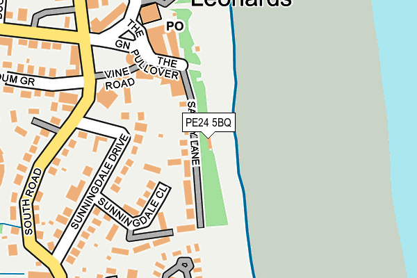
PE24 5BQ is located in the Chapel St Leonards electoral ward, within the local authority district of East Lindsey and the English Parliamentary constituency of Louth and Horncastle. The Sub Integrated Care Board (ICB) Location is NHS Lincolnshire ICB - 71E and the police force is Lincolnshire. This postcode has been in use since July 2006.


GetTheData
Source: OS OpenMap – Local (Ordnance Survey)
Source: OS VectorMap District (Ordnance Survey)
Licence: Open Government Licence (requires attribution)
| Easting | 556278 |
| Northing | 372076 |
| Latitude | 53.222748 |
| Longitude | 0.339392 |
GetTheData
Source: Open Postcode Geo
Licence: Open Government Licence
| Country | England |
| Postcode District | PE24 |
➜ See where PE24 is on a map ➜ Where is Chapel St Leonards? | |
GetTheData
Source: Land Registry Price Paid Data
Licence: Open Government Licence
Elevation or altitude of PE24 5BQ as distance above sea level:
| Metres | Feet | |
|---|---|---|
| Elevation | 10m | 33ft |
Elevation is measured from the approximate centre of the postcode, to the nearest point on an OS contour line from OS Terrain 50, which has contour spacing of ten vertical metres.
➜ How high above sea level am I? Find the elevation of your current position using your device's GPS.
GetTheData
Source: Open Postcode Elevation
Licence: Open Government Licence
| Ward | Chapel St Leonards |
| Constituency | Louth And Horncastle |
GetTheData
Source: ONS Postcode Database
Licence: Open Government Licence
| Bus Station (Ancaster Avenue) | Chapel St Leonards | 283m |
| Eastview Close (South Road) | Chapel St Leonards | 369m |
| Eastview Close (South Road) | Chapel St Leonards | 383m |
| Buckingham Drv (Ancaster Avenue) | Chapel St Leonards | 461m |
| Buckingham Drv (Ancaster Avenue) | Chapel St Leonards | 464m |
GetTheData
Source: NaPTAN
Licence: Open Government Licence
GetTheData
Source: ONS Postcode Database
Licence: Open Government Licence


➜ Get more ratings from the Food Standards Agency
GetTheData
Source: Food Standards Agency
Licence: FSA terms & conditions
| Risk of PE24 5BQ flooding from rivers and sea | Low |
| ➜ PE24 5BQ flood map | |
GetTheData
Source: Open Flood Risk by Postcode
Licence: Open Government Licence
The below table lists the International Territorial Level (ITL) codes (formerly Nomenclature of Territorial Units for Statistics (NUTS) codes) and Local Administrative Units (LAU) codes for PE24 5BQ:
| ITL 1 Code | Name |
|---|---|
| TLF | East Midlands (England) |
| ITL 2 Code | Name |
| TLF3 | Lincolnshire |
| ITL 3 Code | Name |
| TLF30 | Lincolnshire CC |
| LAU 1 Code | Name |
| E07000137 | East Lindsey |
GetTheData
Source: ONS Postcode Directory
Licence: Open Government Licence
The below table lists the Census Output Area (OA), Lower Layer Super Output Area (LSOA), and Middle Layer Super Output Area (MSOA) for PE24 5BQ:
| Code | Name | |
|---|---|---|
| OA | E00132197 | |
| LSOA | E01026048 | East Lindsey 010A |
| MSOA | E02005433 | East Lindsey 010 |
GetTheData
Source: ONS Postcode Directory
Licence: Open Government Licence
| PE24 5TE | Sandy Lane | 39m |
| PE24 5UR | Sunningdale Close | 82m |
| PE24 5TB | The Esplanade | 144m |
| PE24 5TD | Vine Road | 149m |
| PE24 5TQ | Sunningdale Close | 187m |
| PE24 5TJ | Sunningdale Drive | 194m |
| PE24 5TH | South Road | 220m |
| PE24 5TG | The Green | 226m |
| PE24 5YH | Meadow Close | 255m |
| PE24 5TA | Cannings Chalets | 255m |
GetTheData
Source: Open Postcode Geo; Land Registry Price Paid Data
Licence: Open Government Licence