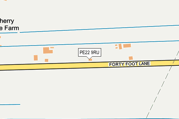
PE22 9RU lies on Forty Foot Lane in Old Leake, Boston. PE22 9RU is located in the Old Leake and Wrangle electoral ward, within the local authority district of Boston and the English Parliamentary constituency of Boston and Skegness. The Sub Integrated Care Board (ICB) Location is NHS Lincolnshire ICB - 71E and the police force is Lincolnshire. This postcode has been in use since January 1980.


GetTheData
Source: OS OpenMap – Local (Ordnance Survey)
Source: OS VectorMap District (Ordnance Survey)
Licence: Open Government Licence (requires attribution)
| Easting | 537803 |
| Northing | 352264 |
| Latitude | 53.049882 |
| Longitude | 0.054359 |
GetTheData
Source: Open Postcode Geo
Licence: Open Government Licence
| Street | Forty Foot Lane |
| Locality | Old Leake |
| Town/City | Boston |
| Country | England |
| Postcode District | PE22 |
➜ See where PE22 is on a map | |
GetTheData
Source: Land Registry Price Paid Data
Licence: Open Government Licence
Elevation or altitude of PE22 9RU as distance above sea level:
| Metres | Feet | |
|---|---|---|
| Elevation | 0m | 0ft |
Elevation is measured from the approximate centre of the postcode, to the nearest point on an OS contour line from OS Terrain 50, which has contour spacing of ten vertical metres.
➜ How high above sea level am I? Find the elevation of your current position using your device's GPS.
GetTheData
Source: Open Postcode Elevation
Licence: Open Government Licence
| Ward | Old Leake And Wrangle |
| Constituency | Boston And Skegness |
GetTheData
Source: ONS Postcode Database
Licence: Open Government Licence
| Old Rail Station (Commonside Road) | Leake Commonside | 934m |
| Old Rail Station (Commonside Road) | Leake Commonside | 946m |
| Sandygate Crescent (Fellands Gate) | Leake Commonside | 1,030m |
| Hunstan Lane (Common Side Road) | Leake Commonside | 1,043m |
| Hunstan Lane (Common Side Road) | Leake Commonside | 1,053m |
GetTheData
Source: NaPTAN
Licence: Open Government Licence
| Percentage of properties with Next Generation Access | 16.7% |
| Percentage of properties with Superfast Broadband | 0.0% |
| Percentage of properties with Ultrafast Broadband | 0.0% |
| Percentage of properties with Full Fibre Broadband | 0.0% |
Superfast Broadband is between 30Mbps and 300Mbps
Ultrafast Broadband is > 300Mbps
| Percentage of properties unable to receive 2Mbps | 16.7% |
| Percentage of properties unable to receive 5Mbps | 100.0% |
| Percentage of properties unable to receive 10Mbps | 100.0% |
| Percentage of properties unable to receive 30Mbps | 100.0% |
GetTheData
Source: Ofcom
Licence: Ofcom Terms of Use (requires attribution)
GetTheData
Source: ONS Postcode Database
Licence: Open Government Licence


➜ Get more ratings from the Food Standards Agency
GetTheData
Source: Food Standards Agency
Licence: FSA terms & conditions
| Last Collection | |||
|---|---|---|---|
| Location | Mon-Fri | Sat | Distance |
| Pumping Station | 16:30 | 11:15 | 2,239m |
| Stickney Road | 16:40 | 10:15 | 2,653m |
| Station Road | 16:45 | 07:45 | 2,710m |
GetTheData
Source: Dracos
Licence: Creative Commons Attribution-ShareAlike
| Risk of PE22 9RU flooding from rivers and sea | Low |
| ➜ PE22 9RU flood map | |
GetTheData
Source: Open Flood Risk by Postcode
Licence: Open Government Licence
The below table lists the International Territorial Level (ITL) codes (formerly Nomenclature of Territorial Units for Statistics (NUTS) codes) and Local Administrative Units (LAU) codes for PE22 9RU:
| ITL 1 Code | Name |
|---|---|
| TLF | East Midlands (England) |
| ITL 2 Code | Name |
| TLF3 | Lincolnshire |
| ITL 3 Code | Name |
| TLF30 | Lincolnshire CC |
| LAU 1 Code | Name |
| E07000136 | Boston |
GetTheData
Source: ONS Postcode Directory
Licence: Open Government Licence
The below table lists the Census Output Area (OA), Lower Layer Super Output Area (LSOA), and Middle Layer Super Output Area (MSOA) for PE22 9RU:
| Code | Name | |
|---|---|---|
| OA | E00132055 | |
| LSOA | E01026024 | Boston 001E |
| MSOA | E02005417 | Boston 001 |
GetTheData
Source: ONS Postcode Directory
Licence: Open Government Licence
| PE22 9RP | Midgate Lane | 501m |
| PE22 9RT | Hobhole Bank | 520m |
| PE22 9RS | Hobhole Bank | 717m |
| PE22 9RX | Hobhole Bank | 946m |
| PE22 9RR | Station Road | 960m |
| PE22 9RB | Sandyford Lane | 964m |
| PE22 9RW | Station Road | 1035m |
| PE22 9RF | Station Road | 1057m |
| PE22 9RA | Sandygate Crescent | 1078m |
| PE22 9RD | Cowbroads Lane | 1117m |
GetTheData
Source: Open Postcode Geo; Land Registry Price Paid Data
Licence: Open Government Licence