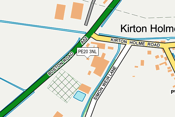
PE20 3NL is located in the Swineshead and Holland Fen electoral ward, within the local authority district of Boston and the English Parliamentary constituency of Boston and Skegness. The Sub Integrated Care Board (ICB) Location is NHS Lincolnshire ICB - 71E and the police force is Lincolnshire. This postcode has been in use since June 1996.


GetTheData
Source: OS OpenMap – Local (Ordnance Survey)
Source: OS VectorMap District (Ordnance Survey)
Licence: Open Government Licence (requires attribution)
| Easting | 525924 |
| Northing | 342068 |
| Latitude | 52.961205 |
| Longitude | -0.126720 |
GetTheData
Source: Open Postcode Geo
Licence: Open Government Licence
| Country | England |
| Postcode District | PE20 |
➜ See where PE20 is on a map ➜ Where is Kirton Holme? | |
GetTheData
Source: Land Registry Price Paid Data
Licence: Open Government Licence
Elevation or altitude of PE20 3NL as distance above sea level:
| Metres | Feet | |
|---|---|---|
| Elevation | 0m | 0ft |
Elevation is measured from the approximate centre of the postcode, to the nearest point on an OS contour line from OS Terrain 50, which has contour spacing of ten vertical metres.
➜ How high above sea level am I? Find the elevation of your current position using your device's GPS.
GetTheData
Source: Open Postcode Elevation
Licence: Open Government Licence
| Ward | Swineshead And Holland Fen |
| Constituency | Boston And Skegness |
GetTheData
Source: ONS Postcode Database
Licence: Open Government Licence
| Kirton Holme Road (Boston Road) | Kirton Holme | 61m |
| Kirton Holme Road (Boston Road) | Kirton Holme | 69m |
| Simon Weir Lane (Holme Road) | Kirton Holme | 214m |
| Simon Weir Lane (Holme Road) | Kirton Holme | 216m |
| Sykemouth Drove (Station Road) | Kirton Holme | 458m |
| Hubberts Bridge Station | 1.9km |
| Swineshead Station | 4.2km |
GetTheData
Source: NaPTAN
Licence: Open Government Licence
GetTheData
Source: ONS Postcode Database
Licence: Open Government Licence


➜ Get more ratings from the Food Standards Agency
GetTheData
Source: Food Standards Agency
Licence: FSA terms & conditions
| Last Collection | |||
|---|---|---|---|
| Location | Mon-Fri | Sat | Distance |
| Broadsides | 16:45 | 10:00 | 1,887m |
| Holmes Road | 16:15 | 09:00 | 2,227m |
| Swineshead Post Office | 17:15 | 10:30 | 2,798m |
GetTheData
Source: Dracos
Licence: Creative Commons Attribution-ShareAlike
| Risk of PE20 3NL flooding from rivers and sea | Low |
| ➜ PE20 3NL flood map | |
GetTheData
Source: Open Flood Risk by Postcode
Licence: Open Government Licence
The below table lists the International Territorial Level (ITL) codes (formerly Nomenclature of Territorial Units for Statistics (NUTS) codes) and Local Administrative Units (LAU) codes for PE20 3NL:
| ITL 1 Code | Name |
|---|---|
| TLF | East Midlands (England) |
| ITL 2 Code | Name |
| TLF3 | Lincolnshire |
| ITL 3 Code | Name |
| TLF30 | Lincolnshire CC |
| LAU 1 Code | Name |
| E07000136 | Boston |
GetTheData
Source: ONS Postcode Directory
Licence: Open Government Licence
The below table lists the Census Output Area (OA), Lower Layer Super Output Area (LSOA), and Middle Layer Super Output Area (MSOA) for PE20 3NL:
| Code | Name | |
|---|---|---|
| OA | E00132116 | |
| LSOA | E01026033 | Boston 006B |
| MSOA | E02005422 | Boston 006 |
GetTheData
Source: ONS Postcode Directory
Licence: Open Government Licence
| PE20 1TF | Simon Weir Lane | 196m |
| PE20 1TE | 241m | |
| PE20 1TT | 296m | |
| PE20 1TQ | 324m | |
| PE20 1TH | Beck Bank | 426m |
| PE20 1SY | Holme Road | 511m |
| PE20 1TL | Kells Drove | 534m |
| PE20 1TU | Sykemouth Drove | 557m |
| PE20 1TW | Hubberts Bridge Road | 600m |
| PE20 3HB | Boston Road | 1106m |
GetTheData
Source: Open Postcode Geo; Land Registry Price Paid Data
Licence: Open Government Licence