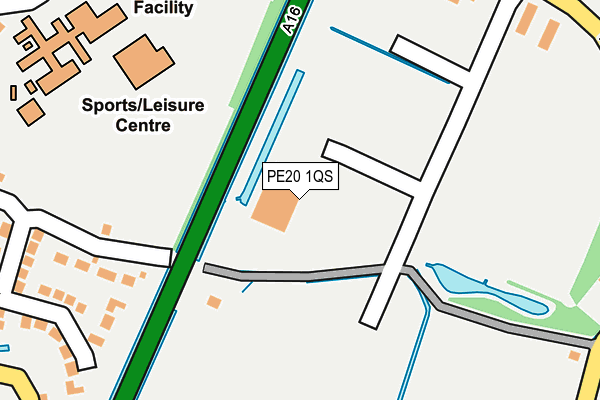
PE20 1QS is located in the Kirton and Frampton electoral ward, within the local authority district of Boston and the English Parliamentary constituency of Boston and Skegness. The Sub Integrated Care Board (ICB) Location is NHS Lincolnshire ICB - 71E and the police force is Lincolnshire. This postcode has been in use since February 2017.


GetTheData
Source: OS OpenMap – Local (Ordnance Survey)
Source: OS VectorMap District (Ordnance Survey)
Licence: Open Government Licence (requires attribution)
| Easting | 530768 |
| Northing | 337886 |
| Latitude | 52.922499 |
| Longitude | -0.056324 |
GetTheData
Source: Open Postcode Geo
Licence: Open Government Licence
| Country | England |
| Postcode District | PE20 |
➜ See where PE20 is on a map ➜ Where is Kirton? | |
GetTheData
Source: Land Registry Price Paid Data
Licence: Open Government Licence
| Ward | Kirton And Frampton |
| Constituency | Boston And Skegness |
GetTheData
Source: ONS Postcode Database
Licence: Open Government Licence
| Middlecott School (Edinburgh Drive) | Kirton | 310m |
| Eleven Acre Lane (Wash Road) | Kirton | 406m |
| Eleven Acre Lane (Wash Road) | Kirton | 421m |
| Town Hall (Station Road) | Kirton | 582m |
| Town Hall (Station Road) | Kirton | 594m |
GetTheData
Source: NaPTAN
Licence: Open Government Licence
GetTheData
Source: ONS Postcode Database
Licence: Open Government Licence


➜ Get more ratings from the Food Standards Agency
GetTheData
Source: Food Standards Agency
Licence: FSA terms & conditions
| Last Collection | |||
|---|---|---|---|
| Location | Mon-Fri | Sat | Distance |
| Middlegate Road | 16:30 | 07:30 | 1,629m |
| Kirton End | 16:30 | 09:30 | 2,784m |
| Parthian Avenue | 17:30 | 12:15 | 3,170m |
GetTheData
Source: Dracos
Licence: Creative Commons Attribution-ShareAlike
| Risk of PE20 1QS flooding from rivers and sea | Low |
| ➜ PE20 1QS flood map | |
GetTheData
Source: Open Flood Risk by Postcode
Licence: Open Government Licence
The below table lists the International Territorial Level (ITL) codes (formerly Nomenclature of Territorial Units for Statistics (NUTS) codes) and Local Administrative Units (LAU) codes for PE20 1QS:
| ITL 1 Code | Name |
|---|---|
| TLF | East Midlands (England) |
| ITL 2 Code | Name |
| TLF3 | Lincolnshire |
| ITL 3 Code | Name |
| TLF30 | Lincolnshire CC |
| LAU 1 Code | Name |
| E07000136 | Boston |
GetTheData
Source: ONS Postcode Directory
Licence: Open Government Licence
The below table lists the Census Output Area (OA), Lower Layer Super Output Area (LSOA), and Middle Layer Super Output Area (MSOA) for PE20 1QS:
| Code | Name | |
|---|---|---|
| OA | E00132034 | |
| LSOA | E01026019 | Boston 007C |
| MSOA | E02005423 | Boston 007 |
GetTheData
Source: ONS Postcode Directory
Licence: Open Government Licence
| PE20 1LA | The Paddock | 243m |
| PE20 1JU | Edinburgh Close | 300m |
| PE20 1JT | Edinburgh Crescent | 306m |
| PE20 1QA | Drainside South | 322m |
| PE20 1JW | Princess Road | 323m |
| PE20 1JP | Thorne Way | 332m |
| PE20 1JQ | Edinburgh Drive | 350m |
| PE20 1JR | Edinburgh Drive | 361m |
| PE20 1HZ | King Street | 370m |
| PE20 1QQ | Wash Road | 374m |
GetTheData
Source: Open Postcode Geo; Land Registry Price Paid Data
Licence: Open Government Licence