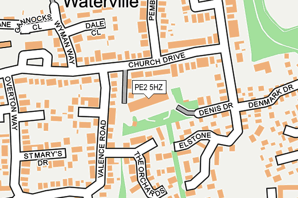
PE2 5HZ is located in the Orton Waterville electoral ward, within the unitary authority of Peterborough and the English Parliamentary constituency of North West Cambridgeshire. The Sub Integrated Care Board (ICB) Location is NHS Cambridgeshire and Peterborough ICB - 06H and the police force is Cambridgeshire. This postcode has been in use since August 1992.


GetTheData
Source: OS OpenMap – Local (Ordnance Survey)
Source: OS VectorMap District (Ordnance Survey)
Licence: Open Government Licence (requires attribution)
| Easting | 515925 |
| Northing | 295964 |
| Latitude | 52.549189 |
| Longitude | -0.291791 |
GetTheData
Source: Open Postcode Geo
Licence: Open Government Licence
| Country | England |
| Postcode District | PE2 |
➜ See where PE2 is on a map ➜ Where is Peterborough? | |
GetTheData
Source: Land Registry Price Paid Data
Licence: Open Government Licence
Elevation or altitude of PE2 5HZ as distance above sea level:
| Metres | Feet | |
|---|---|---|
| Elevation | 20m | 66ft |
Elevation is measured from the approximate centre of the postcode, to the nearest point on an OS contour line from OS Terrain 50, which has contour spacing of ten vertical metres.
➜ How high above sea level am I? Find the elevation of your current position using your device's GPS.
GetTheData
Source: Open Postcode Elevation
Licence: Open Government Licence
| Ward | Orton Waterville |
| Constituency | North West Cambridgeshire |
GetTheData
Source: ONS Postcode Database
Licence: Open Government Licence
| Church Drive | Orton Waterville | 241m |
| Church Drive | Orton Waterville | 243m |
| Aboyne Avenue (Lady Lodge Drive) | Orton Waterville | 249m |
| Aboyne Avenue (Lady Lodge Drive) | Orton Waterville | 253m |
| Windmill (Cherry Orton Road) | Orton Waterville | 421m |
| Ferry Meadows (Nene Valley Railway) | Ferry Meadows | 1,310m |
| Orton Mere (Nene Valley Railway) | Orton Longueville | 1,390m |
| Peterborough Station | 4km |
GetTheData
Source: NaPTAN
Licence: Open Government Licence
GetTheData
Source: ONS Postcode Database
Licence: Open Government Licence


➜ Get more ratings from the Food Standards Agency
GetTheData
Source: Food Standards Agency
Licence: FSA terms & conditions
| Last Collection | |||
|---|---|---|---|
| Location | Mon-Fri | Sat | Distance |
| Church Drive Shops | 17:30 | 12:30 | 235m |
| Orton Waterville Village | 17:30 | 12:30 | 254m |
| Bringhurst Orton Goldhay | 18:15 | 12:45 | 440m |
GetTheData
Source: Dracos
Licence: Creative Commons Attribution-ShareAlike
The below table lists the International Territorial Level (ITL) codes (formerly Nomenclature of Territorial Units for Statistics (NUTS) codes) and Local Administrative Units (LAU) codes for PE2 5HZ:
| ITL 1 Code | Name |
|---|---|
| TLH | East |
| ITL 2 Code | Name |
| TLH1 | East Anglia |
| ITL 3 Code | Name |
| TLH11 | Peterborough |
| LAU 1 Code | Name |
| E06000031 | Peterborough |
GetTheData
Source: ONS Postcode Directory
Licence: Open Government Licence
The below table lists the Census Output Area (OA), Lower Layer Super Output Area (LSOA), and Middle Layer Super Output Area (MSOA) for PE2 5HZ:
| Code | Name | |
|---|---|---|
| OA | E00079117 | |
| LSOA | E01015646 | Peterborough 018D |
| MSOA | E02003254 | Peterborough 018 |
GetTheData
Source: ONS Postcode Directory
Licence: Open Government Licence
| PE2 5AF | Church Drive | 53m |
| PE2 5JG | Denis Drive | 108m |
| PE2 5EX | Church Drive | 111m |
| PE2 5JY | Elstone | 126m |
| PE2 5LA | The Orchards | 134m |
| PE2 5HL | Littlemeer | 135m |
| PE2 5EZ | Church Drive | 135m |
| PE2 5HB | Dale Close | 157m |
| PE2 5HJ | Valence Road | 160m |
| PE2 5JZ | Elstone | 194m |
GetTheData
Source: Open Postcode Geo; Land Registry Price Paid Data
Licence: Open Government Licence