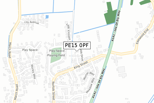
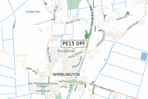
PE15 0PF is located in the Doddington & Wimblington electoral ward, within the local authority district of Fenland and the English Parliamentary constituency of North East Cambridgeshire. The Sub Integrated Care Board (ICB) Location is NHS Cambridgeshire and Peterborough ICB - 06H and the police force is Cambridgeshire. This postcode has been in use since September 2019.


GetTheData
Source: OS Open Zoomstack (Ordnance Survey)
Licence: Open Government Licence (requires attribution)
Attribution: Contains OS data © Crown copyright and database right 2025
Source: Open Postcode Geo
Licence: Open Government Licence (requires attribution)
Attribution: Contains OS data © Crown copyright and database right 2025; Contains Royal Mail data © Royal Mail copyright and database right 2025; Source: Office for National Statistics licensed under the Open Government Licence v.3.0
| Easting | 541675 |
| Northing | 292666 |
| Latitude | 52.513493 |
| Longitude | 0.086330 |
GetTheData
Source: Open Postcode Geo
Licence: Open Government Licence
| Country | England |
| Postcode District | PE15 |
➜ See where PE15 is on a map ➜ Where is Wimblington? | |
GetTheData
Source: Land Registry Price Paid Data
Licence: Open Government Licence
| Ward | Doddington & Wimblington |
| Constituency | North East Cambridgeshire |
GetTheData
Source: ONS Postcode Database
Licence: Open Government Licence
5, CLAYFIELDS DRIVE, WIMBLINGTON, MARCH, PE15 0PF 2022 11 JAN £285,000 |
2021 16 NOV £525,000 |
2021 29 JUN £517,500 |
7A, CLAYFIELDS DRIVE, WIMBLINGTON, MARCH, PE15 0PF 2021 28 JUN £525,000 |
2020 3 DEC £125,000 |
GetTheData
Source: HM Land Registry Price Paid Data
Licence: Contains HM Land Registry data © Crown copyright and database right 2025. This data is licensed under the Open Government Licence v3.0.
| Norman Way (Norfolk Street) | Wimblington | 353m |
| Norman Way (Norfolk Street) | Wimblington | 358m |
| Honeymead Road (March Road) | Wimblington | 448m |
| Honeymead Road (March Road) | Wimblington | 458m |
| Village Hall (Addison Road) | Wimblington | 510m |
GetTheData
Source: NaPTAN
Licence: Open Government Licence
| Percentage of properties with Next Generation Access | 100.0% |
| Percentage of properties with Superfast Broadband | 100.0% |
| Percentage of properties with Ultrafast Broadband | 33.3% |
| Percentage of properties with Full Fibre Broadband | 33.3% |
Superfast Broadband is between 30Mbps and 300Mbps
Ultrafast Broadband is > 300Mbps
| Percentage of properties unable to receive 2Mbps | 0.0% |
| Percentage of properties unable to receive 5Mbps | 0.0% |
| Percentage of properties unable to receive 10Mbps | 0.0% |
| Percentage of properties unable to receive 30Mbps | 0.0% |
GetTheData
Source: Ofcom
Licence: Ofcom Terms of Use (requires attribution)
GetTheData
Source: ONS Postcode Database
Licence: Open Government Licence


➜ Get more ratings from the Food Standards Agency
GetTheData
Source: Food Standards Agency
Licence: FSA terms & conditions
| Last Collection | |||
|---|---|---|---|
| Location | Mon-Fri | Sat | Distance |
| Wimblington Post Office | 17:15 | 11:00 | 460m |
| Wimblington Road | 17:30 | 09:05 | 535m |
| Eastwood | 16:45 | 08:00 | 562m |
GetTheData
Source: Dracos
Licence: Creative Commons Attribution-ShareAlike
The below table lists the International Territorial Level (ITL) codes (formerly Nomenclature of Territorial Units for Statistics (NUTS) codes) and Local Administrative Units (LAU) codes for PE15 0PF:
| ITL 1 Code | Name |
|---|---|
| TLH | East |
| ITL 2 Code | Name |
| TLH1 | East Anglia |
| ITL 3 Code | Name |
| TLH12 | Cambridgeshire CC |
| LAU 1 Code | Name |
| E07000010 | Fenland |
GetTheData
Source: ONS Postcode Directory
Licence: Open Government Licence
The below table lists the Census Output Area (OA), Lower Layer Super Output Area (LSOA), and Middle Layer Super Output Area (MSOA) for PE15 0PF:
| Code | Name | |
|---|---|---|
| OA | E00091380 | |
| LSOA | E01018111 | Fenland 010C |
| MSOA | E02003751 | Fenland 010 |
GetTheData
Source: ONS Postcode Directory
Licence: Open Government Licence
| PE15 0RF | Fenland Close | 96m |
| PE15 0QF | King Street | 122m |
| PE15 0QE | Eaton Estate | 213m |
| PE15 0PQ | Morton Way | 221m |
| PE15 0QG | Orchard Way | 222m |
| PE15 0PP | Rose Cottage Gardens | 261m |
| PE15 0QP | Meadow Way | 271m |
| PE15 0NY | Greenwood Way | 277m |
| PE15 0PW | Woodysfield | 311m |
| PE15 0NR | Morley Way | 330m |
GetTheData
Source: Open Postcode Geo; Land Registry Price Paid Data
Licence: Open Government Licence