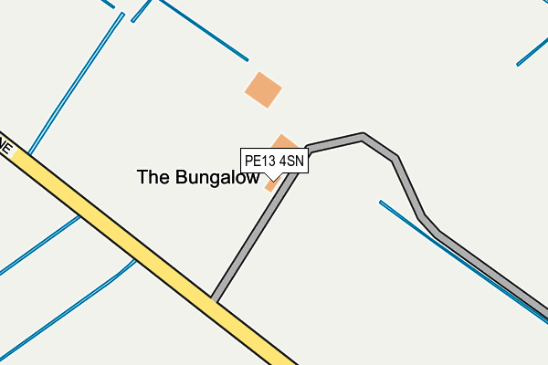
PE13 4SN is located in the Parson Drove & Wisbech St Mary electoral ward, within the local authority district of Fenland and the English Parliamentary constituency of North East Cambridgeshire. The Sub Integrated Care Board (ICB) Location is NHS Cambridgeshire and Peterborough ICB - 06H and the police force is Cambridgeshire. This postcode has been in use since January 1980.


GetTheData
Source: OS OpenMap – Local (Ordnance Survey)
Source: OS VectorMap District (Ordnance Survey)
Licence: Open Government Licence (requires attribution)
| Easting | 539523 |
| Northing | 306852 |
| Latitude | 52.641476 |
| Longitude | 0.060589 |
GetTheData
Source: Open Postcode Geo
Licence: Open Government Licence
| Country | England |
| Postcode District | PE13 |
➜ See where PE13 is on a map | |
GetTheData
Source: Land Registry Price Paid Data
Licence: Open Government Licence
Elevation or altitude of PE13 4SN as distance above sea level:
| Metres | Feet | |
|---|---|---|
| Elevation | 0m | 0ft |
Elevation is measured from the approximate centre of the postcode, to the nearest point on an OS contour line from OS Terrain 50, which has contour spacing of ten vertical metres.
➜ How high above sea level am I? Find the elevation of your current position using your device's GPS.
GetTheData
Source: Open Postcode Elevation
Licence: Open Government Licence
| Ward | Parson Drove & Wisbech St Mary |
| Constituency | North East Cambridgeshire |
GetTheData
Source: ONS Postcode Database
Licence: Open Government Licence
| Plash Drove (Black Drove) | Tholomas Drove | 781m |
| Plash Drove (Black Drove) | Tholomas Drove | 817m |
| Murrow Lane (Front Road) | Murrow | 1,232m |
| Murrow Lane (Front Road) | Murrow | 1,239m |
| Willock Lane (High Road) | Bunkers Hill | 1,259m |
GetTheData
Source: NaPTAN
Licence: Open Government Licence
GetTheData
Source: ONS Postcode Database
Licence: Open Government Licence


➜ Get more ratings from the Food Standards Agency
GetTheData
Source: Food Standards Agency
Licence: FSA terms & conditions
| Last Collection | |||
|---|---|---|---|
| Location | Mon-Fri | Sat | Distance |
| Four Horseshoes | 16:15 | 09:30 | 4,053m |
| Coronation Avenue | 16:30 | 10:00 | 5,063m |
| Coldham Friday Bridge | 09:30 | 09:30 | 5,556m |
GetTheData
Source: Dracos
Licence: Creative Commons Attribution-ShareAlike
The below table lists the International Territorial Level (ITL) codes (formerly Nomenclature of Territorial Units for Statistics (NUTS) codes) and Local Administrative Units (LAU) codes for PE13 4SN:
| ITL 1 Code | Name |
|---|---|
| TLH | East |
| ITL 2 Code | Name |
| TLH1 | East Anglia |
| ITL 3 Code | Name |
| TLH12 | Cambridgeshire CC |
| LAU 1 Code | Name |
| E07000010 | Fenland |
GetTheData
Source: ONS Postcode Directory
Licence: Open Government Licence
The below table lists the Census Output Area (OA), Lower Layer Super Output Area (LSOA), and Middle Layer Super Output Area (MSOA) for PE13 4SN:
| Code | Name | |
|---|---|---|
| OA | E00091285 | |
| LSOA | E01018092 | Fenland 004F |
| MSOA | E02003745 | Fenland 004 |
GetTheData
Source: ONS Postcode Directory
Licence: Open Government Licence
| PE13 4SL | High Road | 855m |
| PE13 4SP | Plash Drove | 904m |
| PE13 4JH | Murrow Lane | 1061m |
| PE13 4SD | Seadyke Road | 1086m |
| PE13 4AF | Seadyke Bank | 1260m |
| PE13 4JU | The Pigeons | 1280m |
| PE13 4SQ | Bunkers Hill | 1285m |
| PE13 4JJ | Silvers Lane | 1298m |
| PE13 4EL | Folleys Drove | 1301m |
| PE13 4SW | High Road | 1320m |
GetTheData
Source: Open Postcode Geo; Land Registry Price Paid Data
Licence: Open Government Licence