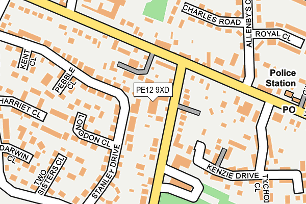
PE12 9XD is located in the Sutton Bridge electoral ward, within the local authority district of South Holland and the English Parliamentary constituency of South Holland and The Deepings. The Sub Integrated Care Board (ICB) Location is NHS Lincolnshire ICB - 71E and the police force is Lincolnshire. This postcode has been in use since January 1980.


GetTheData
Source: OS OpenMap – Local (Ordnance Survey)
Source: OS VectorMap District (Ordnance Survey)
Licence: Open Government Licence (requires attribution)
| Easting | 547271 |
| Northing | 321394 |
| Latitude | 52.770063 |
| Longitude | 0.181517 |
GetTheData
Source: Open Postcode Geo
Licence: Open Government Licence
| Country | England |
| Postcode District | PE12 |
➜ See where PE12 is on a map ➜ Where is Sutton Bridge? | |
GetTheData
Source: Land Registry Price Paid Data
Licence: Open Government Licence
Elevation or altitude of PE12 9XD as distance above sea level:
| Metres | Feet | |
|---|---|---|
| Elevation | 0m | 0ft |
Elevation is measured from the approximate centre of the postcode, to the nearest point on an OS contour line from OS Terrain 50, which has contour spacing of ten vertical metres.
➜ How high above sea level am I? Find the elevation of your current position using your device's GPS.
GetTheData
Source: Open Postcode Elevation
Licence: Open Government Licence
| Ward | Sutton Bridge |
| Constituency | South Holland And The Deepings |
GetTheData
Source: ONS Postcode Database
Licence: Open Government Licence
| Greyhound Ph (Bridge Road) | Sutton Bridge | 107m |
| Greyhound Ph (Bridge Road) | Sutton Bridge | 112m |
| Railway Lane | Sutton Bridge | 127m |
| Post Office (Bridge Road) | Sutton Bridge | 220m |
| Post Office (Bridge Road) | Sutton Bridge | 276m |
GetTheData
Source: NaPTAN
Licence: Open Government Licence
GetTheData
Source: ONS Postcode Database
Licence: Open Government Licence


➜ Get more ratings from the Food Standards Agency
GetTheData
Source: Food Standards Agency
Licence: FSA terms & conditions
| Last Collection | |||
|---|---|---|---|
| Location | Mon-Fri | Sat | Distance |
| Allenbys Chase | 15:45 | 09:45 | 243m |
| Chestnut Terrace | 16:15 | 09:30 | 253m |
| Sutton Bridge Post Office | 17:00 | 12:00 | 269m |
GetTheData
Source: Dracos
Licence: Creative Commons Attribution-ShareAlike
| Risk of PE12 9XD flooding from rivers and sea | Low |
| ➜ PE12 9XD flood map | |
GetTheData
Source: Open Flood Risk by Postcode
Licence: Open Government Licence
The below table lists the International Territorial Level (ITL) codes (formerly Nomenclature of Territorial Units for Statistics (NUTS) codes) and Local Administrative Units (LAU) codes for PE12 9XD:
| ITL 1 Code | Name |
|---|---|
| TLF | East Midlands (England) |
| ITL 2 Code | Name |
| TLF3 | Lincolnshire |
| ITL 3 Code | Name |
| TLF30 | Lincolnshire CC |
| LAU 1 Code | Name |
| E07000140 | South Holland |
GetTheData
Source: ONS Postcode Directory
Licence: Open Government Licence
The below table lists the Census Output Area (OA), Lower Layer Super Output Area (LSOA), and Middle Layer Super Output Area (MSOA) for PE12 9XD:
| Code | Name | |
|---|---|---|
| OA | E00133467 | |
| LSOA | E01026279 | South Holland 008F |
| MSOA | E02005472 | South Holland 008 |
GetTheData
Source: ONS Postcode Directory
Licence: Open Government Licence
| PE12 9LP | Railway Lane North | 63m |
| PE12 9TE | The Birches | 69m |
| PE12 9XQ | Stanley Drive | 92m |
| PE12 9SG | Bridge Road | 138m |
| PE12 9QX | Longdon Close | 141m |
| PE12 9UY | Railway Lane | 155m |
| PE12 9PZ | Kinderley Close | 175m |
| PE12 9TN | Chapel Court | 183m |
| PE12 9QZ | Pebble Close | 190m |
| PE12 9TA | Charles Road | 208m |
GetTheData
Source: Open Postcode Geo; Land Registry Price Paid Data
Licence: Open Government Licence