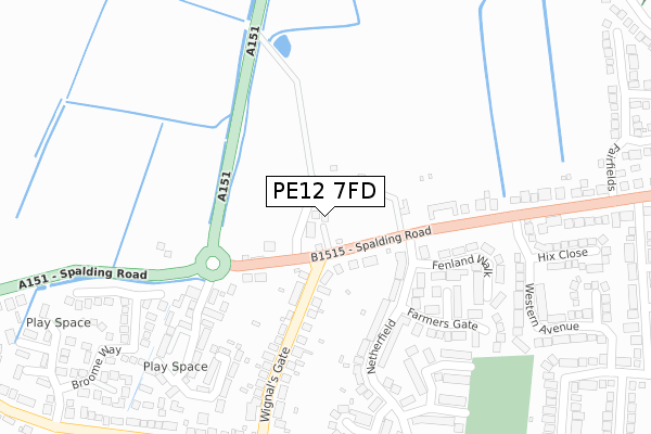
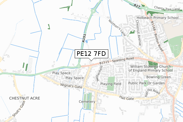
PE12 7FD is located in the Holbeach Town electoral ward, within the local authority district of South Holland and the English Parliamentary constituency of South Holland and The Deepings. The Sub Integrated Care Board (ICB) Location is NHS Lincolnshire ICB - 71E and the police force is Lincolnshire. This postcode has been in use since April 2020.


GetTheData
Source: OS Open Zoomstack (Ordnance Survey)
Licence: Open Government Licence (requires attribution)
Attribution: Contains OS data © Crown copyright and database right 2025
Source: Open Postcode Geo
Licence: Open Government Licence (requires attribution)
Attribution: Contains OS data © Crown copyright and database right 2025; Contains Royal Mail data © Royal Mail copyright and database right 2025; Source: Office for National Statistics licensed under the Open Government Licence v.3.0
| Easting | 534800 |
| Northing | 324875 |
| Latitude | 52.804611 |
| Longitude | -0.001764 |
GetTheData
Source: Open Postcode Geo
Licence: Open Government Licence
| Country | England |
| Postcode District | PE12 |
➜ See where PE12 is on a map ➜ Where is Holbeach? | |
GetTheData
Source: Land Registry Price Paid Data
Licence: Open Government Licence
| Ward | Holbeach Town |
| Constituency | South Holland And The Deepings |
GetTheData
Source: ONS Postcode Database
Licence: Open Government Licence
7, WOODROWE COURT, HOLBEACH, SPALDING, PE12 7FD 2020 25 MAR £259,000 |
GetTheData
Source: HM Land Registry Price Paid Data
Licence: Contains HM Land Registry data © Crown copyright and database right 2025. This data is licensed under the Open Government Licence v3.0.
| Netherfield (Spalding Road) | Holbeach | 61m |
| Netherfield (Spalding Road) | Holbeach | 106m |
| 23 Wignals Gate (Wignals Gate) | Holbeach | 203m |
| 23 Wignals Gate (Wignals Gate) | Holbeach | 206m |
| Fairfields (Spalding Road) | Holbeach | 477m |
GetTheData
Source: NaPTAN
Licence: Open Government Licence
GetTheData
Source: ONS Postcode Database
Licence: Open Government Licence


➜ Get more ratings from the Food Standards Agency
GetTheData
Source: Food Standards Agency
Licence: FSA terms & conditions
| Last Collection | |||
|---|---|---|---|
| Location | Mon-Fri | Sat | Distance |
| Wignalls Gate | 17:00 | 07:15 | 59m |
| Cranmore Lane | 16:30 | 11:30 | 413m |
| Langwith Gardens | 16:20 | 11:30 | 564m |
GetTheData
Source: Dracos
Licence: Creative Commons Attribution-ShareAlike
The below table lists the International Territorial Level (ITL) codes (formerly Nomenclature of Territorial Units for Statistics (NUTS) codes) and Local Administrative Units (LAU) codes for PE12 7FD:
| ITL 1 Code | Name |
|---|---|
| TLF | East Midlands (England) |
| ITL 2 Code | Name |
| TLF3 | Lincolnshire |
| ITL 3 Code | Name |
| TLF30 | Lincolnshire CC |
| LAU 1 Code | Name |
| E07000140 | South Holland |
GetTheData
Source: ONS Postcode Directory
Licence: Open Government Licence
The below table lists the Census Output Area (OA), Lower Layer Super Output Area (LSOA), and Middle Layer Super Output Area (MSOA) for PE12 7FD:
| Code | Name | |
|---|---|---|
| OA | E00133315 | |
| LSOA | E01026252 | South Holland 003C |
| MSOA | E02005467 | South Holland 003 |
GetTheData
Source: ONS Postcode Directory
Licence: Open Government Licence
| PE12 7HW | Spalding Road | 112m |
| PE12 7HJ | Spalding Road | 142m |
| PE12 7HL | Wignals Gate | 201m |
| PE12 7NP | Netherfield | 215m |
| PE12 7NS | Fenland Walk | 244m |
| PE12 7NU | Reapers Close | 250m |
| PE12 7NX | Windmill Close | 275m |
| PE12 7JH | John Harrison Way | 280m |
| PE12 7NT | Farmers Gate | 287m |
| PE12 7JF | Greenwich Avenue | 296m |
GetTheData
Source: Open Postcode Geo; Land Registry Price Paid Data
Licence: Open Government Licence