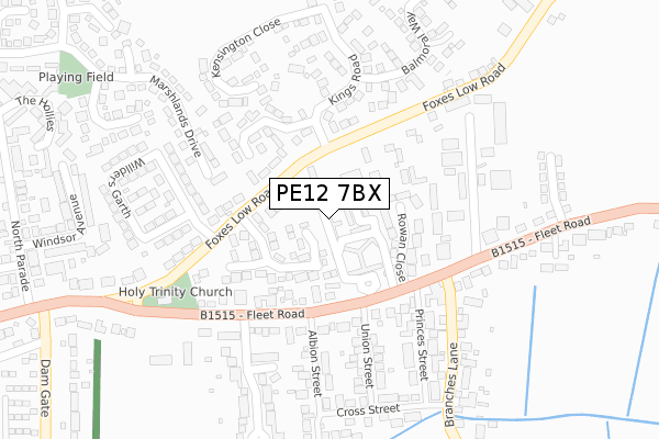
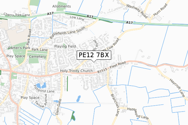
PE12 7BX is located in the Fleet electoral ward, within the local authority district of South Holland and the English Parliamentary constituency of South Holland and The Deepings. The Sub Integrated Care Board (ICB) Location is NHS Lincolnshire ICB - 71E and the police force is Lincolnshire. This postcode has been in use since November 2017.


GetTheData
Source: OS Open Zoomstack (Ordnance Survey)
Licence: Open Government Licence (requires attribution)
Attribution: Contains OS data © Crown copyright and database right 2025
Source: Open Postcode Geo
Licence: Open Government Licence (requires attribution)
Attribution: Contains OS data © Crown copyright and database right 2025; Contains Royal Mail data © Royal Mail copyright and database right 2025; Source: Office for National Statistics licensed under the Open Government Licence v.3.0
| Easting | 536958 |
| Northing | 324960 |
| Latitude | 52.804832 |
| Longitude | 0.030262 |
GetTheData
Source: Open Postcode Geo
Licence: Open Government Licence
| Country | England |
| Postcode District | PE12 |
➜ See where PE12 is on a map ➜ Where is Holbeach? | |
GetTheData
Source: Land Registry Price Paid Data
Licence: Open Government Licence
| Ward | Fleet |
| Constituency | South Holland And The Deepings |
GetTheData
Source: ONS Postcode Database
Licence: Open Government Licence
| Rowan Close (Fleet Road) | Holbeach | 142m |
| Rowan Close (Fleet Road) | Holbeach | 152m |
| Foxes Low Road Junction (Willders Garth) | Holbeach | 200m |
| Foxes Low Road Junction (Willders Garth) | Holbeach | 206m |
| Damgate (Fleet Street) | Holbeach | 451m |
GetTheData
Source: NaPTAN
Licence: Open Government Licence
| Percentage of properties with Next Generation Access | 100.0% |
| Percentage of properties with Superfast Broadband | 100.0% |
| Percentage of properties with Ultrafast Broadband | 0.0% |
| Percentage of properties with Full Fibre Broadband | 0.0% |
Superfast Broadband is between 30Mbps and 300Mbps
Ultrafast Broadband is > 300Mbps
| Median download speed | 40.0Mbps |
| Average download speed | 38.4Mbps |
| Maximum download speed | 69.65Mbps |
| Median upload speed | 10.0Mbps |
| Average upload speed | 8.2Mbps |
| Maximum upload speed | 19.72Mbps |
| Percentage of properties unable to receive 2Mbps | 0.0% |
| Percentage of properties unable to receive 5Mbps | 0.0% |
| Percentage of properties unable to receive 10Mbps | 0.0% |
| Percentage of properties unable to receive 30Mbps | 0.0% |
GetTheData
Source: Ofcom
Licence: Ofcom Terms of Use (requires attribution)
GetTheData
Source: ONS Postcode Database
Licence: Open Government Licence


➜ Get more ratings from the Food Standards Agency
GetTheData
Source: Food Standards Agency
Licence: FSA terms & conditions
| Last Collection | |||
|---|---|---|---|
| Location | Mon-Fri | Sat | Distance |
| Kings Road | 16:00 | 11:00 | 110m |
| Dangate | 17:15 | 12:00 | 467m |
| Battlefields Lane Middle | 16:00 | 11:00 | 538m |
GetTheData
Source: Dracos
Licence: Creative Commons Attribution-ShareAlike
| Risk of PE12 7BX flooding from rivers and sea | Low |
| ➜ PE12 7BX flood map | |
GetTheData
Source: Open Flood Risk by Postcode
Licence: Open Government Licence
The below table lists the International Territorial Level (ITL) codes (formerly Nomenclature of Territorial Units for Statistics (NUTS) codes) and Local Administrative Units (LAU) codes for PE12 7BX:
| ITL 1 Code | Name |
|---|---|
| TLF | East Midlands (England) |
| ITL 2 Code | Name |
| TLF3 | Lincolnshire |
| ITL 3 Code | Name |
| TLF30 | Lincolnshire CC |
| LAU 1 Code | Name |
| E07000140 | South Holland |
GetTheData
Source: ONS Postcode Directory
Licence: Open Government Licence
The below table lists the Census Output Area (OA), Lower Layer Super Output Area (LSOA), and Middle Layer Super Output Area (MSOA) for PE12 7BX:
| Code | Name | |
|---|---|---|
| OA | E00133274 | |
| LSOA | E01026245 | South Holland 010A |
| MSOA | E02005474 | South Holland 010 |
GetTheData
Source: ONS Postcode Directory
Licence: Open Government Licence
| PE12 7QL | Armitage Close | 72m |
| PE12 7BP | Orchard Park | 73m |
| PE12 7BT | Rowan Close | 97m |
| PE12 7JU | The Brambles | 98m |
| PE12 7PA | Foxes Low Road | 123m |
| PE12 8LA | Fleet Road | 159m |
| PE12 7RL | Sandringham Court | 171m |
| PE12 7RG | Kingston Gardens | 207m |
| PE12 7BB | Princes Street | 228m |
| PE12 7BA | Union Street | 234m |
GetTheData
Source: Open Postcode Geo; Land Registry Price Paid Data
Licence: Open Government Licence