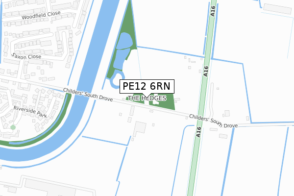
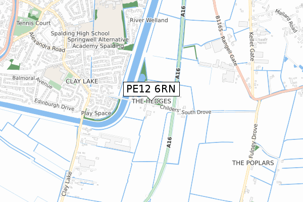
PE12 6RN is located in the Spalding St Mary's electoral ward, within the local authority district of South Holland and the English Parliamentary constituency of South Holland and The Deepings. The Sub Integrated Care Board (ICB) Location is NHS Lincolnshire ICB - 71E and the police force is Lincolnshire. This postcode has been in use since November 2018.


GetTheData
Source: OS Open Zoomstack (Ordnance Survey)
Licence: Open Government Licence (requires attribution)
Attribution: Contains OS data © Crown copyright and database right 2025
Source: Open Postcode Geo
Licence: Open Government Licence (requires attribution)
Attribution: Contains OS data © Crown copyright and database right 2025; Contains Royal Mail data © Royal Mail copyright and database right 2025; Source: Office for National Statistics licensed under the Open Government Licence v.3.0
| Easting | 525836 |
| Northing | 320502 |
| Latitude | 52.767484 |
| Longitude | -0.136339 |
GetTheData
Source: Open Postcode Geo
Licence: Open Government Licence
| Country | England |
| Postcode District | PE12 |
➜ See where PE12 is on a map | |
GetTheData
Source: Land Registry Price Paid Data
Licence: Open Government Licence
| Ward | Spalding St Mary's |
| Constituency | South Holland And The Deepings |
GetTheData
Source: ONS Postcode Database
Licence: Open Government Licence
| Balmoral Avenue (Holyrood Walk) | Spalding | 1,347m |
| Clarence Gardens (Holyrood Walk) | Spalding | 1,397m |
| Clay Lake Lane School (Clay Lake Lane) | Spalding | 1,511m |
| Clay Lake Lane School (Clay Lake Lane) | Spalding | 1,517m |
| Marlborough Avenue (Balmoral Avenue) | Spalding | 1,521m |
| Spalding Station | 2.7km |
GetTheData
Source: NaPTAN
Licence: Open Government Licence
GetTheData
Source: ONS Postcode Database
Licence: Open Government Licence


➜ Get more ratings from the Food Standards Agency
GetTheData
Source: Food Standards Agency
Licence: FSA terms & conditions
| Last Collection | |||
|---|---|---|---|
| Location | Mon-Fri | Sat | Distance |
| Cowbit Post Office | 17:15 | 11:00 | 2,450m |
| Orchard Way | 17:15 | 10:30 | 2,567m |
| Westlode Street | 17:45 | 12:00 | 2,589m |
GetTheData
Source: Dracos
Licence: Creative Commons Attribution-ShareAlike
| Risk of PE12 6RN flooding from rivers and sea | Very Low |
| ➜ PE12 6RN flood map | |
GetTheData
Source: Open Flood Risk by Postcode
Licence: Open Government Licence
The below table lists the International Territorial Level (ITL) codes (formerly Nomenclature of Territorial Units for Statistics (NUTS) codes) and Local Administrative Units (LAU) codes for PE12 6RN:
| ITL 1 Code | Name |
|---|---|
| TLF | East Midlands (England) |
| ITL 2 Code | Name |
| TLF3 | Lincolnshire |
| ITL 3 Code | Name |
| TLF30 | Lincolnshire CC |
| LAU 1 Code | Name |
| E07000140 | South Holland |
GetTheData
Source: ONS Postcode Directory
Licence: Open Government Licence
The below table lists the Census Output Area (OA), Lower Layer Super Output Area (LSOA), and Middle Layer Super Output Area (MSOA) for PE12 6RN:
| Code | Name | |
|---|---|---|
| OA | E00133423 | |
| LSOA | E01026268 | South Holland 007A |
| MSOA | E02005471 | South Holland 007 |
GetTheData
Source: ONS Postcode Directory
Licence: Open Government Licence
| PE12 6BL | 826m | |
| PE12 6AF | Drain Bank | 839m |
| PE11 2FA | Mallard Close | 1129m |
| PE12 6BW | Fulney Drove | 1139m |
| PE11 2FN | Swan Close | 1179m |
| PE11 2FQ | Riverside Park | 1191m |
| PE12 6AZ | Burr Lane | 1197m |
| PE11 2FZ | Swift Court | 1226m |
| PE11 2FX | Kingfisher Court | 1235m |
| PE11 2FT | Heron Way | 1247m |
GetTheData
Source: Open Postcode Geo; Land Registry Price Paid Data
Licence: Open Government Licence