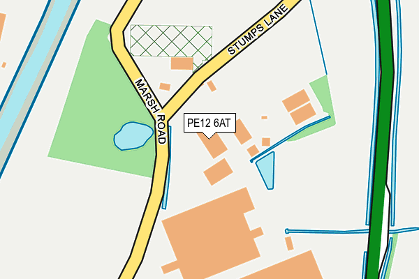
PE12 6AT lies on Stumps Lane in Spalding. PE12 6AT is located in the Spalding St Paul's electoral ward, within the local authority district of South Holland and the English Parliamentary constituency of South Holland and The Deepings. The Sub Integrated Care Board (ICB) Location is NHS Lincolnshire ICB - 71E and the police force is Lincolnshire. This postcode has been in use since July 1986.


GetTheData
Source: OS OpenMap – Local (Ordnance Survey)
Source: OS VectorMap District (Ordnance Survey)
Licence: Open Government Licence (requires attribution)
| Easting | 526383 |
| Northing | 324586 |
| Latitude | 52.804051 |
| Longitude | -0.126663 |
GetTheData
Source: Open Postcode Geo
Licence: Open Government Licence
| Street | Stumps Lane |
| Town/City | Spalding |
| Country | England |
| Postcode District | PE12 |
➜ See where PE12 is on a map ➜ Where is Spalding? | |
GetTheData
Source: Land Registry Price Paid Data
Licence: Open Government Licence
Elevation or altitude of PE12 6AT as distance above sea level:
| Metres | Feet | |
|---|---|---|
| Elevation | 10m | 33ft |
Elevation is measured from the approximate centre of the postcode, to the nearest point on an OS contour line from OS Terrain 50, which has contour spacing of ten vertical metres.
➜ How high above sea level am I? Find the elevation of your current position using your device's GPS.
GetTheData
Source: Open Postcode Elevation
Licence: Open Government Licence
| Ward | Spalding St Paul's |
| Constituency | South Holland And The Deepings |
GetTheData
Source: ONS Postcode Database
Licence: Open Government Licence
ROMAN BANK HOUSE, STUMPS LANE, SPALDING, PE12 6AT 2009 6 APR £440,000 |
2006 22 NOV £176,000 |
HAZELDENE, STUMPS LANE, SPALDING, PE12 6AT 2003 10 APR £181,834 |
1995 15 AUG £46,000 |
GetTheData
Source: HM Land Registry Price Paid Data
Licence: Contains HM Land Registry data © Crown copyright and database right 2025. This data is licensed under the Open Government Licence v3.0.
| Springfields Outlet (Camel Gate) | Spalding | 587m |
| St Pauls Church (Holbeach Road) | Spalding | 856m |
| St Pauls Church (Holbeach Road) | Spalding | 883m |
| Queens Road (Holbeach Road) | Spalding | 1,005m |
| Queens Road (Holbeach Road) | Spalding | 1,054m |
| Spalding Station | 2.6km |
GetTheData
Source: NaPTAN
Licence: Open Government Licence
GetTheData
Source: ONS Postcode Database
Licence: Open Government Licence


➜ Get more ratings from the Food Standards Agency
GetTheData
Source: Food Standards Agency
Licence: FSA terms & conditions
| Last Collection | |||
|---|---|---|---|
| Location | Mon-Fri | Sat | Distance |
| Spalding Delivery Office | 18:15 | 12:00 | 230m |
| Springfields | 17:40 | 12:00 | 564m |
| Horseshoe Road Bridge | 16:00 | 11:00 | 1,565m |
GetTheData
Source: Dracos
Licence: Creative Commons Attribution-ShareAlike
| Risk of PE12 6AT flooding from rivers and sea | Medium |
| ➜ PE12 6AT flood map | |
GetTheData
Source: Open Flood Risk by Postcode
Licence: Open Government Licence
The below table lists the International Territorial Level (ITL) codes (formerly Nomenclature of Territorial Units for Statistics (NUTS) codes) and Local Administrative Units (LAU) codes for PE12 6AT:
| ITL 1 Code | Name |
|---|---|
| TLF | East Midlands (England) |
| ITL 2 Code | Name |
| TLF3 | Lincolnshire |
| ITL 3 Code | Name |
| TLF30 | Lincolnshire CC |
| LAU 1 Code | Name |
| E07000140 | South Holland |
GetTheData
Source: ONS Postcode Directory
Licence: Open Government Licence
The below table lists the Census Output Area (OA), Lower Layer Super Output Area (LSOA), and Middle Layer Super Output Area (MSOA) for PE12 6AT:
| Code | Name | |
|---|---|---|
| OA | E00133441 | |
| LSOA | E01026270 | South Holland 007C |
| MSOA | E02005471 | South Holland 007 |
GetTheData
Source: ONS Postcode Directory
Licence: Open Government Licence
| PE12 6HB | Ash Tree Lane | 74m |
| PE11 2BB | West Marsh Road | 356m |
| PE12 6ES | Camel Gate | 502m |
| PE12 6EX | Roman Bank | 603m |
| PE12 6JP | Holbeach Road | 657m |
| PE11 2HR | Roman Bank | 789m |
| PE11 2HT | Crown Drive | 815m |
| PE12 6ER | Holbeach Road | 822m |
| PE11 2HS | Roman Bank | 835m |
| PE11 2HU | Crown Drive | 844m |
GetTheData
Source: Open Postcode Geo; Land Registry Price Paid Data
Licence: Open Government Licence