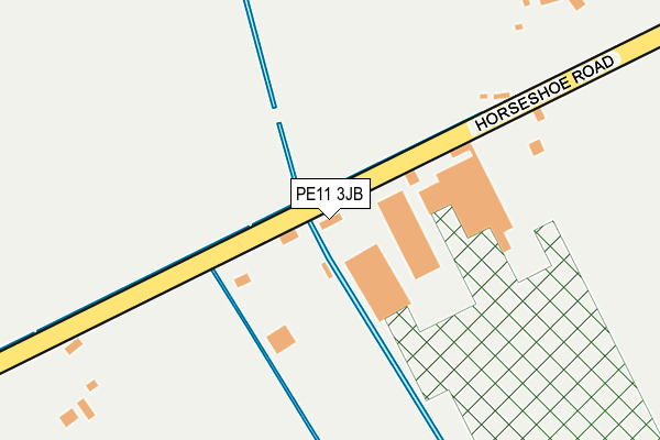
PE11 3JB lies on Horseshoe Road in Spalding. PE11 3JB is located in the Spalding Monks House electoral ward, within the local authority district of South Holland and the English Parliamentary constituency of South Holland and The Deepings. The Sub Integrated Care Board (ICB) Location is NHS Lincolnshire ICB - 71E and the police force is Lincolnshire. This postcode has been in use since January 1980.


GetTheData
Source: OS OpenMap – Local (Ordnance Survey)
Source: OS VectorMap District (Ordnance Survey)
Licence: Open Government Licence (requires attribution)
| Easting | 522358 |
| Northing | 321274 |
| Latitude | 52.775219 |
| Longitude | -0.187573 |
GetTheData
Source: Open Postcode Geo
Licence: Open Government Licence
| Street | Horseshoe Road |
| Town/City | Spalding |
| Country | England |
| Postcode District | PE11 |
➜ See where PE11 is on a map | |
GetTheData
Source: Land Registry Price Paid Data
Licence: Open Government Licence
Elevation or altitude of PE11 3JB as distance above sea level:
| Metres | Feet | |
|---|---|---|
| Elevation | 0m | 0ft |
Elevation is measured from the approximate centre of the postcode, to the nearest point on an OS contour line from OS Terrain 50, which has contour spacing of ten vertical metres.
➜ How high above sea level am I? Find the elevation of your current position using your device's GPS.
GetTheData
Source: Open Postcode Elevation
Licence: Open Government Licence
| Ward | Spalding Monks House |
| Constituency | South Holland And The Deepings |
GetTheData
Source: ONS Postcode Database
Licence: Open Government Licence
| East Road (Horseshoe Road) | Horseshoe Bridge | 476m |
| East Road (Horseshoe Road) | Horseshoe Bridge | 483m |
| Highways Depot (Bourne Road) | Pode Hole | 878m |
| Demand Responsive Area | Pode Hole | 880m |
| Highways Depot (Bourne Road) | Pode Hole | 882m |
| Spalding Station | 2.6km |
GetTheData
Source: NaPTAN
Licence: Open Government Licence
GetTheData
Source: ONS Postcode Database
Licence: Open Government Licence


➜ Get more ratings from the Food Standards Agency
GetTheData
Source: Food Standards Agency
Licence: FSA terms & conditions
| Last Collection | |||
|---|---|---|---|
| Location | Mon-Fri | Sat | Distance |
| Westlode Street | 17:45 | 12:00 | 2,832m |
| Horseshoe Road Bridge | 16:00 | 11:00 | 3,950m |
| Fern Drive | 17:30 | 12:00 | 4,712m |
GetTheData
Source: Dracos
Licence: Creative Commons Attribution-ShareAlike
| Risk of PE11 3JB flooding from rivers and sea | Medium |
| ➜ PE11 3JB flood map | |
GetTheData
Source: Open Flood Risk by Postcode
Licence: Open Government Licence
The below table lists the International Territorial Level (ITL) codes (formerly Nomenclature of Territorial Units for Statistics (NUTS) codes) and Local Administrative Units (LAU) codes for PE11 3JB:
| ITL 1 Code | Name |
|---|---|
| TLF | East Midlands (England) |
| ITL 2 Code | Name |
| TLF3 | Lincolnshire |
| ITL 3 Code | Name |
| TLF30 | Lincolnshire CC |
| LAU 1 Code | Name |
| E07000140 | South Holland |
GetTheData
Source: ONS Postcode Directory
Licence: Open Government Licence
The below table lists the Census Output Area (OA), Lower Layer Super Output Area (LSOA), and Middle Layer Super Output Area (MSOA) for PE11 3JB:
| Code | Name | |
|---|---|---|
| OA | E00133393 | |
| LSOA | E01026262 | South Holland 009A |
| MSOA | E02005473 | South Holland 009 |
GetTheData
Source: ONS Postcode Directory
Licence: Open Government Licence
| PE11 3LJ | Bourne Road | 703m |
| PE11 3WF | Gershwin Lane | 803m |
| PE11 3WG | Westside | 836m |
| PE11 3WN | Delacorte Green | 858m |
| PE11 3LW | Bourne Road | 898m |
| PE11 3WJ | Astor Place | 898m |
| PE11 1YS | Buttercup Close | 921m |
| PE11 3GY | Kimblewick Lane | 926m |
| PE11 1YR | Lavender Drive | 939m |
| PE11 3WH | Ambassador Walk | 941m |
GetTheData
Source: Open Postcode Geo; Land Registry Price Paid Data
Licence: Open Government Licence