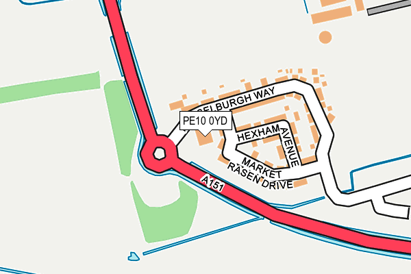
PE10 0YD is located in the Bourne Austerby electoral ward, within the local authority district of South Kesteven and the English Parliamentary constituency of Grantham and Stamford. The Sub Integrated Care Board (ICB) Location is NHS Lincolnshire ICB - 71E and the police force is Lincolnshire. This postcode has been in use since July 2016.


GetTheData
Source: OS OpenMap – Local (Ordnance Survey)
Source: OS VectorMap District (Ordnance Survey)
Licence: Open Government Licence (requires attribution)
| Easting | 508573 |
| Northing | 319112 |
| Latitude | 52.758736 |
| Longitude | -0.392548 |
GetTheData
Source: Open Postcode Geo
Licence: Open Government Licence
| Country | England |
| Postcode District | PE10 |
➜ See where PE10 is on a map ➜ Where is Bourne? | |
GetTheData
Source: Land Registry Price Paid Data
Licence: Open Government Licence
Elevation or altitude of PE10 0YD as distance above sea level:
| Metres | Feet | |
|---|---|---|
| Elevation | 20m | 66ft |
Elevation is measured from the approximate centre of the postcode, to the nearest point on an OS contour line from OS Terrain 50, which has contour spacing of ten vertical metres.
➜ How high above sea level am I? Find the elevation of your current position using your device's GPS.
GetTheData
Source: Open Postcode Elevation
Licence: Open Government Licence
| Ward | Bourne Austerby |
| Constituency | Grantham And Stamford |
GetTheData
Source: ONS Postcode Database
Licence: Open Government Licence
| Beech Avenue (West Road) | Bourne | 884m |
| Beech Avenue (West Road) | Bourne | 886m |
| Westbourne Park (West Road) | Bourne | 980m |
| Westbourne Park (West Road) | Bourne | 995m |
| Manor Lane (West Street) | Bourne | 1,183m |
GetTheData
Source: NaPTAN
Licence: Open Government Licence
GetTheData
Source: ONS Postcode Database
Licence: Open Government Licence


➜ Get more ratings from the Food Standards Agency
GetTheData
Source: Food Standards Agency
Licence: FSA terms & conditions
| Last Collection | |||
|---|---|---|---|
| Location | Mon-Fri | Sat | Distance |
| Thevillas | 17:30 | 12:15 | 974m |
| West Street-manor Court | 17:30 | 12:15 | 1,219m |
| Beech Avenue-forest Avenue | 17:30 | 12:15 | 1,272m |
GetTheData
Source: Dracos
Licence: Creative Commons Attribution-ShareAlike
The below table lists the International Territorial Level (ITL) codes (formerly Nomenclature of Territorial Units for Statistics (NUTS) codes) and Local Administrative Units (LAU) codes for PE10 0YD:
| ITL 1 Code | Name |
|---|---|
| TLF | East Midlands (England) |
| ITL 2 Code | Name |
| TLF3 | Lincolnshire |
| ITL 3 Code | Name |
| TLF30 | Lincolnshire CC |
| LAU 1 Code | Name |
| E07000141 | South Kesteven |
GetTheData
Source: ONS Postcode Directory
Licence: Open Government Licence
The below table lists the Census Output Area (OA), Lower Layer Super Output Area (LSOA), and Middle Layer Super Output Area (MSOA) for PE10 0YD:
| Code | Name | |
|---|---|---|
| OA | E00133579 | |
| LSOA | E01026301 | South Kesteven 010C |
| MSOA | E02005485 | South Kesteven 010 |
GetTheData
Source: ONS Postcode Directory
Licence: Open Government Licence
| PE10 0XZ | Market Rasen Drive | 105m |
| PE10 0YB | Hexham Avenue | 114m |
| PE10 0YE | Fontwell Park Drive | 131m |
| PE10 0XY | Musselburgh Way | 188m |
| PE10 0WJ | Haydock Park Drive | 357m |
| PE10 0WF | Great Leighs | 523m |
| PE10 0XG | Windsor Court | 565m |
| PE10 0WS | Newton Abbot Way | 592m |
| PE10 0WE | Cheltenham Court | 617m |
| PE10 0WW | Warwick Close | 620m |
GetTheData
Source: Open Postcode Geo; Land Registry Price Paid Data
Licence: Open Government Licence