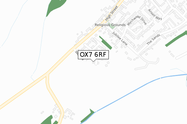
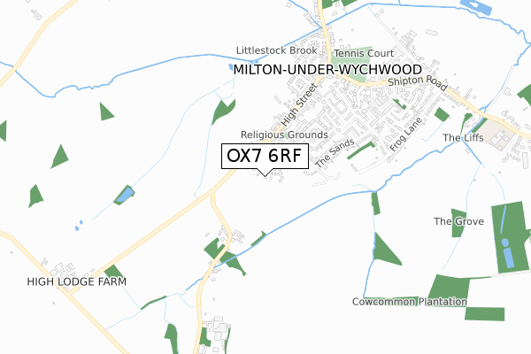
OX7 6RF is located in the Milton-under-Wychwood electoral ward, within the local authority district of West Oxfordshire and the English Parliamentary constituency of Witney. The Sub Integrated Care Board (ICB) Location is NHS Buckinghamshire, Oxfordshire and Berkshire West ICB - 10Q and the police force is Thames Valley. This postcode has been in use since December 2019.


GetTheData
Source: OS Open Zoomstack (Ordnance Survey)
Licence: Open Government Licence (requires attribution)
Attribution: Contains OS data © Crown copyright and database right 2025
Source: Open Postcode Geo
Licence: Open Government Licence (requires attribution)
Attribution: Contains OS data © Crown copyright and database right 2025; Contains Royal Mail data © Royal Mail copyright and database right 2025; Source: Office for National Statistics licensed under the Open Government Licence v.3.0
| Easting | 426209 |
| Northing | 217807 |
| Latitude | 51.858247 |
| Longitude | -1.620829 |
GetTheData
Source: Open Postcode Geo
Licence: Open Government Licence
| Country | England |
| Postcode District | OX7 |
➜ See where OX7 is on a map ➜ Where is Milton-under-Wychwood? | |
GetTheData
Source: Land Registry Price Paid Data
Licence: Open Government Licence
| Ward | Milton-under-wychwood |
| Constituency | Witney |
GetTheData
Source: ONS Postcode Database
Licence: Open Government Licence
| Jubilee Lane (The Sands) | Milton-under-wychwood | 236m |
| The Old Quart Pot Ph (High Street) | Milton-under-wychwood | 509m |
| The Old Quart Pot Ph (High Street) | Milton-under-wychwood | 514m |
| Brookfield Close (Church Road) | Milton-under-wychwood | 639m |
| Brookfield Close (Church Road) | Milton-under-wychwood | 645m |
| Shipton Station | 2.1km |
| Ascott-under-Wychwood Station | 4km |
| Kingham Station | 4.9km |
GetTheData
Source: NaPTAN
Licence: Open Government Licence
GetTheData
Source: ONS Postcode Database
Licence: Open Government Licence


➜ Get more ratings from the Food Standards Agency
GetTheData
Source: Food Standards Agency
Licence: FSA terms & conditions
| Last Collection | |||
|---|---|---|---|
| Location | Mon-Fri | Sat | Distance |
| Church Street | 16:45 | 09:15 | 1,674m |
| Shipton Station | 16:45 | 09:15 | 2,049m |
| Bruern Abbey | 15:45 | 08:15 | 2,607m |
GetTheData
Source: Dracos
Licence: Creative Commons Attribution-ShareAlike
The below table lists the International Territorial Level (ITL) codes (formerly Nomenclature of Territorial Units for Statistics (NUTS) codes) and Local Administrative Units (LAU) codes for OX7 6RF:
| ITL 1 Code | Name |
|---|---|
| TLJ | South East (England) |
| ITL 2 Code | Name |
| TLJ1 | Berkshire, Buckinghamshire and Oxfordshire |
| ITL 3 Code | Name |
| TLJ14 | Oxfordshire CC |
| LAU 1 Code | Name |
| E07000181 | West Oxfordshire |
GetTheData
Source: ONS Postcode Directory
Licence: Open Government Licence
The below table lists the Census Output Area (OA), Lower Layer Super Output Area (LSOA), and Middle Layer Super Output Area (MSOA) for OX7 6RF:
| Code | Name | |
|---|---|---|
| OA | E00146681 | |
| LSOA | E01028798 | West Oxfordshire 003C |
| MSOA | E02005995 | West Oxfordshire 003 |
GetTheData
Source: ONS Postcode Directory
Licence: Open Government Licence
| OX7 6EW | Jubilee Lane | 165m |
| OX7 6ET | High Street | 168m |
| OX7 6EN | High Street | 176m |
| OX7 6ES | High Street | 211m |
| OX7 6JB | Wychwood Close | 292m |
| OX7 6FG | Jubilee Lane | 298m |
| OX7 6JA | Wychwood Drive | 305m |
| OX7 6LD | High Street | 340m |
| OX7 6LE | High Street | 349m |
| OX7 6EP | The Sands | 400m |
GetTheData
Source: Open Postcode Geo; Land Registry Price Paid Data
Licence: Open Government Licence