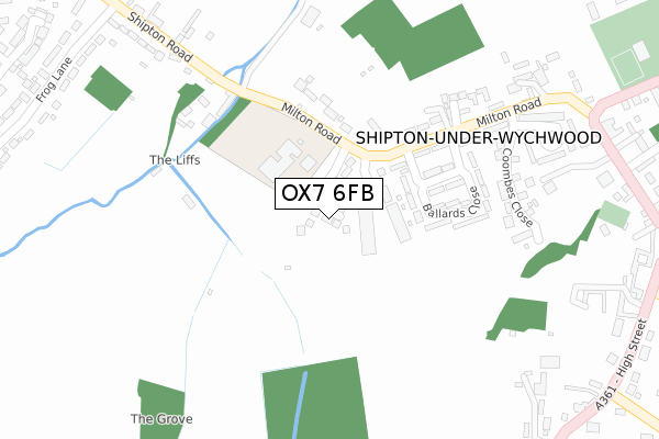
OX7 6FB is located in the Ascott and Shipton electoral ward, within the local authority district of West Oxfordshire and the English Parliamentary constituency of Witney. The Sub Integrated Care Board (ICB) Location is NHS Buckinghamshire, Oxfordshire and Berkshire West ICB - 10Q and the police force is Thames Valley. This postcode has been in use since February 2020.


GetTheData
Source: OS Open Zoomstack (Ordnance Survey)
Licence: Open Government Licence (requires attribution)
Attribution: Contains OS data © Crown copyright and database right 2025
Source: Open Postcode Geo
Licence: Open Government Licence (requires attribution)
Attribution: Contains OS data © Crown copyright and database right 2025; Contains Royal Mail data © Royal Mail copyright and database right 2025; Source: Office for National Statistics licensed under the Open Government Licence v.3.0
| Easting | 427362 |
| Northing | 217905 |
| Latitude | 51.859073 |
| Longitude | -1.604079 |
GetTheData
Source: Open Postcode Geo
Licence: Open Government Licence
| Country | England |
| Postcode District | OX7 |
➜ See where OX7 is on a map ➜ Where is Shipton-under-Wychwood? | |
GetTheData
Source: Land Registry Price Paid Data
Licence: Open Government Licence
| Ward | Ascott And Shipton |
| Constituency | Witney |
GetTheData
Source: ONS Postcode Database
Licence: Open Government Licence
| Post Office (Milton Road) | Shipton-under-wychwood | 238m |
| Post Office (Milton Road) | Shipton-under-wychwood | 257m |
| High Street | Shipton-under-wychwood | 415m |
| High Street | Shipton-under-wychwood | 467m |
| Frog Lane | Milton-under-wychwood | 487m |
| Shipton Station | 1.1km |
| Ascott-under-Wychwood Station | 2.9km |
| Kingham Station | 5.1km |
GetTheData
Source: NaPTAN
Licence: Open Government Licence
GetTheData
Source: ONS Postcode Database
Licence: Open Government Licence


➜ Get more ratings from the Food Standards Agency
GetTheData
Source: Food Standards Agency
Licence: FSA terms & conditions
| Last Collection | |||
|---|---|---|---|
| Location | Mon-Fri | Sat | Distance |
| Church Street | 16:45 | 09:15 | 523m |
| Shipton Station | 16:45 | 09:15 | 911m |
| Bruern Abbey | 15:45 | 08:15 | 2,632m |
GetTheData
Source: Dracos
Licence: Creative Commons Attribution-ShareAlike
The below table lists the International Territorial Level (ITL) codes (formerly Nomenclature of Territorial Units for Statistics (NUTS) codes) and Local Administrative Units (LAU) codes for OX7 6FB:
| ITL 1 Code | Name |
|---|---|
| TLJ | South East (England) |
| ITL 2 Code | Name |
| TLJ1 | Berkshire, Buckinghamshire and Oxfordshire |
| ITL 3 Code | Name |
| TLJ14 | Oxfordshire CC |
| LAU 1 Code | Name |
| E07000181 | West Oxfordshire |
GetTheData
Source: ONS Postcode Directory
Licence: Open Government Licence
The below table lists the Census Output Area (OA), Lower Layer Super Output Area (LSOA), and Middle Layer Super Output Area (MSOA) for OX7 6FB:
| Code | Name | |
|---|---|---|
| OA | E00146502 | |
| LSOA | E01028763 | West Oxfordshire 003A |
| MSOA | E02005995 | West Oxfordshire 003 |
GetTheData
Source: ONS Postcode Directory
Licence: Open Government Licence
| OX7 6BE | St Michaels Close | 176m |
| OX7 6BG | Ballards Close | 180m |
| OX7 6BD | Milton Road | 224m |
| OX7 6NS | Willis Court | 260m |
| OX7 6BU | Coombes Close | 281m |
| OX7 6BX | Tothill | 348m |
| OX7 6JS | Shipton Road | 351m |
| OX7 6BA | High Street | 452m |
| OX7 6DG | High Street | 467m |
| OX7 6JT | Shipton Road | 473m |
GetTheData
Source: Open Postcode Geo; Land Registry Price Paid Data
Licence: Open Government Licence