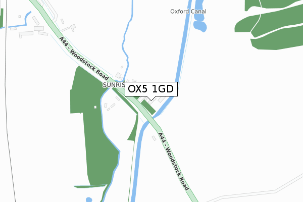
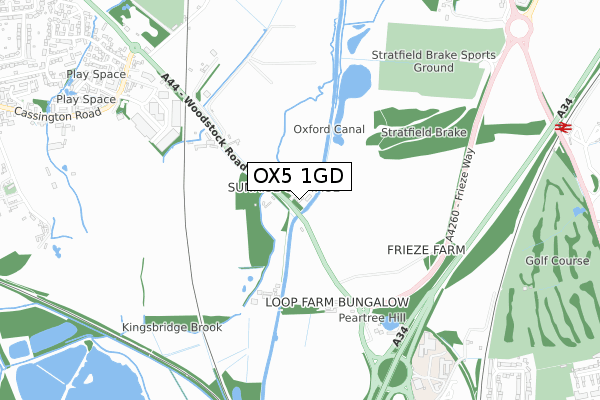
OX5 1GD is located in the Kidlington East electoral ward, within the local authority district of Cherwell and the English Parliamentary constituency of Oxford West and Abingdon. The Sub Integrated Care Board (ICB) Location is NHS Buckinghamshire, Oxfordshire and Berkshire West ICB - 10Q and the police force is Thames Valley. This postcode has been in use since February 2018.


GetTheData
Source: OS Open Zoomstack (Ordnance Survey)
Licence: Open Government Licence (requires attribution)
Attribution: Contains OS data © Crown copyright and database right 2025
Source: Open Postcode Geo
Licence: Open Government Licence (requires attribution)
Attribution: Contains OS data © Crown copyright and database right 2025; Contains Royal Mail data © Royal Mail copyright and database right 2025; Source: Office for National Statistics licensed under the Open Government Licence v.3.0
| Easting | 448971 |
| Northing | 211616 |
| Latitude | 51.801058 |
| Longitude | -1.291209 |
GetTheData
Source: Open Postcode Geo
Licence: Open Government Licence
| Country | England |
| Postcode District | OX5 |
➜ See where OX5 is on a map | |
GetTheData
Source: Land Registry Price Paid Data
Licence: Open Government Licence
| Ward | Kidlington East |
| Constituency | Oxford West And Abingdon |
GetTheData
Source: ONS Postcode Database
Licence: Open Government Licence
| Great Close Road (Cassington Road) | Yarnton | 896m |
| Great Close Road (Cassington Road) | Yarnton | 904m |
| The Turnpike Ph (Woodstock Road) | Yarnton | 1,009m |
| Pear Tree Park And Ride (Woodstock Road) | Pear Tree | 1,032m |
| The Turnpike Ph (Woodstock Road) | Yarnton | 1,044m |
| Oxford Parkway Station | 1.2km |
| Islip Station | 4.6km |
GetTheData
Source: NaPTAN
Licence: Open Government Licence
| Percentage of properties with Next Generation Access | 100.0% |
| Percentage of properties with Superfast Broadband | 100.0% |
| Percentage of properties with Ultrafast Broadband | 0.0% |
| Percentage of properties with Full Fibre Broadband | 0.0% |
Superfast Broadband is between 30Mbps and 300Mbps
Ultrafast Broadband is > 300Mbps
| Median download speed | 28.4Mbps |
| Average download speed | 25.2Mbps |
| Maximum download speed | 37.08Mbps |
| Median upload speed | 4.8Mbps |
| Average upload speed | 4.6Mbps |
| Maximum upload speed | 8.21Mbps |
| Percentage of properties unable to receive 2Mbps | 0.0% |
| Percentage of properties unable to receive 5Mbps | 0.0% |
| Percentage of properties unable to receive 10Mbps | 0.0% |
| Percentage of properties unable to receive 30Mbps | 0.0% |
GetTheData
Source: Ofcom
Licence: Ofcom Terms of Use (requires attribution)
GetTheData
Source: ONS Postcode Database
Licence: Open Government Licence


➜ Get more ratings from the Food Standards Agency
GetTheData
Source: Food Standards Agency
Licence: FSA terms & conditions
| Last Collection | |||
|---|---|---|---|
| Location | Mon-Fri | Sat | Distance |
| Great Close Road | 16:00 | 09:15 | 932m |
| Lock Crescent | 17:00 | 11:30 | 1,219m |
| The Broadway Post Office | 17:00 | 12:00 | 1,267m |
GetTheData
Source: Dracos
Licence: Creative Commons Attribution-ShareAlike
The below table lists the International Territorial Level (ITL) codes (formerly Nomenclature of Territorial Units for Statistics (NUTS) codes) and Local Administrative Units (LAU) codes for OX5 1GD:
| ITL 1 Code | Name |
|---|---|
| TLJ | South East (England) |
| ITL 2 Code | Name |
| TLJ1 | Berkshire, Buckinghamshire and Oxfordshire |
| ITL 3 Code | Name |
| TLJ14 | Oxfordshire CC |
| LAU 1 Code | Name |
| E07000177 | Cherwell |
GetTheData
Source: ONS Postcode Directory
Licence: Open Government Licence
The below table lists the Census Output Area (OA), Lower Layer Super Output Area (LSOA), and Middle Layer Super Output Area (MSOA) for OX5 1GD:
| Code | Name | |
|---|---|---|
| OA | E00145254 | |
| LSOA | E01028511 | Cherwell 019C |
| MSOA | E02005939 | Cherwell 019 |
GetTheData
Source: ONS Postcode Directory
Licence: Open Government Licence
| OX5 1PH | Woodstock Road | 139m |
| OX5 1PQ | Woodstock Road | 441m |
| OX5 1QH | Woodstock Road | 885m |
| OX5 1FZ | Cresswell Close | 917m |
| OX5 1QA | Cassington Road | 923m |
| OX2 8JT | Woodstock Road | 957m |
| OX5 1QW | Great Close Road | 979m |
| OX5 1FX | Cresswell Close | 1005m |
| OX5 1XD | Croxford Gardens | 1006m |
| OX5 1QP | Bernard Close | 1008m |
GetTheData
Source: Open Postcode Geo; Land Registry Price Paid Data
Licence: Open Government Licence