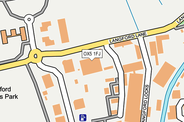
OX5 1FJ is located in the Kidlington West electoral ward, within the local authority district of Cherwell and the English Parliamentary constituency of Oxford West and Abingdon. The Sub Integrated Care Board (ICB) Location is NHS Buckinghamshire, Oxfordshire and Berkshire West ICB - 10Q and the police force is Thames Valley. This postcode has been in use since June 2002.


GetTheData
Source: OS OpenMap – Local (Ordnance Survey)
Source: OS VectorMap District (Ordnance Survey)
Licence: Open Government Licence (requires attribution)
| Easting | 447744 |
| Northing | 214714 |
| Latitude | 51.829016 |
| Longitude | -1.308575 |
GetTheData
Source: Open Postcode Geo
Licence: Open Government Licence
| Country | England |
| Postcode District | OX5 |
➜ See where OX5 is on a map ➜ Where is Kidlington? | |
GetTheData
Source: Land Registry Price Paid Data
Licence: Open Government Licence
Elevation or altitude of OX5 1FJ as distance above sea level:
| Metres | Feet | |
|---|---|---|
| Elevation | 70m | 230ft |
Elevation is measured from the approximate centre of the postcode, to the nearest point on an OS contour line from OS Terrain 50, which has contour spacing of ten vertical metres.
➜ How high above sea level am I? Find the elevation of your current position using your device's GPS.
GetTheData
Source: Open Postcode Elevation
Licence: Open Government Licence
| Ward | Kidlington West |
| Constituency | Oxford West And Abingdon |
GetTheData
Source: ONS Postcode Database
Licence: Open Government Licence
| Oxford Motor Park (Langford Lane) | Kidlington | 216m |
| London Oxford Airport (The Boulevard) | Kidlington | 277m |
| Campsfield House Detention Centre (Evenlode Crescent) | Campsfield | 293m |
| Langford Locks (Langford Lane) | Kidlington | 299m |
| Langford Locks (Langford Lane) | Kidlington | 440m |
| Oxford Parkway Station | 3.6km |
| Hanborough Station | 4.5km |
| Islip Station | 4.9km |
GetTheData
Source: NaPTAN
Licence: Open Government Licence
GetTheData
Source: ONS Postcode Database
Licence: Open Government Licence


➜ Get more ratings from the Food Standards Agency
GetTheData
Source: Food Standards Agency
Licence: FSA terms & conditions
| Last Collection | |||
|---|---|---|---|
| Location | Mon-Fri | Sat | Distance |
| Kidlington Airport | 16:30 | 09:30 | 244m |
| The Moors | 17:15 | 11:30 | 684m |
| Rowel Drive | 16:30 | 09:00 | 698m |
GetTheData
Source: Dracos
Licence: Creative Commons Attribution-ShareAlike
The below table lists the International Territorial Level (ITL) codes (formerly Nomenclature of Territorial Units for Statistics (NUTS) codes) and Local Administrative Units (LAU) codes for OX5 1FJ:
| ITL 1 Code | Name |
|---|---|
| TLJ | South East (England) |
| ITL 2 Code | Name |
| TLJ1 | Berkshire, Buckinghamshire and Oxfordshire |
| ITL 3 Code | Name |
| TLJ14 | Oxfordshire CC |
| LAU 1 Code | Name |
| E07000177 | Cherwell |
GetTheData
Source: ONS Postcode Directory
Licence: Open Government Licence
The below table lists the Census Output Area (OA), Lower Layer Super Output Area (LSOA), and Middle Layer Super Output Area (MSOA) for OX5 1FJ:
| Code | Name | |
|---|---|---|
| OA | E00145154 | |
| LSOA | E01028488 | Cherwell 019A |
| MSOA | E02005939 | Cherwell 019 |
GetTheData
Source: ONS Postcode Directory
Licence: Open Government Licence
| OX5 1GF | Langford Locks | 323m |
| OX5 1HT | Langford Lane | 381m |
| OX5 1RF | Evenlode Crescent | 406m |
| OX5 1JE | Bankside | 491m |
| OX5 1LG | Lakesmere Close | 547m |
| OX5 1LA | Rowles Way | 561m |
| OX5 1TG | Flatford Place | 628m |
| OX5 1SE | Rowel Drive | 670m |
| OX5 1AL | Banbury Road | 675m |
| OX5 2AA | The Moors | 700m |
GetTheData
Source: Open Postcode Geo; Land Registry Price Paid Data
Licence: Open Government Licence