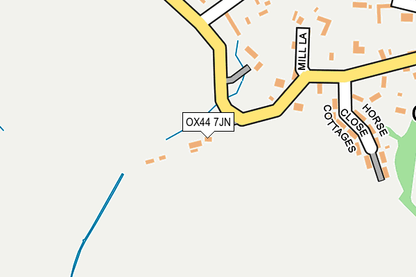
OX44 7JN lies on Rectory Road in Great Haseley, Oxford. OX44 7JN is located in the Haseley Brook electoral ward, within the local authority district of South Oxfordshire and the English Parliamentary constituency of Henley. The Sub Integrated Care Board (ICB) Location is NHS Buckinghamshire, Oxfordshire and Berkshire West ICB - 10Q and the police force is Thames Valley. This postcode has been in use since August 1992.


GetTheData
Source: OS OpenMap – Local (Ordnance Survey)
Source: OS VectorMap District (Ordnance Survey)
Licence: Open Government Licence (requires attribution)
| Easting | 463652 |
| Northing | 201702 |
| Latitude | 51.710455 |
| Longitude | -1.080141 |
GetTheData
Source: Open Postcode Geo
Licence: Open Government Licence
| Street | Rectory Road |
| Locality | Great Haseley |
| Town/City | Oxford |
| Country | England |
| Postcode District | OX44 |
➜ See where OX44 is on a map ➜ Where is Great Haseley? | |
GetTheData
Source: Land Registry Price Paid Data
Licence: Open Government Licence
Elevation or altitude of OX44 7JN as distance above sea level:
| Metres | Feet | |
|---|---|---|
| Elevation | 80m | 262ft |
Elevation is measured from the approximate centre of the postcode, to the nearest point on an OS contour line from OS Terrain 50, which has contour spacing of ten vertical metres.
➜ How high above sea level am I? Find the elevation of your current position using your device's GPS.
GetTheData
Source: Open Postcode Elevation
Licence: Open Government Licence
| Ward | Haseley Brook |
| Constituency | Henley |
GetTheData
Source: ONS Postcode Database
Licence: Open Government Licence
| Back Way West (Rectory Road) | Great Haseley | 182m |
| Back Way West (Rectory Road) | Great Haseley | 184m |
| Horse Close Cottages (Rectory Road) | Great Haseley | 244m |
| Horse Close Cottages (Rectory Road) | Great Haseley | 257m |
| Back Way East (Rectory Road) | Great Haseley | 556m |
GetTheData
Source: NaPTAN
Licence: Open Government Licence
GetTheData
Source: ONS Postcode Database
Licence: Open Government Licence


➜ Get more ratings from the Food Standards Agency
GetTheData
Source: Food Standards Agency
Licence: FSA terms & conditions
| Last Collection | |||
|---|---|---|---|
| Location | Mon-Fri | Sat | Distance |
| Great Haseley | 16:45 | 09:15 | 378m |
| Latchford Lane | 16:55 | 10:15 | 754m |
| Little Haseley | 16:55 | 09:00 | 1,168m |
GetTheData
Source: Dracos
Licence: Creative Commons Attribution-ShareAlike
The below table lists the International Territorial Level (ITL) codes (formerly Nomenclature of Territorial Units for Statistics (NUTS) codes) and Local Administrative Units (LAU) codes for OX44 7JN:
| ITL 1 Code | Name |
|---|---|
| TLJ | South East (England) |
| ITL 2 Code | Name |
| TLJ1 | Berkshire, Buckinghamshire and Oxfordshire |
| ITL 3 Code | Name |
| TLJ14 | Oxfordshire CC |
| LAU 1 Code | Name |
| E07000179 | South Oxfordshire |
GetTheData
Source: ONS Postcode Directory
Licence: Open Government Licence
The below table lists the Census Output Area (OA), Lower Layer Super Output Area (LSOA), and Middle Layer Super Output Area (MSOA) for OX44 7JN:
| Code | Name | |
|---|---|---|
| OA | E00145909 | |
| LSOA | E01028647 | South Oxfordshire 004B |
| MSOA | E02005961 | South Oxfordshire 004 |
GetTheData
Source: ONS Postcode Directory
Licence: Open Government Licence
| OX44 7JW | Rectory Road | 153m |
| OX44 7JL | Rectory Road | 203m |
| OX44 7JU | Mill Lane | 207m |
| OX44 7JR | Back Way | 234m |
| OX44 7JT | Wincey View | 237m |
| OX44 7JJ | Horse Close | 249m |
| OX44 7JQ | Rectory Road | 386m |
| OX44 7LS | Lewington Close | 395m |
| OX44 7JP | Back Way | 432m |
| OX44 7JG | Rectory Road | 578m |
GetTheData
Source: Open Postcode Geo; Land Registry Price Paid Data
Licence: Open Government Licence