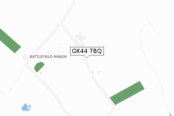
OX44 7BQ is located in the Chalgrove electoral ward, within the local authority district of South Oxfordshire and the English Parliamentary constituency of Henley. The Sub Integrated Care Board (ICB) Location is NHS Buckinghamshire, Oxfordshire and Berkshire West ICB - 10Q and the police force is Thames Valley. This postcode has been in use since December 2019.


GetTheData
Source: OS Open Zoomstack (Ordnance Survey)
Licence: Open Government Licence (requires attribution)
Attribution: Contains OS data © Crown copyright and database right 2025
Source: Open Postcode Geo
Licence: Open Government Licence (requires attribution)
Attribution: Contains OS data © Crown copyright and database right 2025; Contains Royal Mail data © Royal Mail copyright and database right 2025; Source: Office for National Statistics licensed under the Open Government Licence v.3.0
| Easting | 465009 |
| Northing | 198389 |
| Latitude | 51.680516 |
| Longitude | -1.061120 |
GetTheData
Source: Open Postcode Geo
Licence: Open Government Licence
| Country | England |
| Postcode District | OX44 |
➜ See where OX44 is on a map | |
GetTheData
Source: Land Registry Price Paid Data
Licence: Open Government Licence
| Ward | Chalgrove |
| Constituency | Henley |
GetTheData
Source: ONS Postcode Database
Licence: Open Government Licence
| The Red Lion Ph (High Street) | Chalgrove | 1,988m |
| The Red Lion Ph (High Street) | Chalgrove | 1,992m |
GetTheData
Source: NaPTAN
Licence: Open Government Licence
GetTheData
Source: ONS Postcode Database
Licence: Open Government Licence


➜ Get more ratings from the Food Standards Agency
GetTheData
Source: Food Standards Agency
Licence: FSA terms & conditions
| Last Collection | |||
|---|---|---|---|
| Location | Mon-Fri | Sat | Distance |
| Monument Industrial Estate | 17:30 | 11:00 | 1,413m |
| Monumont Road | 17:30 | 09:15 | 1,838m |
| Chalgrove Post Office | 17:30 | 11:20 | 1,958m |
GetTheData
Source: Dracos
Licence: Creative Commons Attribution-ShareAlike
The below table lists the International Territorial Level (ITL) codes (formerly Nomenclature of Territorial Units for Statistics (NUTS) codes) and Local Administrative Units (LAU) codes for OX44 7BQ:
| ITL 1 Code | Name |
|---|---|
| TLJ | South East (England) |
| ITL 2 Code | Name |
| TLJ1 | Berkshire, Buckinghamshire and Oxfordshire |
| ITL 3 Code | Name |
| TLJ14 | Oxfordshire CC |
| LAU 1 Code | Name |
| E07000179 | South Oxfordshire |
GetTheData
Source: ONS Postcode Directory
Licence: Open Government Licence
The below table lists the Census Output Area (OA), Lower Layer Super Output Area (LSOA), and Middle Layer Super Output Area (MSOA) for OX44 7BQ:
| Code | Name | |
|---|---|---|
| OA | E00145735 | |
| LSOA | E01028610 | South Oxfordshire 007E |
| MSOA | E02005964 | South Oxfordshire 007 |
GetTheData
Source: ONS Postcode Directory
Licence: Open Government Licence
| OX44 7XZ | Tower Estate | 990m |
| OX44 7LP | Standhill Cottage | 1537m |
| OX44 7LW | Brook Close | 1658m |
| OX44 7YH | Liddon Road | 1750m |
| OX44 7YD | Sixpenny Lane | 1752m |
| OX44 7RE | Laurel Close | 1782m |
| OX44 7YE | French Laurence Way | 1791m |
| OX44 7RN | Chiltern Close | 1792m |
| OX44 7RD | Vicarage Close | 1796m |
| OX44 7YF | French Laurence Way | 1801m |
GetTheData
Source: Open Postcode Geo; Land Registry Price Paid Data
Licence: Open Government Licence