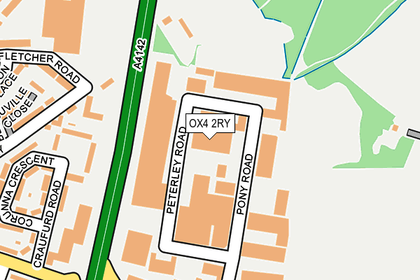
OX4 2RY is located in the Lye Valley electoral ward, within the local authority district of Oxford and the English Parliamentary constituency of Oxford East. The Sub Integrated Care Board (ICB) Location is NHS Buckinghamshire, Oxfordshire and Berkshire West ICB - 10Q and the police force is Thames Valley. This postcode has been in use since October 1987.


GetTheData
Source: OS OpenMap – Local (Ordnance Survey)
Source: OS VectorMap District (Ordnance Survey)
Licence: Open Government Licence (requires attribution)
| Easting | 455679 |
| Northing | 204811 |
| Latitude | 51.739247 |
| Longitude | -1.195045 |
GetTheData
Source: Open Postcode Geo
Licence: Open Government Licence
| Country | England |
| Postcode District | OX4 |
➜ See where OX4 is on a map ➜ Where is Oxford? | |
GetTheData
Source: Land Registry Price Paid Data
Licence: Open Government Licence
Elevation or altitude of OX4 2RY as distance above sea level:
| Metres | Feet | |
|---|---|---|
| Elevation | 80m | 262ft |
Elevation is measured from the approximate centre of the postcode, to the nearest point on an OS contour line from OS Terrain 50, which has contour spacing of ten vertical metres.
➜ How high above sea level am I? Find the elevation of your current position using your device's GPS.
GetTheData
Source: Open Postcode Elevation
Licence: Open Government Licence
| Ward | Lye Valley |
| Constituency | Oxford East |
GetTheData
Source: ONS Postcode Database
Licence: Open Government Licence
| Horspath Road Industrial Estate (Horspath Road) | Cowley | 253m |
| Brasenose Driftway | Cowley | 268m |
| Horspath Road Industrial Estate (Horspath Road) | Cowley | 270m |
| Brasenose Driftway | Cowley | 273m |
| Fletcher Road | Cowley | 294m |
GetTheData
Source: NaPTAN
Licence: Open Government Licence
GetTheData
Source: ONS Postcode Database
Licence: Open Government Licence


➜ Get more ratings from the Food Standards Agency
GetTheData
Source: Food Standards Agency
Licence: FSA terms & conditions
| Last Collection | |||
|---|---|---|---|
| Location | Mon-Fri | Sat | Distance |
| Pony Road | 17:15 | 11:45 | 262m |
| Paget Road | 17:15 | 11:45 | 360m |
| Horspath Road | 17:00 | 11:45 | 597m |
GetTheData
Source: Dracos
Licence: Creative Commons Attribution-ShareAlike
The below table lists the International Territorial Level (ITL) codes (formerly Nomenclature of Territorial Units for Statistics (NUTS) codes) and Local Administrative Units (LAU) codes for OX4 2RY:
| ITL 1 Code | Name |
|---|---|
| TLJ | South East (England) |
| ITL 2 Code | Name |
| TLJ1 | Berkshire, Buckinghamshire and Oxfordshire |
| ITL 3 Code | Name |
| TLJ14 | Oxfordshire CC |
| LAU 1 Code | Name |
| E07000178 | Oxford |
GetTheData
Source: ONS Postcode Directory
Licence: Open Government Licence
The below table lists the Census Output Area (OA), Lower Layer Super Output Area (LSOA), and Middle Layer Super Output Area (MSOA) for OX4 2RY:
| Code | Name | |
|---|---|---|
| OA | E00145485 | |
| LSOA | E01028557 | Oxford 013E |
| MSOA | E02005952 | Oxford 013 |
GetTheData
Source: ONS Postcode Directory
Licence: Open Government Licence
| OX4 2TZ | Peterley Road | 95m |
| OX4 2RD | Pony Road | 109m |
| OX4 2GZ | Brasenose Driftway | 183m |
| OX4 2RA | Craufurd Road | 214m |
| OX4 2SQ | Craufurd Road | 241m |
| OX4 2UE | Fletcher Road | 264m |
| OX4 2PW | Benouville Close | 283m |
| OX4 2RB | Corunna Crescent | 283m |
| OX4 2RQ | Burton Place | 313m |
| OX4 2QY | Brasenose Driftway | 314m |
GetTheData
Source: Open Postcode Geo; Land Registry Price Paid Data
Licence: Open Government Licence