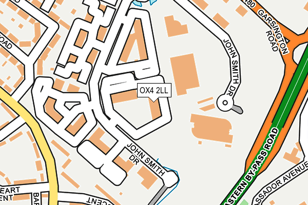
OX4 2LL is located in the Temple Cowley electoral ward, within the local authority district of Oxford and the English Parliamentary constituency of Oxford East. The Sub Integrated Care Board (ICB) Location is NHS Buckinghamshire, Oxfordshire and Berkshire West ICB - 10Q and the police force is Thames Valley. This postcode has been in use since April 2007.


GetTheData
Source: OS OpenMap – Local (Ordnance Survey)
Source: OS VectorMap District (Ordnance Survey)
Licence: Open Government Licence (requires attribution)
| Easting | 454873 |
| Northing | 203663 |
| Latitude | 51.729011 |
| Longitude | -1.206878 |
GetTheData
Source: Open Postcode Geo
Licence: Open Government Licence
| Country | England |
| Postcode District | OX4 |
➜ See where OX4 is on a map ➜ Where is Oxford? | |
GetTheData
Source: Land Registry Price Paid Data
Licence: Open Government Licence
Elevation or altitude of OX4 2LL as distance above sea level:
| Metres | Feet | |
|---|---|---|
| Elevation | 70m | 230ft |
Elevation is measured from the approximate centre of the postcode, to the nearest point on an OS contour line from OS Terrain 50, which has contour spacing of ten vertical metres.
➜ How high above sea level am I? Find the elevation of your current position using your device's GPS.
GetTheData
Source: Open Postcode Elevation
Licence: Open Government Licence
| Ward | Temple Cowley |
| Constituency | Oxford East |
GetTheData
Source: ONS Postcode Database
Licence: Open Government Licence
| Barns Road | Cowley | 234m |
| The Longwall Ph (Garsington Road) | Cowley | 266m |
| The Longwall Ph (Garsington Road) | Cowley | 282m |
| Bartholomew Road East (Bartholomew Road) | Littlemore | 300m |
| Tesco Store (Oxford Retail Park) | Cowley | 303m |
| Oxford Station | 5.1km |
| Radley Station | 5.3km |
GetTheData
Source: NaPTAN
Licence: Open Government Licence
GetTheData
Source: ONS Postcode Database
Licence: Open Government Licence


➜ Get more ratings from the Food Standards Agency
GetTheData
Source: Food Standards Agency
Licence: FSA terms & conditions
| Last Collection | |||
|---|---|---|---|
| Location | Mon-Fri | Sat | Distance |
| Barnes Road | 17:00 | 12:00 | 255m |
| Phipps Road | 17:15 | 12:00 | 287m |
| St Lukes Road | 17:15 | 12:00 | 424m |
GetTheData
Source: Dracos
Licence: Creative Commons Attribution-ShareAlike
The below table lists the International Territorial Level (ITL) codes (formerly Nomenclature of Territorial Units for Statistics (NUTS) codes) and Local Administrative Units (LAU) codes for OX4 2LL:
| ITL 1 Code | Name |
|---|---|
| TLJ | South East (England) |
| ITL 2 Code | Name |
| TLJ1 | Berkshire, Buckinghamshire and Oxfordshire |
| ITL 3 Code | Name |
| TLJ14 | Oxfordshire CC |
| LAU 1 Code | Name |
| E07000178 | Oxford |
GetTheData
Source: ONS Postcode Directory
Licence: Open Government Licence
The below table lists the Census Output Area (OA), Lower Layer Super Output Area (LSOA), and Middle Layer Super Output Area (MSOA) for OX4 2LL:
| Code | Name | |
|---|---|---|
| OA | E00145339 | |
| LSOA | E01028529 | Oxford 015C |
| MSOA | E02005954 | Oxford 015 |
GetTheData
Source: ONS Postcode Directory
Licence: Open Government Licence
| OX4 3RE | Barns Road | 205m |
| OX4 3HL | Frederick Road | 233m |
| OX4 3RH | Kersington Crescent | 235m |
| OX4 3QZ | Barns Road | 250m |
| OX4 3HX | Bailey Road | 250m |
| OX4 3HP | Boswell Road | 262m |
| OX4 3RL | Amory Close | 263m |
| OX4 3QW | Bartholomew Road | 288m |
| OX4 3QJ | Bartholomew Road | 303m |
| OX4 3HJ | Phipps Road | 314m |
GetTheData
Source: Open Postcode Geo; Land Registry Price Paid Data
Licence: Open Government Licence